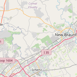
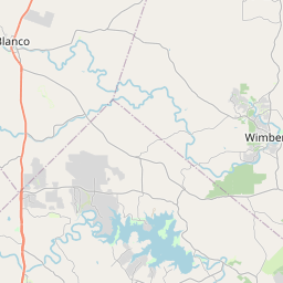
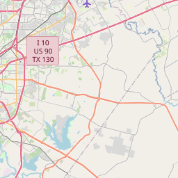
Lake Dunlap Map, Satellite view of Lake Dunlap, Texas
Lake Dunlap is a census-designated place (CDP) located in Guadalupe County, Texas, USA.
Location informations of Lake Dunlap
Latitude of city of Lake Dunlap is 29.67578 and longitude of city of Lake Dunlap is -98.07223- What Country is Lake Dunlap In? Lake Dunlap is located in the United States of America.
- What State is Lake Dunlap located in? Lake Dunlap is located in Texas.
- What County is Lake Dunlap In? The County of Lake Dunlap is Guadalupe County
Lake Dunlap, Texas (TX), USA Geographic Information
| Country | United States |
| Country Code | US |
| State Name | Texas |
| Latitude | 29.67578 |
| Longitude | -98.07223 |
| DMS Lat | 29°40'32.808" N |
| DMS Long | 98°4'20.028" W |
| DMS coordinates : | 29°40'32.808" N 98°4'20.028" W |
Current Date and Time in Lake Dunlap, Texas, USA
| Lake Dunlap Time Zone : America/Chicago |
What day is it in Lake Dunlap right now?Friday (April 25, 2025) |
What time is it?Current local time and date at Lake Dunlap is 4/25/2025 - 8:45:29 PM |
Postcode / zip code of Lake Dunlap
Lake Dunlap is the actual or alternate city name associated with 1 ZIP Codes by the US Postal Service.
List of all postal codes in Lake Dunlap, Texas, United States.
78130 Zip Code
Online Map of Lake Dunlap - road map, satellite view and street view


Check out our interactive map of Lake Dunlap, Texas and you'll easily find your way around the Lake Dunlap major roads and highways.
Satellite Map of Lake Dunlap, TX, USA
This is online map of the address Lake Dunlap, TX, United States. You may use button to move and zoom in / out. The map information is for reference only.
New Braunfels Municipal Airport (4.31 Km / 2.68 Miles)
Resolute Health Hospital New Braunfels Helipad (5.17 Km / 3.21 Miles)
Cunningham Airpark (5.74 Km / 3.57 Miles)
Hilltop Ranch Airport (6.62 Km / 4.11 Miles)
Christus Santa Rosa Hospital Helipad (6.72 Km / 4.18 Miles)
Moltz Airport (7.47 Km / 4.64 Miles)
McCoy Building Supply 16 Heliport (7.51 Km / 4.67 Miles)
Gary's Airport (10.96 Km / 6.81 Miles)
Huber Airpark (11.36 Km / 7.06 Miles)
Geronimo Field (11.87 Km / 7.37 Miles)
Chips Airport (12.27 Km / 7.62 Miles)
Fox Airport (12.27 Km / 7.62 Miles)
H M Ranch Airport (12.83 Km / 7.97 Miles)
Flying R Ranch Airport (13.80 Km / 8.58 Miles)
Saint's Strip Ultralightport (14.03 Km / 8.72 Miles)
Ireland Airport (14.42 Km / 8.96 Miles)
Leading Edge San Marcos Heliport (15.13 Km / 9.40 Miles)
Guadalupe Regional Medical Center Heliport (17.10 Km / 10.62 Miles)
Woodstone Corporation Heliport (19.55 Km / 12.15 Miles)
Randolph Air Force Base Auxiliary Airport (20.02 Km / 12.44 Miles)
CLEAR SPRING EL (2.82 Km / 1.75 Miles)
PREMIER H S OF NEW BRAUNFELS (3.30 Km / 2.05 Miles)
VINTAGE OAKS AREA EL (3.61 Km / 2.25 Miles)
GARDEN RIDGE AREA H S (3.62 Km / 2.25 Miles)
KINDER RANCH AREA H S (3.62 Km / 2.25 Miles)
HWY 46 AREA EL (3.62 Km / 2.25 Miles)
FREIHEIT EL (3.67 Km / 2.28 Miles)
CHURCH HILL MIDDLE (3.91 Km / 2.43 Miles)
CANYON H S (4.03 Km / 2.50 Miles)
COMAL DISCIPLINE CENTER (4.06 Km / 2.52 Miles)
CANYON MIDDLE (4.07 Km / 2.53 Miles)
COMAL ACADEMY (4.11 Km / 2.55 Miles)
GOODWIN FRAZIER EL (4.23 Km / 2.63 Miles)
KLEIN ROAD EL (4.46 Km / 2.77 Miles)
MEMORIAL EL (4.57 Km / 2.84 Miles)
WALNUT SPRINGS EL (4.57 Km / 2.84 Miles)
COUNTY LINE EL (4.78 Km / 2.97 Miles)
William Edge Institute (3.74 Km / 2.32 Miles)
List of places near to Lake Dunlap
| Name | Distance |
|---|---|
| New Braunfels | 4.90 Km / 3.04 Miles |
| McQueeney | 10.03 Km / 6.23 Miles |
| Geronimo | 10.27 Km / 6.38 Miles |
| Marion | 13.35 Km / 8.30 Miles |
| Seguin | 15.79 Km / 9.81 Miles |
| Cibolo | 18.33 Km / 11.39 Miles |
| Santa Clara | 18.83 Km / 11.70 Miles |
| Schertz | 21.32 Km / 13.25 Miles |
| Redwood | 21.55 Km / 13.39 Miles |
| Garden Ridge | 22.98 Km / 14.28 Miles |
| Zuehl | 23.02 Km / 14.30 Miles |
| New Berlin | 23.70 Km / 14.73 Miles |
| Kingsbury | 23.79 Km / 14.78 Miles |