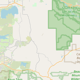
Lake Riverside Map, Satellite view of Lake Riverside, California
Lake Riverside is a census-designated place (CDP) located in Riverside County, California, USA.
Location informations of Lake Riverside
Latitude of city of Lake Riverside is 33.51874 and longitude of city of Lake Riverside is -116.81210- What Country is Lake Riverside In? Lake Riverside is located in the United States of America.
- What State is Lake Riverside located in? Lake Riverside is located in California.
- What County is Lake Riverside In? The County of Lake Riverside is Riverside County
Lake Riverside, California (CA), USA Geographic Information
| Country | United States |
| Country Code | US |
| State Name | California |
| Latitude | 33.51874 |
| Longitude | -116.8121 |
| DMS Lat | 33°31'7.464" N |
| DMS Long | 116°48'43.56" W |
| DMS coordinates : | 33°31'7.464" N 116°48'43.56" W |
Current Date and Time in Lake Riverside, California, USA
| Lake Riverside Time Zone : America/Los_Angeles |
What day is it in Lake Riverside right now?Wednesday (June 11, 2025) |
What time is it?Current local time and date at Lake Riverside is 21:22:09 (06/11/2025) : (America/Los_Angeles) |
Postcode / zip code of Lake Riverside
Lake Riverside is the actual or alternate city name associated with 1 ZIP Codes by the US Postal Service.
List of all postal codes in Lake Riverside, California, United States.
92536 Zip Code
Area Codes Lake Riverside, California, USA
Lake Riverside, California covers 1 Area Codes
951 Area CodeOnline Map of Lake Riverside - road map, satellite view and street view


Check out our interactive map of Lake Riverside, California and you'll easily find your way around the Lake Riverside major roads and highways.
Satellite Map of Lake Riverside, CA, USA
This is online map of the address Lake Riverside, CA, United States. You may use button to move and zoom in / out. The map information is for reference only.
Lake Riverside Estates Airport (1.42 Km / 0.88 Miles)
White Mountain Landing Strip (10.44 Km / 6.49 Miles)
Middle Aguanga Airstrip (10.50 Km / 6.52 Miles)
Ernst Field (10.92 Km / 6.79 Miles)
Sundance Ranch Airstrip (10.99 Km / 6.83 Miles)
Ward Ranch Airport (12.07 Km / 7.50 Miles)
Butterfield Lake Estates Heliport (14.52 Km / 9.02 Miles)
Anza Landing Strip (15.44 Km / 9.59 Miles)
Palomar Observatory Parking Lot Helipad (18.47 Km / 11.48 Miles)
Palomar Observatory Road Helipad (18.56 Km / 11.53 Miles)
Blackwater Heliport (21.36 Km / 13.27 Miles)
Goodhart Canyon Airport (21.72 Km / 13.50 Miles)
Garner Ranch Landing Strip (21.92 Km / 13.62 Miles)
USFS Keenwild Helitack Base (23.44 Km / 14.57 Miles)
Billy Joe Airport (24.04 Km / 14.94 Miles)
Cal Fire San Diego Puerta La Cruz Helipad (24.87 Km / 15.46 Miles)
List of places near to Lake Riverside
| Name | Distance |
|---|---|
| Aguanga | 9.77 Km / 6.07 Miles |
| Anza | 13.45 Km / 8.36 Miles |
| Mountain Center | 22.11 Km / 13.74 Miles |