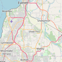
Lake Roesiger Map, Satellite view of Lake Roesiger, Washington
Lake Roesiger is a census-designated place (CDP) located in Snohomish County, Washington, USA.
Location informations of Lake Roesiger
Latitude of city of Lake Roesiger is 47.98343 and longitude of city of Lake Roesiger is -121.92929- What Country is Lake Roesiger In? Lake Roesiger is located in the United States of America.
- What State is Lake Roesiger located in? Lake Roesiger is located in Washington.
- What County is Lake Roesiger In? The County of Lake Roesiger is Snohomish County
Lake Roesiger, Washington (WA), USA Geographic Information
| Country | United States |
| Country Code | US |
| State Name | Washington |
| Latitude | 47.98343 |
| Longitude | -121.92929 |
| DMS Lat | 47°59'0.348" N |
| DMS Long | 121°55'45.444" W |
| DMS coordinates : | 47°59'0.348" N 121°55'45.444" W |
Current Date and Time in Lake Roesiger, Washington, USA
| Lake Roesiger Time Zone : America/Los_Angeles |
What day is it in Lake Roesiger right now?Tuesday (April 29, 2025) |
What time is it?Current local time and date at Lake Roesiger is 19:23:21 (04/29/2025) : (America/Los_Angeles) |
Postcode / zip code of Lake Roesiger
Lake Roesiger is the actual or alternate city name associated with 1 ZIP Codes by the US Postal Service.
List of all postal codes in Lake Roesiger, Washington, United States.
98290 Zip Code
Area Codes Lake Roesiger, Washington, USA
Lake Roesiger, Washington covers 1 Area Codes
360 Area CodeOnline Map of Lake Roesiger - road map, satellite view and street view


Check out our interactive map of Lake Roesiger, Washington and you'll easily find your way around the Lake Roesiger major roads and highways.
Satellite Map of Lake Roesiger, WA, USA
This is online map of the address Lake Roesiger, WA, United States. You may use button to move and zoom in / out. The map information is for reference only.
Streamline Heliport (8.09 Km / 5.03 Miles)
Reoh1 Heliport (11.57 Km / 7.19 Miles)
Van De Plasch Airport (12.37 Km / 7.68 Miles)
B & M Ranch Airport (13.17 Km / 8.18 Miles)
First Air Field (13.41 Km / 8.33 Miles)
Green Valley Airfield (14.07 Km / 8.74 Miles)
Heineck Farm Airport (15.42 Km / 9.58 Miles)
Harvey Field (15.53 Km / 9.65 Miles)
Sky Harbor Airport (16.18 Km / 10.05 Miles)
Frontier Airpark (17.22 Km / 10.70 Miles)
Roesler Timber Company Heliport (18.35 Km / 11.40 Miles)
Calkins Equipment Company Heliport (19.11 Km / 11.88 Miles)
Jim & Julie's Airport (19.37 Km / 12.04 Miles)
Kyles Airport (20.60 Km / 12.80 Miles)
General Hospital of Everett Heliport (20.67 Km / 12.84 Miles)
Providence Hospital Heliport (21.45 Km / 13.33 Miles)
Naval Station Everett Heliport (21.96 Km / 13.64 Miles)
Janes Heliport (23.01 Km / 14.30 Miles)
Fsa - Everett Heliport (24.44 Km / 15.19 Miles)
List of places near to Lake Roesiger
| Name | Distance |
|---|---|
| Lake Bosworth | 7.45 Km / 4.63 Miles |
| Three Lakes | 7.48 Km / 4.65 Miles |
| Machias | 8.69 Km / 5.40 Miles |
| Chain Lake | 10.00 Km / 6.21 Miles |
| Lake Stevens | 10.61 Km / 6.59 Miles |
| Lochsloy | 10.76 Km / 6.69 Miles |
| Cavalero | 10.84 Km / 6.74 Miles |
| Granite Falls | 11.56 Km / 7.18 Miles |
| Woods Creek | 11.87 Km / 7.38 Miles |
| Monroe North | 12.03 Km / 7.48 Miles |
| Bunk Foss | 12.53 Km / 7.79 Miles |
| North Sultan | 14.52 Km / 9.02 Miles |
| Monroe | 14.57 Km / 9.05 Miles |
| Canyon Creek | 14.62 Km / 9.08 Miles |
| Lake Cassidy | 14.63 Km / 9.09 Miles |
| Fobes Hill | 14.70 Km / 9.13 Miles |
| Snohomish | 14.82 Km / 9.21 Miles |
| Sultan | 15.85 Km / 9.85 Miles |
| Verlot | 16.40 Km / 10.19 Miles |
| Startup | 19.06 Km / 11.84 Miles |
| Sisco Heights | 19.26 Km / 11.97 Miles |
| Cathcart | 19.69 Km / 12.23 Miles |
| Marysville | 19.93 Km / 12.38 Miles |
| Everett | 20.31 Km / 12.62 Miles |
| North Marysville | 20.79 Km / 12.92 Miles |
| Eastmont | 21.08 Km / 13.10 Miles |
| Silver Firs | 21.30 Km / 13.24 Miles |
| High Bridge | 21.62 Km / 13.43 Miles |
| Clearview | 22.18 Km / 13.78 Miles |
| Gold Bar | 22.31 Km / 13.86 Miles |
| Maltby | 24.11 Km / 14.98 Miles |
| May Creek | 24.23 Km / 15.06 Miles |
| Mill Creek | 24.66 Km / 15.32 Miles |