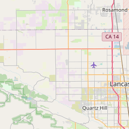
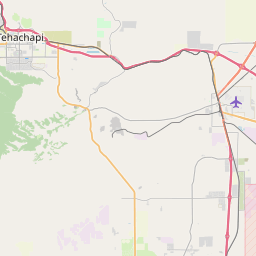
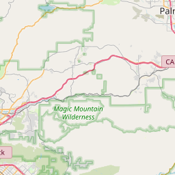
Lancaster Map, Satellite view of Lancaster, California
Lancaster is a city located in Los Angeles County, California, USA.
Location informations of Lancaster
Latitude of city of Lancaster is 34.69804 and longitude of city of Lancaster is -118.13674- What Country is Lancaster In? Lancaster is located in the United States of America.
- What State is Lancaster located in? Lancaster is located in California.
- What County is Lancaster In? The County of Lancaster is Los Angeles County
Lancaster, California (CA), USA Geographic Information
| Country | United States |
| Country Code | US |
| State Name | California |
| Latitude | 34.69804 |
| Longitude | -118.13674 |
| DMS Lat | 34°41'52.944" N |
| DMS Long | 118°8'12.264" W |
| DMS coordinates : | 34°41'52.944" N 118°8'12.264" W |
Current Date and Time in Lancaster, California, USA
| Lancaster Time Zone : America/Los_Angeles |
What day is it in Lancaster right now?Monday (June 2, 2025) |
What time is it?Current local time and date at Lancaster is 14:18:33 (06/02/2025) : (America/Los_Angeles) |
Postcode / zip code of Lancaster
Lancaster is the actual or alternate city name associated with 7 ZIP Codes by the US Postal Service.
List of all postal codes in Lancaster, California, United States.
93534 Zip Code 93535 Zip Code 93536 Zip Code 93539 Zip Code 93551 Zip Code 93584 Zip Code 93586 Zip Code
Online Map of Lancaster - road map, satellite view and street view


Check out our interactive map of Lancaster, California and you'll easily find your way around the Lancaster major roads and highways.
Satellite Map of Lancaster, CA, USA
This is online map of the address Lancaster, CA, United States. You may use button to move and zoom in / out. The map information is for reference only.
Antelope Valley Hospital Medical Center Heliport (2.41 Km / 1.50 Miles)
Antelope Valley Airport (5.42 Km / 3.37 Miles)
Antelope Valley Service Center Heliport (5.68 Km / 3.53 Miles)
Sheriff's Heliport (7.11 Km / 4.42 Miles)
Oban Airport (7.95 Km / 4.94 Miles)
Quartz Hill Airport (8.29 Km / 5.15 Miles)
High Desert Hospital Heliport (8.60 Km / 5.34 Miles)
General WM J Fox Airfield (8.91 Km / 5.54 Miles)
Palmdale Regional Airport / USAF Plant 42 Airport (8.98 Km / 5.58 Miles)
Liberty Field (11.88 Km / 7.38 Miles)
Salinas Landesert Ranch Airport (12.01 Km / 7.46 Miles)
Bohunk's Airpark (12.84 Km / 7.98 Miles)
Palmdale Medical Center Heliport (12.90 Km / 8.01 Miles)
Galbraith Airport (13.82 Km / 8.59 Miles)
Grimes Airport (14.76 Km / 9.17 Miles)
Little Buttes Antique Airfield (16.75 Km / 10.41 Miles)
Pearland Airport (17.72 Km / 11.01 Miles)
Rosamond Skypark Airport (20.31 Km / 12.62 Miles)
Sky Castle Airport (23.43 Km / 14.56 Miles)
SCE Vincent Substation Heliport (23.57 Km / 14.65 Miles)
Antelope Valley High (682 m / 0.42 Miles)
Early Childhood Education (1.13 Km / 0.70 Miles)
Lancaster Alternative and Virtual Academies (1.20 Km / 0.74 Miles)
Desert Winds Continuation High (1.28 Km / 0.79 Miles)
Crossroads Community Day (1.38 Km / 0.86 Miles)
El Dorado Elementary (1.41 Km / 0.87 Miles)
Monte Vista Elementary (1.46 Km / 0.91 Miles)
Linda Verde Elementary (1.46 Km / 0.91 Miles)
Piute Middle (1.76 Km / 1.10 Miles)
Mariposa Elementary (1.90 Km / 1.18 Miles)
Joshua Elementary (2.09 Km / 1.30 Miles)
Sierra Elementary (2.23 Km / 1.38 Miles)
Sunnydale Elementary (2.26 Km / 1.40 Miles)
Desert View Elementary (2.46 Km / 1.53 Miles)
New Vista Middle (3.31 Km / 2.05 Miles)
Fulton and Alsbury Academy of Arts and Engineering (3.31 Km / 2.06 Miles)
Lincoln Elementary (3.40 Km / 2.12 Miles)
Discovery (3.51 Km / 2.18 Miles)
Jack Northrop Elementary (3.62 Km / 2.25 Miles)
Amargosa Creek Middle (4.08 Km / 2.54 Miles)
Lancaster Beauty School (1.05 Km / 0.65 Miles)
University of Antelope Valley (1.62 Km / 1.00 Miles)
High Desert Medical College (2.53 Km / 1.57 Miles)
Career Care Institute (2.84 Km / 1.77 Miles)
List of places near to Lancaster
| Name | Distance |
|---|---|
| Quartz Hill | 9.48 Km / 5.89 Miles |
| Desert View Highlands | 12.01 Km / 7.46 Miles |
| Palmdale | 13.32 Km / 8.28 Miles |
| Leona Valley | 16.44 Km / 10.22 Miles |
| Rosamond | 18.63 Km / 11.58 Miles |
| Vincent | 22.04 Km / 13.70 Miles |
| Sun Village | 22.55 Km / 14.01 Miles |
| Elizabeth Lake | 22.71 Km / 14.11 Miles |
| Littlerock | 24.15 Km / 15.01 Miles |