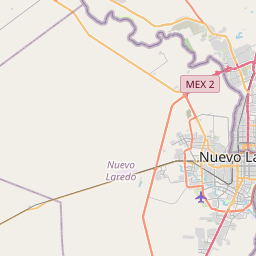
Laredo Ranchettes Map, Satellite view of Laredo Ranchettes, Texas
Laredo Ranchettes is a census-designated place (CDP) located in Webb County, Texas, USA.
Location informations of Laredo Ranchettes
Latitude of city of Laredo Ranchettes is 27.48530 and longitude of city of Laredo Ranchettes is -99.37087- What Country is Laredo Ranchettes In? Laredo Ranchettes is located in the United States of America.
- What State is Laredo Ranchettes located in? Laredo Ranchettes is located in Texas.
- What County is Laredo Ranchettes In? The County of Laredo Ranchettes is Webb County
Laredo Ranchettes, Texas (TX), USA Geographic Information
| Country | United States |
| Country Code | US |
| State Name | Texas |
| Latitude | 27.4853 |
| Longitude | -99.37087 |
| DMS Lat | 27°29'7.08" N |
| DMS Long | 99°22'15.132" W |
| DMS coordinates : | 27°29'7.08" N 99°22'15.132" W |
Current Date and Time in Laredo Ranchettes, Texas, USA
| Laredo Ranchettes Time Zone : America/Chicago |
What day is it in Laredo Ranchettes right now?Saturday (June 7, 2025) |
What time is it?Current local time and date at Laredo Ranchettes is 6/7/2025 - 12:52:50 AM |
Postcode / zip code of Laredo Ranchettes
Laredo Ranchettes is the actual or alternate city name associated with 1 ZIP Codes by the US Postal Service.
List of all postal codes in Laredo Ranchettes, Texas, United States.
78043 Zip Code
Online Map of Laredo Ranchettes - road map, satellite view and street view


Check out our interactive map of Laredo Ranchettes, Texas and you'll easily find your way around the Laredo Ranchettes major roads and highways.
Satellite Map of Laredo Ranchettes, TX, USA
This is online map of the address Laredo Ranchettes, TX, United States. You may use button to move and zoom in / out. The map information is for reference only.
Killam Ranch Airport (7.00 Km / 4.35 Miles)
Laredo International Airport (11.06 Km / 6.87 Miles)
Laredo Medical Center Heliport (11.86 Km / 7.37 Miles)
Link Ranch Airport (11.90 Km / 7.39 Miles)
Lobo Ranch Airport (14.10 Km / 8.76 Miles)
House Tank Airport (14.29 Km / 8.88 Miles)
Laredo Auxiliary Airfield #2 (14.45 Km / 8.98 Miles)
Doctors Hospital of Laredo Heliport (17.22 Km / 10.70 Miles)
Santa Maria Ranch Airport (19.13 Km / 11.89 Miles)
Killam & Hurd Airport (20.71 Km / 12.87 Miles)
Rancho Blanco Airport (22.47 Km / 13.96 Miles)
WEBB COUNTY J J A E P (3.19 Km / 1.98 Miles)
YOUTH VILLAGE DETENTION CENTER (3.24 Km / 2.01 Miles)
FREEDOM EL (4.05 Km / 2.52 Miles)
List of places near to Laredo Ranchettes
| Name | Distance |
|---|---|
| San Carlos II | 0.53 Km / 0.33 Miles |
| Laredo Ranchettes West | 0.53 Km / 0.33 Miles |
| San Carlos I | 0.56 Km / 0.35 Miles |
| Ranchitos East | 0.72 Km / 0.45 Miles |
| Tanquecitos South Acres | 1.00 Km / 0.62 Miles |
| Los Altos | 1.58 Km / 0.98 Miles |
| Tanquecitos South Acres II | 1.72 Km / 1.07 Miles |
| Pueblo Nuevo | 6.03 Km / 3.75 Miles |
| La Coma | 6.82 Km / 4.24 Miles |
| La Presa | 11.53 Km / 7.16 Miles |
| Laredo | 13.68 Km / 8.50 Miles |
| Rio Bravo | 17.25 Km / 10.72 Miles |
| El Cenizo | 19.06 Km / 11.84 Miles |
| Los Centenarios | 21.01 Km / 13.06 Miles |
| Los Arcos | 21.36 Km / 13.27 Miles |
| Los Fresnos | 21.73 Km / 13.50 Miles |
| Los Nopalitos | 22.09 Km / 13.73 Miles |
| Los Veteranos I | 22.28 Km / 13.84 Miles |
| Las Haciendas | 23.50 Km / 14.60 Miles |
| Colorado Acres | 23.52 Km / 14.61 Miles |