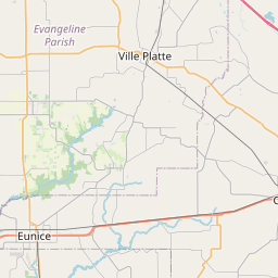
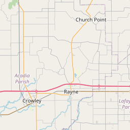
Leonville Map, Satellite view of Leonville, Louisiana
Leonville is a town located in St. Landry Parish, Louisiana, USA.
Location informations of Leonville
Latitude of city of Leonville is 30.47047 and longitude of city of Leonville is -91.97845- What Country is Leonville In? Leonville is located in the United States of America.
- What State is Leonville located in? Leonville is located in Louisiana.
- What County is Leonville In? The County of Leonville is St. Landry Parish
Leonville, Louisiana (LA), USA Geographic Information
| Country | United States |
| Country Code | US |
| State Name | Louisiana |
| Latitude | 30.47047 |
| Longitude | -91.97845 |
| DMS Lat | 30°28'13.692" N |
| DMS Long | 91°58'42.42" W |
| DMS coordinates : | 30°28'13.692" N 91°58'42.42" W |
Current Date and Time in Leonville, Louisiana, USA
| Leonville Time Zone : America/Chicago |
What day is it in Leonville right now?Saturday (May 31, 2025) |
What time is it?Current local time and date at Leonville is 10:09:50 (05/31/2025) : (America/Chicago) |
Postcode / zip code of Leonville
Leonville is the actual or alternate city name associated with 3 ZIP Codes by the US Postal Service.
List of all postal codes in Leonville, Louisiana, United States.
70512 Zip Code 70551 Zip Code 70570 Zip Code
Online Map of Leonville - road map, satellite view and street view


Check out our interactive map of Leonville, Louisiana and you'll easily find your way around the Leonville major roads and highways.
Satellite Map of Leonville, LA, USA
This is online map of the address Leonville, LA, United States. You may use button to move and zoom in / out. The map information is for reference only.
Kidder Airport (5.25 Km / 3.26 Miles)
Tim Bullard Memorial Airport (5.90 Km / 3.66 Miles)
Craig's Field (6.36 Km / 3.95 Miles)
Couvillion Airport (8.09 Km / 5.03 Miles)
St Luke General Hospital Heliport (8.68 Km / 5.40 Miles)
Aeleron Airport (8.69 Km / 5.40 Miles)
Opelousas General Health System South Campus Heliport (9.58 Km / 5.96 Miles)
Med-South Heliport (9.74 Km / 6.05 Miles)
Opelousas General Health System Main Campus Heliport (12.42 Km / 7.72 Miles)
Juneau Landing Strip (13.12 Km / 8.15 Miles)
Gerald's Airstrip (13.26 Km / 8.24 Miles)
Red Oak Landing Airport (13.73 Km / 8.53 Miles)
Ron Airport (13.96 Km / 8.67 Miles)
Omni Heliport (14.90 Km / 9.26 Miles)
St Landry Parish Ahart Field (15.16 Km / 9.42 Miles)
Yankee Field (15.75 Km / 9.79 Miles)
T & M Airfield (16.73 Km / 10.40 Miles)
Dupuis Airport (17.59 Km / 10.93 Miles)
Kibs Air Park (18.88 Km / 11.73 Miles)
Star Dusters Airport (20.72 Km / 12.88 Miles)
Leonville Elementary School (539 m / 0.33 Miles)
List of places near to Leonville
| Name | Distance |
|---|---|
| Grand Coteau | 8.61 Km / 5.35 Miles |
| Arnaudville | 8.83 Km / 5.49 Miles |
| Port Barre | 10.25 Km / 6.37 Miles |
| Sunset | 10.85 Km / 6.74 Miles |
| Opelousas | 12.11 Km / 7.52 Miles |
| Washington | 17.88 Km / 11.11 Miles |
| Carencro | 18.34 Km / 11.40 Miles |
| Cankton | 18.70 Km / 11.62 Miles |
| Cecilia | 19.08 Km / 11.86 Miles |
| Lawtell | 20.49 Km / 12.73 Miles |
| Krotz Springs | 22.84 Km / 14.19 Miles |
| Breaux Bridge | 23.18 Km / 14.40 Miles |
| Church Point | 23.90 Km / 14.85 Miles |