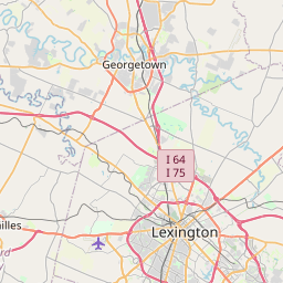
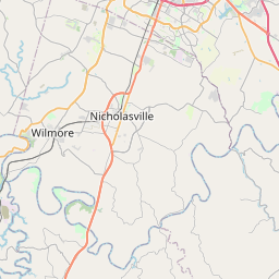
Lexington-Fayette Map, Satellite view of Lexington-Fayette, Kentucky
Lexington-Fayette is a urban-county located in Fayette County, Kentucky, USA.
Location informations of Lexington-Fayette
Latitude of city of Lexington-Fayette is 38.04980 and longitude of city of Lexington-Fayette is -84.45855- What Country is Lexington-Fayette In? Lexington-Fayette is located in the United States of America.
- What State is Lexington-Fayette located in? Lexington-Fayette is located in Kentucky.
- What County is Lexington-Fayette In? The County of Lexington-Fayette is Fayette County
Lexington-Fayette, Kentucky (KY), USA Geographic Information
| Country | United States |
| Country Code | US |
| State Name | Kentucky |
| Latitude | 38.0498 |
| Longitude | -84.45855 |
| DMS Lat | 38°2'59.28" N |
| DMS Long | 84°27'30.78" W |
| DMS coordinates : | 38°2'59.28" N 84°27'30.78" W |
Current Date and Time in Lexington-Fayette, Kentucky, USA
| Lexington-Fayette Time Zone : America/New_York |
What day is it in Lexington-Fayette right now?Friday (August 15, 2025) |
What time is it?Current local time and date at Lexington-Fayette is 8/15/2025 - 6:28:02 PM |
Postcode / zip code of Lexington-Fayette
Lexington-Fayette is the actual or alternate city name associated with 40 ZIP Codes by the US Postal Service.
List of all postal codes in Lexington-Fayette, Kentucky, United States.
40361 Zip Code 40502 Zip Code 40503 Zip Code 40504 Zip Code 40505 Zip Code 40506 Zip Code 40507 Zip Code 40508 Zip Code 40509 Zip Code 40510 Zip Code 40511 Zip Code 40512 Zip Code 40513 Zip Code 40514 Zip Code 40515 Zip Code 40516 Zip Code 40517 Zip Code 40522 Zip Code 40523 Zip Code 40524 Zip Code 40526 Zip Code 40533 Zip Code 40536 Zip Code 40544 Zip Code 40546 Zip Code 40550 Zip Code 40555 Zip Code 40574 Zip Code 40575 Zip Code 40576 Zip Code 40577 Zip Code 40578 Zip Code 40579 Zip Code 40580 Zip Code 40581 Zip Code 40582 Zip Code 40583 Zip Code 40588 Zip Code 40591 Zip Code 40598 Zip Code
Area Codes Lexington-Fayette, Kentucky, USA
Lexington-Fayette, Kentucky covers 1 Area Codes
859 Area CodeOnline Map of Lexington-Fayette - road map, satellite view and street view


Check out our interactive map of Lexington-Fayette, Kentucky and you'll easily find your way around the Lexington-Fayette major roads and highways.
Satellite Map of Lexington-Fayette, KY, USA
This is online map of the address Lexington-Fayette, KY, United States. You may use button to move and zoom in / out. The map information is for reference only.
Baptist Health Hamburg Heliport (3.92 Km / 2.44 Miles)
University of Kentucky Hospital Heliport (4.85 Km / 3.01 Miles)
Baptist Health Lexington Heliport (5.89 Km / 3.66 Miles)
Saint Joseph Hospital Heliport (6.13 Km / 3.81 Miles)
Coal Field (10.67 Km / 6.63 Miles)
LRFO Heliport (12.19 Km / 7.58 Miles)
Morning Star Heliport (12.31 Km / 7.65 Miles)
Creech Heliport (12.78 Km / 7.94 Miles)
Blue Grass Station Army Heliport (12.98 Km / 8.06 Miles)
Blue Grass Airport (12.99 Km / 8.07 Miles)
Wild Blue Airport (13.72 Km / 8.52 Miles)
Zanzibar Farm Airport (14.33 Km / 8.90 Miles)
Sunbright Heliport (14.95 Km / 9.29 Miles)
Clear Lake Heliport (14.96 Km / 9.30 Miles)
Air Castle Airport (15.64 Km / 9.72 Miles)
Blue Haven Farm Airport (15.88 Km / 9.87 Miles)
Brennan Farm Airport (18.18 Km / 11.30 Miles)
Georgetown-Scott County Regional Airport (20.63 Km / 12.82 Miles)
Renick Field (20.96 Km / 13.03 Miles)
Clark Regional Medical Center Heliport (23.60 Km / 14.66 Miles)
Yates Elementary School (489 m / 0.30 Miles)
Northern Elementary School (1.62 Km / 1.01 Miles)
Deep Springs Elementary School (1.65 Km / 1.02 Miles)
Bryan Station Middle School (1.88 Km / 1.17 Miles)
Dixie Elementary Magnet School (1.90 Km / 1.18 Miles)
William Wells Brown Elementary (1.92 Km / 1.19 Miles)
Bryan Station High School (1.96 Km / 1.21 Miles)
Arlington Elementary School (1.99 Km / 1.23 Miles)
Frederick Douglass High School (2.27 Km / 1.41 Miles)
STEAM Academy (2.36 Km / 1.46 Miles)
Ashland Elementary School (2.36 Km / 1.47 Miles)
Carter G. Woodson Academy (2.38 Km / 1.48 Miles)
Crawford Middle School (2.41 Km / 1.50 Miles)
ABLE (2.76 Km / 1.71 Miles)
Homebound Secondary (2.77 Km / 1.72 Miles)
Homebound Elementary (2.77 Km / 1.72 Miles)
Fayette Pre-School (2.77 Km / 1.72 Miles)
Martin L King Acad for Excellence Alt (2.80 Km / 1.74 Miles)
Eastside Technical Center (2.85 Km / 1.77 Miles)
Lexington Trad Magnet School (2.85 Km / 1.77 Miles)
Summit Salon Academy-Lexington (2.41 Km / 1.50 Miles)
Transylvania University (3.05 Km / 1.90 Miles)
University of Kentucky (4.22 Km / 2.62 Miles)
Bluegrass Community and Technical College (4.83 Km / 3.00 Miles)
List of places near to Lexington-Fayette
| Name | Distance |
|---|---|
| Georgetown | 19.84 Km / 12.33 Miles |
| Keene | 19.95 Km / 12.40 Miles |
| Nicholasville | 21.32 Km / 13.25 Miles |
| Midway | 22.69 Km / 14.10 Miles |
| Versailles | 23.77 Km / 14.77 Miles |