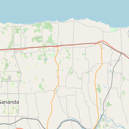
Lyncourt Map, Satellite view of Lyncourt, New York
Lyncourt is a census-designated place (CDP) located in Onondaga County, New York, USA.
Location informations of Lyncourt
Latitude of city of Lyncourt is 43.08146 and longitude of city of Lyncourt is -76.12576- What Country is Lyncourt In? Lyncourt is located in the United States of America.
- What State is Lyncourt located in? Lyncourt is located in New York.
- What County is Lyncourt In? The County of Lyncourt is Onondaga County
Lyncourt, New York (NY), USA Geographic Information
| Country | United States |
| Country Code | US |
| State Name | New York |
| Latitude | 43.08146 |
| Longitude | -76.12576 |
| DMS Lat | 43°4'53.256" N |
| DMS Long | 76°7'32.736" W |
| DMS coordinates : | 43°4'53.256" N 76°7'32.736" W |
Current Date and Time in Lyncourt, New York, USA
| Lyncourt Time Zone : America/New_York |
What day is it in Lyncourt right now?Friday (April 25, 2025) |
What time is it?Current local time and date at Lyncourt is 4/25/2025 - 3:24:26 PM |
Postcode / zip code of Lyncourt
Lyncourt is the actual or alternate city name associated with 2 ZIP Codes by the US Postal Service.
List of all postal codes in Lyncourt, New York, United States.
13206 Zip Code 13208 Zip Code
Online Map of Lyncourt - road map, satellite view and street view


Check out our interactive map of Lyncourt, New York and you'll easily find your way around the Lyncourt major roads and highways.
Satellite Map of Lyncourt, NY, USA
This is online map of the address Lyncourt, NY, United States. You may use button to move and zoom in / out. The map information is for reference only.
St. Joseph's Hospital Heliport (3.53 Km / 2.19 Miles)
Syracuse Hancock International Airport (3.66 Km / 2.28 Miles)
Upstate Medical University Hospital Helipad (4.50 Km / 2.79 Miles)
SUNY Health Science Center Heliport (4.55 Km / 2.82 Miles)
Michael Airfield (11.15 Km / 6.93 Miles)
Onondaga County Sheriff's Department Heliport (13.09 Km / 8.13 Miles)
Camillus Airport (13.77 Km / 8.55 Miles)
Airlane Enterprises Airport (14.41 Km / 8.95 Miles)
Poolsbrook Aerodrome (15.24 Km / 9.47 Miles)
Station 241 Heliport (15.78 Km / 9.80 Miles)
B-Ville Airpark (16.63 Km / 10.33 Miles)
Riveredge Airpark (18.20 Km / 11.31 Miles)
Horseshoe Island Airport (19.34 Km / 12.01 Miles)
Marcellus Airport (19.80 Km / 12.31 Miles)
Carter Flight Park Ultralightport (19.98 Km / 12.41 Miles)
Syracuse Suburban Airport (20.85 Km / 12.95 Miles)
Caughdenoy Airport (21.12 Km / 13.12 Miles)
Shepard Airport (21.36 Km / 13.27 Miles)
Anthonson Airport (22.95 Km / 14.26 Miles)
Luther Airport (23.50 Km / 14.60 Miles)
LYNCOURT SCHOOL (322 m / 0.20 Miles)
WEBSTER ELEMENTARY SCHOOL (1.22 Km / 0.76 Miles)
SALEM HYDE ELEMENTARY SCHOOL (1.28 Km / 0.80 Miles)
LINCOLN MIDDLE SCHOOL (1.80 Km / 1.12 Miles)
LEMOYNE ELEMENTARY SCHOOL (1.84 Km / 1.14 Miles)
GRANT MIDDLE SCHOOL (2.01 Km / 1.25 Miles)
HUNTINGTON K-8 SCHOOL (2.60 Km / 1.62 Miles)
HENNINGER HIGH SCHOOL (2.69 Km / 1.67 Miles)
FRANKLIN ELEMENTARY SCHOOL (2.69 Km / 1.67 Miles)
ROXBORO ROAD MIDDLE SCHOOL (2.98 Km / 1.85 Miles)
ROXBORO ROAD ELEMENTARY SCHOOL (2.98 Km / 1.85 Miles)
DR WEEKS ELEMENTARY SCHOOL (3.04 Km / 1.89 Miles)
ONONDAGA-CORTLAND-MADISON BOCES (3.37 Km / 2.10 Miles)
PARK HILL SCHOOL (3.65 Km / 2.27 Miles)
HUTCHINGS CHILD & YOUTH SERVICES (4.12 Km / 2.56 Miles)
EAST SYRACUSE ELEMENTARY SCHOOL (4.25 Km / 2.64 Miles)
NATE PERRY ELEMENTARY SCHOOL (4.51 Km / 2.80 Miles)
HURLBUT W SMITH K-8 SCHOOL (4.55 Km / 2.83 Miles)
INSTITUTE OF TECHNOLOGY AT SYRACUSE CENTRAL (4.77 Km / 2.96 Miles)
CHESTNUT HILL ELEMENTARY SCHOOL (4.78 Km / 2.97 Miles)
Continental School of Beauty Culture-Mattydale (3.24 Km / 2.01 Miles)
St. Joseph's College of Nursing (3.43 Km / 2.13 Miles)
Onondaga School of Therapeutic Massage-Syracuse (3.94 Km / 2.45 Miles)
Onondaga Cortland Madison BOCES (4.28 Km / 2.66 Miles)
Upstate Medical University (4.56 Km / 2.83 Miles)
Le Moyne College (4.59 Km / 2.85 Miles)
Syracuse University (4.68 Km / 2.91 Miles)
Pomeroy College of Nursing at Crouse Hospital (4.71 Km / 2.92 Miles)
List of places near to Lyncourt
| Name | Distance |
|---|---|
| Mattydale | 2.41 Km / 1.50 Miles |
| Galeville | 3.95 Km / 2.45 Miles |
| Syracuse | 4.10 Km / 2.55 Miles |
| East Syracuse | 4.23 Km / 2.63 Miles |
| Salina | 4.52 Km / 2.81 Miles |
| De Witt | 5.35 Km / 3.32 Miles |
| North Syracuse | 5.94 Km / 3.69 Miles |
| Solvay | 7.12 Km / 4.42 Miles |
| Liverpool | 7.97 Km / 4.95 Miles |
| Geddes | 8.04 Km / 5.00 Miles |
| Westvale | 8.57 Km / 5.33 Miles |
| Lakeland | 9.37 Km / 5.82 Miles |
| Fairmount | 9.92 Km / 6.16 Miles |
| Minoa | 10.17 Km / 6.32 Miles |
| Fayetteville | 11.41 Km / 7.09 Miles |
| Cicero | 11.55 Km / 7.18 Miles |
| Nedrow | 11.90 Km / 7.39 Miles |
| Clay | 12.05 Km / 7.49 Miles |
| Manlius (Town) | 12.22 Km / 7.59 Miles |
| Bridgeport | 13.57 Km / 8.43 Miles |
| Onondaga | 13.72 Km / 8.53 Miles |
| Seneca Knolls | 13.72 Km / 8.53 Miles |
| Manlius | 14.98 Km / 9.31 Miles |
| Camillus | 15.23 Km / 9.46 Miles |
| Camillus (Town) | 15.34 Km / 9.53 Miles |
| Village Green | 16.26 Km / 10.10 Miles |
| Brewerton | 16.86 Km / 10.48 Miles |
| Baldwinsville | 18.86 Km / 11.72 Miles |
| Van Buren | 19.08 Km / 11.86 Miles |
| LaFayette | 19.41 Km / 12.06 Miles |
| Sullivan | 19.70 Km / 12.24 Miles |
| Marcellus | 20.61 Km / 12.81 Miles |
| Constantia (CDP) | 21.12 Km / 13.12 Miles |
| Sand Ridge | 21.17 Km / 13.15 Miles |
| Pompey | 21.17 Km / 13.15 Miles |
| Chittenango | 21.44 Km / 13.32 Miles |
| Phoenix | 21.88 Km / 13.60 Miles |
| Marcellus (Town) | 22.30 Km / 13.86 Miles |
| Central Square | 22.89 Km / 14.22 Miles |
| Schroeppel | 23.08 Km / 14.34 Miles |
| Lysander | 23.15 Km / 14.38 Miles |
| Constantia | 23.70 Km / 14.73 Miles |