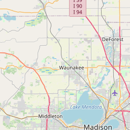
Maple Bluff Map, Satellite view of Maple Bluff, Wisconsin
Maple Bluff is a village located in Dane County, Wisconsin, USA.
Location informations of Maple Bluff
Latitude of city of Maple Bluff is 43.11833 and longitude of city of Maple Bluff is -89.37956- What Country is Maple Bluff In? Maple Bluff is located in the United States of America.
- What State is Maple Bluff located in? Maple Bluff is located in Wisconsin.
- What County is Maple Bluff In? The County of Maple Bluff is Dane County
Maple Bluff, Wisconsin (WI), USA Geographic Information
| Country | United States |
| Country Code | US |
| State Name | Wisconsin |
| Latitude | 43.11833 |
| Longitude | -89.37956 |
| DMS Lat | 43°7'5.988" N |
| DMS Long | 89°22'46.416" W |
| DMS coordinates : | 43°7'5.988" N 89°22'46.416" W |
Current Date and Time in Maple Bluff, Wisconsin, USA
| Maple Bluff Time Zone : America/Chicago |
What day is it in Maple Bluff right now?Monday (June 9, 2025) |
What time is it?Current local time and date at Maple Bluff is 20:24:40 (06/09/2025) : (America/Chicago) |
Postcode / zip code of Maple Bluff
Maple Bluff is the actual or alternate city name associated with 1 ZIP Codes by the US Postal Service.
List of all postal codes in Maple Bluff, Wisconsin, United States.
53704 Zip Code
Online Map of Maple Bluff - road map, satellite view and street view


Check out our interactive map of Maple Bluff, Wisconsin and you'll easily find your way around the Maple Bluff major roads and highways.
Satellite Map of Maple Bluff, WI, USA
This is online map of the address Maple Bluff, WI, United States. You may use button to move and zoom in / out. The map information is for reference only.
Army Guard Heliport (3.26 Km / 2.03 Miles)
Dane County Regional Truax Field (4.17 Km / 2.59 Miles)
Meriter/Park Heliport (6.14 Km / 3.81 Miles)
Uw Hospital & Clinics Heliport (6.41 Km / 3.98 Miles)
SSM Health, St. Marys Hospital - Madison Heliport (6.84 Km / 4.25 Miles)
Waunakee Airport (8.88 Km / 5.52 Miles)
Middleton Municipal Morey Field (12.34 Km / 7.67 Miles)
Dane Airport (13.60 Km / 8.45 Miles)
Blackhawk Airfield (15.82 Km / 9.83 Miles)
Elert Airport (16.87 Km / 10.48 Miles)
Morrisonville International Airport (17.55 Km / 10.90 Miles)
Little Wheel Field (17.85 Km / 11.09 Miles)
Verona Airport (18.70 Km / 11.62 Miles)
Eberle Ranch Airport (18.72 Km / 11.63 Miles)
Quale Airport (19.23 Km / 11.95 Miles)
Quams Marina Seaplane Base (20.58 Km / 12.79 Miles)
Uff-Da Airport (20.85 Km / 12.95 Miles)
Mc Manus Hoonch-Na-Shee-Kaw Airport (21.05 Km / 13.08 Miles)
Peterson Field (21.45 Km / 13.33 Miles)
Spiegel Field (22.91 Km / 14.23 Miles)
Shabazz-City High (1.37 Km / 0.85 Miles)
Sherman Middle (1.39 Km / 0.86 Miles)
Isthmus Montessori Academy Public (2.06 Km / 1.28 Miles)
Mendota Elementary (2.08 Km / 1.29 Miles)
Lake View Elementary (2.42 Km / 1.50 Miles)
Mendota Mental Health Institution (2.47 Km / 1.53 Miles)
Central Wisconsin Center (2.64 Km / 1.64 Miles)
Lindbergh Elementary (2.88 Km / 1.79 Miles)
Emerson Elementary (2.92 Km / 1.82 Miles)
East High (3.08 Km / 1.91 Miles)
Gompers Elementary (3.22 Km / 2.00 Miles)
Black Hawk Middle (3.22 Km / 2.00 Miles)
Capital High (3.67 Km / 2.28 Miles)
Lapham Elementary (3.69 Km / 2.29 Miles)
Innovative & Alternative Middle (3.70 Km / 2.30 Miles)
Innovative & Alternative High (3.93 Km / 2.44 Miles)
Marquette Elementary (3.98 Km / 2.47 Miles)
Lowell Elementary (4.24 Km / 2.63 Miles)
Hawthorne Elementary (4.25 Km / 2.64 Miles)
Madison Area Technical College (4.21 Km / 2.62 Miles)
List of places near to Maple Bluff
| Name | Distance |
|---|---|
| Madison (Town) | 2.51 Km / 1.56 Miles |
| Madison | 5.33 Km / 3.31 Miles |
| Westport | 6.71 Km / 4.17 Miles |
| Shorewood Hills | 7.03 Km / 4.37 Miles |
| Monona | 7.25 Km / 4.50 Miles |
| Waunakee | 10.25 Km / 6.37 Miles |
| Middleton | 10.39 Km / 6.46 Miles |
| Windsor | 11.54 Km / 7.17 Miles |
| Burke | 11.90 Km / 7.39 Miles |
| Blooming Grove | 13.43 Km / 8.35 Miles |
| McFarland | 13.84 Km / 8.60 Miles |
| Springfield | 14.31 Km / 8.89 Miles |
| DeForest | 14.68 Km / 9.12 Miles |
| Vienna | 15.00 Km / 9.32 Miles |
| Sun Prairie | 15.29 Km / 9.50 Miles |
| Cottage Grove | 15.35 Km / 9.54 Miles |
| Verona (Town) | 15.65 Km / 9.72 Miles |
| Middleton (Town) | 16.10 Km / 10.00 Miles |
| Sun Prairie (Town) | 16.46 Km / 10.23 Miles |
| Dunn | 16.97 Km / 10.54 Miles |
| Dane | 17.72 Km / 11.01 Miles |
| Cottage Grove (Town) | 17.77 Km / 11.04 Miles |
| Verona | 18.89 Km / 11.74 Miles |
| Fitchburg | 18.99 Km / 11.80 Miles |
| Dane (Town) | 19.52 Km / 12.13 Miles |
| Oregon | 21.38 Km / 13.28 Miles |
| Bristol | 21.68 Km / 13.47 Miles |
| Pleasant Springs | 22.39 Km / 13.91 Miles |
| Cross Plains | 22.42 Km / 13.93 Miles |
| Berry | 22.65 Km / 14.07 Miles |
| Leeds | 23.35 Km / 14.51 Miles |
| Cross Plains (Town) | 23.41 Km / 14.55 Miles |
| Arlington (Town) | 24.26 Km / 15.07 Miles |
| Oregon (Town) | 24.27 Km / 15.08 Miles |
| Arlington | 24.43 Km / 15.18 Miles |
| Lodi | 24.79 Km / 15.40 Miles |