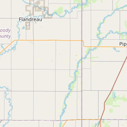
Mapleton Map, Satellite view of Mapleton, South Dakota
Mapleton is a township located in Minnehaha County, South Dakota, USA.
Location informations of Mapleton
Latitude of city of Mapleton is 43.63805 and longitude of city of Mapleton is -96.70145- What Country is Mapleton In? Mapleton is located in the United States of America.
- What State is Mapleton located in? Mapleton is located in South Dakota.
- What County is Mapleton In? The County of Mapleton is Minnehaha County
Mapleton, South Dakota (SD), USA Geographic Information
| Country | United States |
| Country Code | US |
| State Name | South Dakota |
| Latitude | 43.63805 |
| Longitude | -96.70145 |
| DMS Lat | 43°38'16.98" N |
| DMS Long | 96°42'5.22" W |
| DMS coordinates : | 43°38'16.98" N 96°42'5.22" W |
Current Date and Time in Mapleton, South Dakota, USA
| Mapleton Time Zone : America/Chicago |
What day is it in Mapleton right now?Thursday (June 12, 2025) |
What time is it?Current local time and date at Mapleton is 10:10:45 (06/12/2025) : (America/Chicago) |
Postcode / zip code of Mapleton
Mapleton is the actual or alternate city name associated with 5 ZIP Codes by the US Postal Service.
List of all postal codes in Mapleton, South Dakota, United States.
57005 Zip Code 57055 Zip Code 57104 Zip Code 57107 Zip Code 57110 Zip Code
Online Map of Mapleton - road map, satellite view and street view


Check out our interactive map of Mapleton, South Dakota and you'll easily find your way around the Mapleton major roads and highways.
Satellite Map of Mapleton, SD, USA
This is online map of the address Mapleton, SD, United States. You may use button to move and zoom in / out. The map information is for reference only.
Glawe's Airport (4.40 Km / 2.73 Miles)
Sioux Falls Regional Airport / Joe Foss Field (6.66 Km / 4.14 Miles)
Mc Kennan Hospital Heliport (11.61 Km / 7.21 Miles)
Sanford Usd Medical Center Heliport (11.91 Km / 7.40 Miles)
Erickson Intergalactic Airport (15.94 Km / 9.90 Miles)
Avera Heart Hospital of South Dakota Heliport (17.55 Km / 10.90 Miles)
Weelborg Airport (18.75 Km / 11.65 Miles)
Oakleaf Airport (20.56 Km / 12.78 Miles)
Avera Dells Area Hospital Heliport (21.22 Km / 13.18 Miles)
Marv Skie / Lincoln County Airport (21.87 Km / 13.59 Miles)
Chris Hofer Landing Strip (23.22 Km / 14.43 Miles)
Jensen Airport (24.79 Km / 15.40 Miles)
Renberg Elementary - 42 (4.77 Km / 2.96 Miles)
List of places near to Mapleton
| Name | Distance |
|---|---|
| Renner Corner | 1.13 Km / 0.70 Miles |
| Meadow View Addition | 2.16 Km / 1.34 Miles |
| Sverdrup | 8.14 Km / 5.06 Miles |
| Brandon (Township) | 8.19 Km / 5.09 Miles |
| Crooks | 9.29 Km / 5.77 Miles |
| Pine Lakes Addition | 10.95 Km / 6.80 Miles |
| Sioux Falls | 11.24 Km / 6.98 Miles |
| Benton | 11.25 Km / 6.99 Miles |
| Brandon | 11.48 Km / 7.13 Miles |
| Edison | 12.28 Km / 7.63 Miles |
| Lyons | 13.64 Km / 8.48 Miles |
| Split Rock | 13.75 Km / 8.54 Miles |
| Baltic | 14.06 Km / 8.74 Miles |
| Anderson | 14.57 Km / 9.05 Miles |
| Wayne | 15.88 Km / 9.87 Miles |
| Red Rock | 16.06 Km / 9.98 Miles |
| Garretson | 18.25 Km / 11.34 Miles |
| Dell Rapids (Township) | 18.45 Km / 11.46 Miles |
| Shindler | 18.62 Km / 11.57 Miles |
| Palisade | 18.82 Km / 11.69 Miles |
| Hartford | 19.48 Km / 12.10 Miles |
| Valley Springs (Township) | 19.70 Km / 12.24 Miles |
| Valley Springs | 19.80 Km / 12.30 Miles |
| Springdale | 19.83 Km / 12.32 Miles |
| Logan | 20.55 Km / 12.77 Miles |
| Hartford (Township) | 20.81 Km / 12.93 Miles |
| Dell Rapids | 20.91 Km / 12.99 Miles |
| Burk | 21.37 Km / 13.28 Miles |
| Grand Meadow | 21.60 Km / 13.42 Miles |
| Sherman | 22.57 Km / 14.02 Miles |
| Wall Lake | 22.62 Km / 14.06 Miles |
| Delapre | 22.74 Km / 14.13 Miles |
| Harrisburg | 22.98 Km / 14.28 Miles |
| Tea | 23.91 Km / 14.86 Miles |
| Colton | 24.52 Km / 15.24 Miles |
| Highland | 24.80 Km / 15.41 Miles |