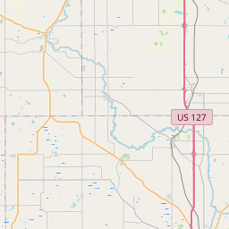
Mason Map, Satellite view of Mason, Michigan
Mason is a city located in Ingham County, Michigan, USA.
Location informations of Mason
Latitude of city of Mason is 42.57920 and longitude of city of Mason is -84.44358- What Country is Mason In? Mason is located in the United States of America.
- What State is Mason located in? Mason is located in Michigan.
- What County is Mason In? The County of Mason is Ingham County
Mason, Michigan (MI), USA Geographic Information
| Country | United States |
| Country Code | US |
| State Name | Michigan |
| Latitude | 42.5792 |
| Longitude | -84.44358 |
| DMS Lat | 42°34'45.12" N |
| DMS Long | 84°26'36.888" W |
| DMS coordinates : | 42°34'45.12" N 84°26'36.888" W |
Current Date and Time in Mason, Michigan, USA
| Mason Time Zone : America/Detroit |
What day is it in Mason right now?Saturday (May 17, 2025) |
What time is it?Current local time and date at Mason is 5/17/2025 - 5:58:45 PM |
Postcode / zip code of Mason
Mason is the actual or alternate city name associated with 1 ZIP Codes by the US Postal Service.
List of all postal codes in Mason, Michigan, United States.
48854 Zip Code
Online Map of Mason - road map, satellite view and street view


Check out our interactive map of Mason, Michigan and you'll easily find your way around the Mason major roads and highways.
Satellite Map of Mason, MI, USA
This is online map of the address Mason, MI, United States. You may use button to move and zoom in / out. The map information is for reference only.
Mason Jewett Field (2.24 Km / 1.39 Miles)
Sawyer Field (2.37 Km / 1.47 Miles)
Eichmeier Field (2.93 Km / 1.82 Miles)
Potato Pond Heliport (4.28 Km / 2.66 Miles)
Lakeside Airport (10.92 Km / 6.78 Miles)
Jet Pad Heliport (13.16 Km / 8.18 Miles)
McLaren Greater Lansing Hospital Heliport (14.37 Km / 8.93 Miles)
Rapids Airway Airport (15.93 Km / 9.90 Miles)
Ingham Medical Helistop (16.40 Km / 10.19 Miles)
State Police HQ Heliport (16.84 Km / 10.46 Miles)
Skyway Estates Airport (17.02 Km / 10.58 Miles)
Michigan National Guard Headquarters Heliport (17.24 Km / 10.71 Miles)
Sparrow Hospital Heliport (18.84 Km / 11.71 Miles)
Maidens Airport (19.75 Km / 12.27 Miles)
Erch Heliport (19.95 Km / 12.40 Miles)
Williams Field (24.30 Km / 15.10 Miles)
Steele Street Elementary School (667 m / 0.41 Miles)
Mason High School (1.05 Km / 0.65 Miles)
Mason Middle School (1.46 Km / 0.91 Miles)
Ingham Administrative Unit (2.05 Km / 1.28 Miles)
Wilson Talent Center (2.26 Km / 1.40 Miles)
SLCEvergreen (2.26 Km / 1.40 Miles)
SAIL Skills for Adult Independent Living (2.26 Km / 1.40 Miles)
Heartwood School (2.30 Km / 1.43 Miles)
List of places near to Mason
| Name | Distance |
|---|---|
| Vevay | 4.87 Km / 3.03 Miles |
| Alaiedon | 6.15 Km / 3.82 Miles |
| Aurelius | 8.84 Km / 5.49 Miles |
| Delhi | 8.97 Km / 5.57 Miles |
| Holt | 9.00 Km / 5.59 Miles |
| Ingham | 11.23 Km / 6.98 Miles |
| Dansville | 11.78 Km / 7.32 Miles |
| Wheatfield | 12.06 Km / 7.49 Miles |
| Leslie (Township) | 12.08 Km / 7.51 Miles |
| Leslie | 14.24 Km / 8.85 Miles |
| Onondaga | 14.39 Km / 8.94 Miles |
| Okemos | 15.96 Km / 9.92 Miles |
| Bunker Hill | 16.34 Km / 10.15 Miles |
| Meridian | 16.36 Km / 10.17 Miles |
| Lansing | 17.83 Km / 11.08 Miles |
| Williamston | 17.93 Km / 11.14 Miles |
| Dimondale | 18.35 Km / 11.40 Miles |
| Eaton Rapids (Township) | 18.76 Km / 11.66 Miles |
| Haslett | 18.98 Km / 11.79 Miles |
| Windsor | 19.01 Km / 11.81 Miles |
| Eaton Rapids | 19.05 Km / 11.84 Miles |
| East Lansing | 19.14 Km / 11.89 Miles |
| Leroy | 19.75 Km / 12.27 Miles |
| White Oak | 19.86 Km / 12.34 Miles |
| Williamstown | 20.58 Km / 12.79 Miles |
| Lansing (Charter Township) | 21.21 Km / 13.18 Miles |
| Hamlin | 22.28 Km / 13.84 Miles |
| Edgemont Park | 22.30 Km / 13.86 Miles |
| Waverly | 22.95 Km / 14.26 Miles |
| Rives | 23.06 Km / 14.33 Miles |
| Stockbridge (Township) | 23.62 Km / 14.68 Miles |
| Tompkins | 23.82 Km / 14.80 Miles |
| Webberville | 24.11 Km / 14.98 Miles |
| Delta | 24.31 Km / 15.11 Miles |
| Potterville | 24.80 Km / 15.41 Miles |