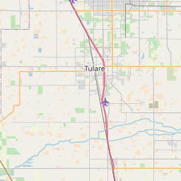
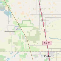
Matheny Map, Satellite view of Matheny, California
Matheny is a census-designated place (CDP) located in Tulare County, California, USA.
Location informations of Matheny
Latitude of city of Matheny is 36.17065 and longitude of city of Matheny is -119.35161- What Country is Matheny In? Matheny is located in the United States of America.
- What State is Matheny located in? Matheny is located in California.
- What County is Matheny In? The County of Matheny is Tulare County
Matheny, California (CA), USA Geographic Information
| Country | United States |
| Country Code | US |
| State Name | California |
| Latitude | 36.17065 |
| Longitude | -119.35161 |
| DMS Lat | 36°10'14.34" N |
| DMS Long | 119°21'5.796" W |
| DMS coordinates : | 36°10'14.34" N 119°21'5.796" W |
Current Date and Time in Matheny, California, USA
| Matheny Time Zone : America/Los_Angeles |
What day is it in Matheny right now?Sunday (May 25, 2025) |
What time is it?Current local time and date at Matheny is 18:37:49 (05/25/2025) : (America/Los_Angeles) |
Postcode / zip code of Matheny
Matheny is the actual or alternate city name associated with 1 ZIP Codes by the US Postal Service.
List of all postal codes in Matheny, California, United States.
93274 Zip Code
Online Map of Matheny - road map, satellite view and street view


Check out our interactive map of Matheny, California and you'll easily find your way around the Matheny major roads and highways.
Satellite Map of Matheny, CA, USA
This is online map of the address Matheny, CA, United States. You may use button to move and zoom in / out. The map information is for reference only.
SCE San Joaquin Heliport (2.12 Km / 1.32 Miles)
Mefford Field (2.80 Km / 1.74 Miles)
Tulare Motor Sports #2 Heliport (3.66 Km / 2.27 Miles)
Tulare Motor Sports #1 Heliport (4.08 Km / 2.54 Miles)
Moores Airport (7.98 Km / 4.96 Miles)
Rankin Airport (9.26 Km / 5.75 Miles)
Colburn Airport (14.90 Km / 9.26 Miles)
Visalia International Airport (16.88 Km / 10.49 Miles)
Ragan Farms Airport (17.76 Km / 11.03 Miles)
Kaweah Delta District Heliport (A-lll) (18.26 Km / 11.34 Miles)
Green Acres Airport (18.95 Km / 11.77 Miles)
Boswell Airport (19.34 Km / 12.02 Miles)
Exeter Airport (19.80 Km / 12.30 Miles)
Corcoran South Airport (19.90 Km / 12.37 Miles)
3H Cattle Company Airport (19.94 Km / 12.39 Miles)
Ianni Strip (20.30 Km / 12.61 Miles)
Baldwin Airport (20.92 Km / 13.00 Miles)
Tipton Field (21.57 Km / 13.40 Miles)
Strathmore Field (21.72 Km / 13.50 Miles)
Saint Johns Airport (22.44 Km / 13.94 Miles)
Countryside Community Day (2.85 Km / 1.77 Miles)
Tulare Technical Preparatory High (2.87 Km / 1.78 Miles)
Palo Verde Elementary (2.93 Km / 1.82 Miles)
Cypress Elementary (3.13 Km / 1.95 Miles)
Mulcahy Middle (3.37 Km / 2.09 Miles)
Tulare City Community Day (3.50 Km / 2.18 Miles)
Tulare Support (3.51 Km / 2.18 Miles)
Lincoln Elementary (3.53 Km / 2.19 Miles)
Roosevelt Elementary (3.54 Km / 2.20 Miles)
Tulare Union High (4.37 Km / 2.71 Miles)
Sierra Vista Charter High (4.53 Km / 2.81 Miles)
Wilson Elementary (4.55 Km / 2.83 Miles)
Frank Kohn Elementary (4.67 Km / 2.90 Miles)
Maple Elementary (4.69 Km / 2.92 Miles)
Tulare Western High (4.98 Km / 3.10 Miles)
List of places near to Matheny
| Name | Distance |
|---|---|
| Tulare | 4.14 Km / 2.57 Miles |
| East Tulare Villa | 7.23 Km / 4.49 Miles |
| Tipton | 12.87 Km / 8.00 Miles |
| Waukena | 14.62 Km / 9.08 Miles |
| Woodville | 16.17 Km / 10.05 Miles |
| Visalia | 18.53 Km / 11.51 Miles |
| Farmersville | 19.19 Km / 11.92 Miles |
| Linnell Camp | 19.24 Km / 11.96 Miles |
| Plainview | 19.76 Km / 12.28 Miles |
| Corcoran | 20.42 Km / 12.69 Miles |
| Goshen | 20.98 Km / 13.04 Miles |
| West Goshen | 21.77 Km / 13.53 Miles |
| Poplar-Cotton Center | 22.18 Km / 13.78 Miles |
| Pixley | 23.11 Km / 14.36 Miles |
| Exeter | 23.40 Km / 14.54 Miles |
| Patterson Tract | 23.76 Km / 14.76 Miles |
| Lindsay | 23.92 Km / 14.86 Miles |
| Tooleville | 24.87 Km / 15.45 Miles |
| Tonyville | 24.96 Km / 15.51 Miles |