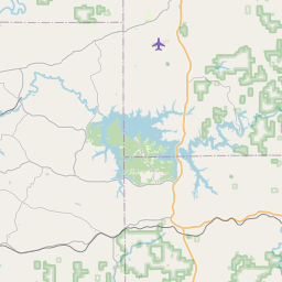
Mockingbird Valley Map, Satellite view of Mockingbird Valley, Kentucky
Mockingbird Valley is a city located in Jefferson County, Kentucky, USA.
Location informations of Mockingbird Valley
Latitude of city of Mockingbird Valley is 38.27257 and longitude of city of Mockingbird Valley is -85.68218- What Country is Mockingbird Valley In? Mockingbird Valley is located in the United States of America.
- What State is Mockingbird Valley located in? Mockingbird Valley is located in Kentucky.
- What County is Mockingbird Valley In? The County of Mockingbird Valley is Jefferson County
Mockingbird Valley, Kentucky (KY), USA Geographic Information
| Country | United States |
| Country Code | US |
| State Name | Kentucky |
| Latitude | 38.27257 |
| Longitude | -85.68218 |
| DMS Lat | 38°16'21.252" N |
| DMS Long | 85°40'55.848" W |
| DMS coordinates : | 38°16'21.252" N 85°40'55.848" W |
Current Date and Time in Mockingbird Valley, Kentucky, USA
| Mockingbird Valley Time Zone : America/New_York |
What day is it in Mockingbird Valley right now?Thursday (April 17, 2025) |
What time is it?Current local time and date at Mockingbird Valley is 4/17/2025 - 8:05:08 PM |
Postcode / zip code of Mockingbird Valley
Mockingbird Valley is the actual or alternate city name associated with 1 ZIP Codes by the US Postal Service.
List of all postal codes in Mockingbird Valley, Kentucky, United States.
40207 Zip Code
Area Codes Mockingbird Valley, Kentucky, USA
Mockingbird Valley, Kentucky covers 1 Area Codes
502 Area CodeOnline Map of Mockingbird Valley - road map, satellite view and street view
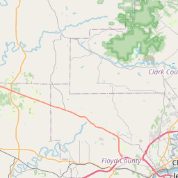

Check out our interactive map of Mockingbird Valley, Kentucky and you'll easily find your way around the Mockingbird Valley major roads and highways.
Satellite Map of Mockingbird Valley, KY, USA
This is online map of the address Mockingbird Valley, KY, United States. You may use button to move and zoom in / out. The map information is for reference only.
Wlky-Tv Studios Heliport (2.66 Km / 1.65 Miles)
Bowman Field (5.21 Km / 3.24 Miles)
Baptist Hospital East Heliport (5.28 Km / 3.28 Miles)
University Hospital Heliport (6.02 Km / 3.74 Miles)
Norton Children's Hospital Heliport (6.43 Km / 4.00 Miles)
UofL Health - Jewish Hospital Heliport (6.49 Km / 4.03 Miles)
Holiday Inn Lakeview Heliport (6.54 Km / 4.06 Miles)
Lyndon Fire Protection District Heliport (7.07 Km / 4.39 Miles)
Norton Audubon Hospital Heliport (7.36 Km / 4.57 Miles)
Norton Brownsboro Hospital Heliport (10.44 Km / 6.49 Miles)
Churchill Downs Heliport (10.89 Km / 6.77 Miles)
Clark Regional Airport (11.42 Km / 7.10 Miles)
Louisville Muhammad Ali International Airport (11.89 Km / 7.38 Miles)
Switch Pad Heliport (11.89 Km / 7.39 Miles)
Professional Arts Building Heliport (13.76 Km / 8.55 Miles)
Papa John's Headquarters Heliport (14.68 Km / 9.12 Miles)
Central Government Center Heliport (15.56 Km / 9.67 Miles)
Greener Horizons Heliport (17.17 Km / 10.67 Miles)
Woodledge Farm Airport (17.52 Km / 10.89 Miles)
Timmons Field (18.34 Km / 11.40 Miles)
Chenoweth Elementary (1.56 Km / 0.97 Miles)
Field Elementary (2.29 Km / 1.42 Miles)
Barret Traditional Middle (2.83 Km / 1.76 Miles)
Bridgepoint Elementary School (3.19 Km / 1.98 Miles)
Kentucky School for the Blind (3.22 Km / 2.00 Miles)
Dunn Elementary (3.58 Km / 2.22 Miles)
Parkview Middle School (3.76 Km / 2.34 Miles)
Maple Elementary School (4.02 Km / 2.50 Miles)
Breckinridge-Franklin Elementary (4.47 Km / 2.78 Miles)
Riverside Elementary School (4.50 Km / 2.79 Miles)
St Matthews Elementary (4.69 Km / 2.92 Miles)
Old Corden Porter School (4.79 Km / 2.98 Miles)
Home of the Innocents Discovery (4.91 Km / 3.05 Miles)
Home of the Innocents School (4.93 Km / 3.06 Miles)
Galen College of Nursing-Louisville (1.30 Km / 0.81 Miles)
The Southern Baptist Theological Seminary (2.75 Km / 1.71 Miles)
Empire Beauty School-Chenoweth (2.85 Km / 1.77 Miles)
Louisville Presbyterian Theological Seminary (3.97 Km / 2.46 Miles)
Ideal Beauty Academy (4.57 Km / 2.84 Miles)
List of places near to Mockingbird Valley
| Name | Distance |
|---|---|
| Rolling Fields | 1.06 Km / 0.66 Miles |
| Indian Hills | 1.70 Km / 1.06 Miles |
| Brownsboro Village | 1.77 Km / 1.10 Miles |
| Druid Hills | 2.05 Km / 1.27 Miles |
| Riverwood | 2.14 Km / 1.33 Miles |
| Bellewood | 2.58 Km / 1.60 Miles |
| Maryhill Estates | 2.86 Km / 1.78 Miles |
| St. Matthews | 3.18 Km / 1.98 Miles |
| Northfield | 3.93 Km / 2.44 Miles |
| Windy Hills | 4.17 Km / 2.59 Miles |
| Norbourne Estates | 4.18 Km / 2.60 Miles |
| Richlawn | 4.23 Km / 2.63 Miles |
| Glenview Manor | 4.29 Km / 2.67 Miles |
| Glenview Hills | 4.54 Km / 2.82 Miles |
| Crossgate | 4.62 Km / 2.87 Miles |
| Woodlawn Park | 4.79 Km / 2.98 Miles |
| Jeffersonville | 4.83 Km / 3.00 Miles |
| Beechwood Village | 4.86 Km / 3.02 Miles |
| Glenview | 4.86 Km / 3.02 Miles |
| Seneca Gardens | 4.87 Km / 3.03 Miles |
| Graymoor-Devondale | 5.16 Km / 3.21 Miles |
| Thornhill | 5.23 Km / 3.25 Miles |
| Strathmoor Village | 5.51 Km / 3.42 Miles |
| Goose Creek | 5.67 Km / 3.52 Miles |
| Kingsley | 5.82 Km / 3.62 Miles |
| Hills and Dales | 5.94 Km / 3.69 Miles |
| Manor Creek | 6.01 Km / 3.73 Miles |
| Strathmoor Manor | 6.05 Km / 3.76 Miles |
| Bancroft | 6.27 Km / 3.90 Miles |
| Wellington | 6.34 Km / 3.94 Miles |
| Old Brownsboro Place | 6.39 Km / 3.97 Miles |
| Norwood | 6.59 Km / 4.09 Miles |
| Spring Valley | 6.75 Km / 4.19 Miles |
| Meadowview Estates | 6.92 Km / 4.30 Miles |
| Louisville | 7.04 Km / 4.37 Miles |
| Utica | 7.24 Km / 4.50 Miles |
| Lyndon | 7.25 Km / 4.50 Miles |
| Clarksville | 7.30 Km / 4.54 Miles |
| Barbourmeade | 7.41 Km / 4.60 Miles |
| Lincolnshire | 7.64 Km / 4.75 Miles |
| St. Regis Park | 7.66 Km / 4.76 Miles |
| Green Spring | 7.69 Km / 4.78 Miles |
| Briarwood | 7.81 Km / 4.85 Miles |
| Plantation | 8.04 Km / 5.00 Miles |
| Cambridge | 8.04 Km / 5.00 Miles |
| Bellemeade | 8.17 Km / 5.08 Miles |
| Brownsboro Farm | 8.24 Km / 5.12 Miles |
| Parkway Village | 8.38 Km / 5.21 Miles |
| Murray Hill | 8.43 Km / 5.24 Miles |
| Audubon Park | 8.51 Km / 5.29 Miles |