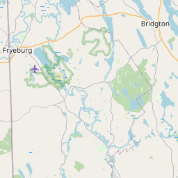
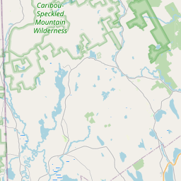
Naples Map, Satellite view of Naples, Maine
Naples is a town located in Cumberland County, Maine, USA.
Location informations of Naples
Latitude of city of Naples is 43.97577 and longitude of city of Naples is -70.63930- What Country is Naples In? Naples is located in the United States of America.
- What State is Naples located in? Naples is located in Maine.
- What County is Naples In? The County of Naples is Cumberland County
Naples, Maine (ME), USA Geographic Information
| Country | United States |
| Country Code | US |
| State Name | Maine |
| Latitude | 43.97577 |
| Longitude | -70.6393 |
| DMS Lat | 43°58'32.772" N |
| DMS Long | 70°38'21.48" W |
| DMS coordinates : | 43°58'32.772" N 70°38'21.48" W |
Current Date and Time in Naples, Maine, USA
| Naples Time Zone : America/New_York |
What day is it in Naples right now?Monday (May 12, 2025) |
What time is it?Current local time and date at Naples is 05:04:12 (05/12/2025) : (America/New_York) |
Postcode / zip code of Naples
Naples is the actual or alternate city name associated with 2 ZIP Codes by the US Postal Service.
List of all postal codes in Naples, Maine, United States.
04015 Zip Code 04055 Zip Code
Online Map of Naples - road map, satellite view and street view


Check out our interactive map of Naples, Maine and you'll easily find your way around the Naples major roads and highways.
Satellite Map of Naples, ME, USA
This is online map of the address Naples, ME, United States. You may use button to move and zoom in / out. The map information is for reference only.
Long Lake Seaplane Base (2.07 Km / 1.29 Miles)
Mast Cove Seaplane Base (2.14 Km / 1.33 Miles)
Twin Eagles Airport (3.21 Km / 2.00 Miles)
Brandy Pond Seaplane Base (4.52 Km / 2.81 Miles)
Hancock Pond Seaplane Base (10.60 Km / 6.59 Miles)
Maple Ridge Airport (12.10 Km / 7.52 Miles)
Crescent Lake Seaplane Base (14.29 Km / 8.88 Miles)
Panther Pond Seaplane Base (15.75 Km / 9.78 Miles)
Dyer's Landing Airport (18.39 Km / 11.43 Miles)
Sebago Lake Basin Seaplane Base (20.75 Km / 12.89 Miles)
Frogg Island Seaplane Base (20.77 Km / 12.91 Miles)
High Note Heliport (23.11 Km / 14.36 Miles)
Dry Pond Seaplane Base (23.12 Km / 14.37 Miles)
Slip Knot Landing Airport (23.23 Km / 14.43 Miles)
Lovewell Pond Seaplane Base (23.80 Km / 14.79 Miles)
Limington Harmon Airport (23.81 Km / 14.79 Miles)
Oxford County Regional Airport (23.82 Km / 14.80 Miles)
Eastern Slopes Regional Airport (24.75 Km / 15.38 Miles)
Lake Region High School (2.84 Km / 1.76 Miles)
Lake Region Vocational Center (2.90 Km / 1.80 Miles)
Lake Region Middle School (3.30 Km / 2.05 Miles)
List of places near to Naples
| Name | Distance |
|---|---|
| Naples (CDP) | 2.45 Km / 1.52 Miles |
| Sebago | 9.89 Km / 6.15 Miles |
| Casco (CDP) | 9.93 Km / 6.17 Miles |
| Casco | 10.43 Km / 6.48 Miles |
| Bridgton (CDP) | 10.57 Km / 6.57 Miles |
| Bridgton | 11.53 Km / 7.16 Miles |
| Denmark | 14.14 Km / 8.79 Miles |
| Harrison | 14.15 Km / 8.79 Miles |
| Otisfield | 14.65 Km / 9.10 Miles |
| Raymond | 15.13 Km / 9.40 Miles |
| Baldwin | 17.37 Km / 10.79 Miles |
| Frye Island | 18.26 Km / 11.35 Miles |
| Steep Falls | 20.24 Km / 12.58 Miles |
| Hiram | 20.83 Km / 12.94 Miles |
| Oxford (CDP) | 20.91 Km / 12.99 Miles |
| Sweden | 21.09 Km / 13.10 Miles |
| Poland | 21.23 Km / 13.19 Miles |
| North Windham | 22.51 Km / 13.99 Miles |
| Standish | 22.74 Km / 14.13 Miles |
| Brownfield | 22.91 Km / 14.24 Miles |
| Oxford | 23.02 Km / 14.30 Miles |
| Gray | 23.13 Km / 14.37 Miles |
| Mechanic Falls | 23.62 Km / 14.68 Miles |
| Fryeburg | 24.74 Km / 15.37 Miles |
| Mechanic Falls (CDP) | 24.90 Km / 15.47 Miles |