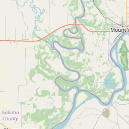
Nason Map, Satellite view of Nason, Illinois
Nason is a city located in Jefferson County, Illinois, USA.
Location informations of Nason
Latitude of city of Nason is 38.17616 and longitude of city of Nason is -88.96757- What Country is Nason In? Nason is located in the United States of America.
- What State is Nason located in? Nason is located in Illinois.
- What County is Nason In? The County of Nason is Jefferson County
Nason, Illinois (IL), USA Geographic Information
| Country | United States |
| Country Code | US |
| State Name | Illinois |
| Latitude | 38.17616 |
| Longitude | -88.96757 |
| DMS Lat | 38°10'34.176" N |
| DMS Long | 88°58'3.252" W |
| DMS coordinates : | 38°10'34.176" N 88°58'3.252" W |
Current Date and Time in Nason, Illinois, USA
| Nason Time Zone : America/Chicago |
What day is it in Nason right now?Sunday (March 30, 2025) |
What time is it?Current local time and date at Nason is 3/30/2025 - 6:35:43 AM |
Postcode / zip code of Nason
Nason is the actual or alternate city name associated with 2 ZIP Codes by the US Postal Service.
List of all postal codes in Nason, Illinois, United States.
62816 Zip Code 62866 Zip Code
Online Map of Nason - road map, satellite view and street view

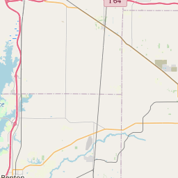
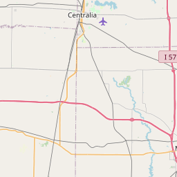
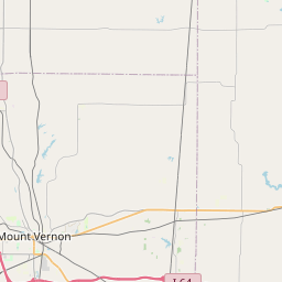
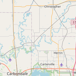
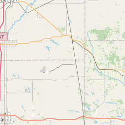


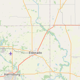
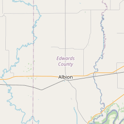


Check out our interactive map of Nason, Illinois and you'll easily find your way around the Nason major roads and highways.
Satellite Map of Nason, IL, USA
This is online map of the address Nason, IL, United States. You may use button to move and zoom in / out. The map information is for reference only.
Big Muddy Correctional Facility Heliport (7.53 Km / 4.68 Miles)
Davy Jones /Private/ Airport (9.04 Km / 5.62 Miles)
Rend Lake Conservancy District Heliport (11.37 Km / 7.06 Miles)
St. Mary's Good Samaritan Heliport (13.71 Km / 8.52 Miles)
Crossroads Community Hospital Heliport (15.37 Km / 9.55 Miles)
Good Samaritan Regional Health Care Center Heliport (16.99 Km / 10.56 Miles)
Mount Vernon Outland Airport (18.85 Km / 11.71 Miles)
Air Evac 11 Heliport (18.87 Km / 11.73 Miles)
Franklin Hospital Heliport (19.03 Km / 11.83 Miles)
Benton Municipal Airport (19.07 Km / 11.85 Miles)
List of places near to Nason
| Name | Distance |
|---|---|
| Elk Prairie | 1.36 Km / 0.85 Miles |
| Ina | 6.22 Km / 3.86 Miles |
| Bonnie | 6.34 Km / 3.94 Miles |
| Waltonville | 7.23 Km / 4.49 Miles |
| Spring Garden | 8.40 Km / 5.22 Miles |
| McClellan | 9.01 Km / 5.60 Miles |
| Bald Hill | 10.95 Km / 6.80 Miles |
| Dodds | 11.62 Km / 7.22 Miles |
| Sesser | 11.86 Km / 7.37 Miles |
| Barren | 11.94 Km / 7.42 Miles |
| Ewing (Township) | 13.65 Km / 8.48 Miles |
| Blissville | 13.80 Km / 8.57 Miles |
| Ewing | 14.01 Km / 8.71 Miles |
| Goode | 14.77 Km / 9.18 Miles |
| Moores Prairie | 16.39 Km / 10.18 Miles |
| Mount Vernon | 16.67 Km / 10.36 Miles |
| Woodlawn | 18.03 Km / 11.20 Miles |
| Opdyke | 18.04 Km / 11.21 Miles |
| Shiloh | 18.38 Km / 11.42 Miles |
| Valier | 19.05 Km / 11.84 Miles |
| Browning | 20.01 Km / 12.43 Miles |
| Mount Vernon (Township) | 20.29 Km / 12.61 Miles |
| Benton | 20.38 Km / 12.66 Miles |
| West City | 20.46 Km / 12.71 Miles |
| Pendleton | 20.54 Km / 12.76 Miles |
| Belle Rive | 20.81 Km / 12.93 Miles |
| Northern | 20.98 Km / 13.04 Miles |
| Casner | 21.32 Km / 13.25 Miles |
| Benton (Township) | 21.71 Km / 13.49 Miles |
| Buckner | 21.88 Km / 13.60 Miles |
| Du Bois (Township) | 22.03 Km / 13.69 Miles |
| Du Bois | 22.04 Km / 13.70 Miles |
| North City | 22.23 Km / 13.81 Miles |
| Radom | 22.89 Km / 14.22 Miles |
| Tamaroa | 23.34 Km / 14.50 Miles |
| Tyrone | 23.53 Km / 14.62 Miles |
| Christopher | 23.85 Km / 14.82 Miles |
| Dahlgren | 24.86 Km / 15.45 Miles |