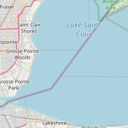
New Baltimore Map, Satellite view of New Baltimore, Michigan
New Baltimore is a city located in Macomb County, Michigan, USA.
Location informations of New Baltimore
Latitude of city of New Baltimore is 42.68114 and longitude of city of New Baltimore is -82.73686- What Country is New Baltimore In? New Baltimore is located in the United States of America.
- What State is New Baltimore located in? New Baltimore is located in Michigan.
- What County is New Baltimore In? The County of New Baltimore is Macomb County
New Baltimore, Michigan (MI), USA Geographic Information
| Country | United States |
| Country Code | US |
| State Name | Michigan |
| Latitude | 42.68114 |
| Longitude | -82.73686 |
| DMS Lat | 42°40'52.104" N |
| DMS Long | 82°44'12.696" W |
| DMS coordinates : | 42°40'52.104" N 82°44'12.696" W |
Current Date and Time in New Baltimore, Michigan, USA
| New Baltimore Time Zone : America/Detroit |
What day is it in New Baltimore right now?Friday (June 6, 2025) |
What time is it?Current local time and date at New Baltimore is 6/6/2025 - 11:59:05 PM |
Postcode / zip code of New Baltimore
New Baltimore is the actual or alternate city name associated with 2 ZIP Codes by the US Postal Service.
List of all postal codes in New Baltimore, Michigan, United States.
48047 Zip Code 48051 Zip Code
Online Map of New Baltimore - road map, satellite view and street view


Check out our interactive map of New Baltimore, Michigan and you'll easily find your way around the New Baltimore major roads and highways.
Satellite Map of New Baltimore, MI, USA
This is online map of the address New Baltimore, MI, United States. You may use button to move and zoom in / out. The map information is for reference only.
Bayview Heliport (1.12 Km / 0.69 Miles)
Wards Long Acres Airport (7.93 Km / 4.93 Miles)
Selfridge Air National Guard Base Airport (11.12 Km / 6.91 Miles)
Marine City Airport (12.31 Km / 7.65 Miles)
Hawks Landing Heliport (12.60 Km / 7.83 Miles)
Dan's Apple Farm Heliport (13.15 Km / 8.17 Miles)
Ray Community Airport (14.01 Km / 8.70 Miles)
Janski Heliport (14.37 Km / 8.93 Miles)
Robertson Field (14.56 Km / 9.05 Miles)
Adair Airstrip (14.70 Km / 9.13 Miles)
Crandall Airport (15.53 Km / 9.65 Miles)
Harsens Island Airport (16.60 Km / 10.32 Miles)
Harsens Island Heliport (16.72 Km / 10.39 Miles)
McLaren Macomb Hospital Heliport (16.74 Km / 10.40 Miles)
Wenning Landing Area Airport (17.15 Km / 10.66 Miles)
Berz-Macomb Airport (18.78 Km / 11.67 Miles)
Dodge Airport (19.83 Km / 12.32 Miles)
David's Landing Airport (20.88 Km / 12.97 Miles)
Jott Heliport (21.33 Km / 13.25 Miles)
Grant Pad Heliport (22.21 Km / 13.80 Miles)
Anchor Bay Middle School North (584 m / 0.36 Miles)
Ashley Elementary School (584 m / 0.36 Miles)
Lighthouse Elementary School (696 m / 0.43 Miles)
Compass Pointe (1.23 Km / 0.76 Miles)
Lottie M Schmidt Elem School (3.49 Km / 2.17 Miles)
Anchor Bay High School (3.50 Km / 2.18 Miles)
Great Oaks Elementary School (3.53 Km / 2.20 Miles)
Anchor Bay Middle School South (4.79 Km / 2.98 Miles)
Macomb Correctional Facility (4.97 Km / 3.09 Miles)
Ross Medical Education Center-New Baltimore (1.25 Km / 0.78 Miles)
List of places near to New Baltimore
| Name | Distance |
|---|---|
| Chesterfield | 5.68 Km / 3.53 Miles |
| Ira | 6.70 Km / 4.16 Miles |
| New Haven | 7.53 Km / 4.68 Miles |
| Lenox | 10.17 Km / 6.32 Miles |
| Casco | 10.91 Km / 6.78 Miles |
| Clay | 12.26 Km / 7.62 Miles |
| Harrison | 12.35 Km / 7.67 Miles |
| Pearl Beach | 12.89 Km / 8.01 Miles |
| Richmond | 14.45 Km / 8.98 Miles |
| Cottrellville | 14.47 Km / 8.99 Miles |
| Macomb | 14.73 Km / 9.15 Miles |
| Mount Clemens | 14.84 Km / 9.22 Miles |
| Ray | 17.50 Km / 10.87 Miles |
| China | 17.51 Km / 10.88 Miles |
| Clinton | 17.86 Km / 11.10 Miles |
| Algonac | 18.22 Km / 11.32 Miles |
| Richmond (Township) | 19.72 Km / 12.25 Miles |
| Columbus | 20.29 Km / 12.61 Miles |
| Marine City | 20.45 Km / 12.71 Miles |
| Armada | 21.77 Km / 13.53 Miles |
| East China | 22.30 Km / 13.86 Miles |
| Fraser | 23.49 Km / 14.60 Miles |
| Memphis | 23.94 Km / 14.88 Miles |
| St. Clair Shores | 23.96 Km / 14.89 Miles |
| Armada (Township) | 24.14 Km / 15.00 Miles |
| Shelby | 24.52 Km / 15.24 Miles |
| St. Clair (Township) | 24.98 Km / 15.52 Miles |