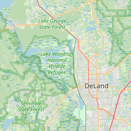
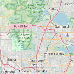
North DeLand Map, Satellite view of North DeLand, Florida
North DeLand is a census-designated place (CDP) located in Volusia County, Florida, USA.
Location informations of North DeLand
Latitude of city of North DeLand is 29.04943 and longitude of city of North DeLand is -81.29812- What Country is North DeLand In? North DeLand is located in the United States of America.
- What State is North DeLand located in? North DeLand is located in Florida.
- What County is North DeLand In? The County of North DeLand is Volusia County
North DeLand, Florida (FL), USA Geographic Information
| Country | United States |
| Country Code | US |
| State Name | Florida |
| Latitude | 29.04943 |
| Longitude | -81.29812 |
| DMS Lat | 29°2'57.948" N |
| DMS Long | 81°17'53.232" W |
| DMS coordinates : | 29°2'57.948" N 81°17'53.232" W |
Current Date and Time in North DeLand, Florida, USA
| North DeLand Time Zone : America/New_York |
What day is it in North DeLand right now?Friday (May 23, 2025) |
What time is it?Current local time and date at North DeLand is 13:47:50 (05/23/2025) : (America/New_York) |
Postcode / zip code of North DeLand
North DeLand is the actual or alternate city name associated with 1 ZIP Codes by the US Postal Service.
List of all postal codes in North DeLand, Florida, United States.
32724 Zip Code
Online Map of North DeLand - road map, satellite view and street view


Check out our interactive map of North DeLand, Florida and you'll easily find your way around the North DeLand major roads and highways.
Satellite Map of North DeLand, FL, USA
This is online map of the address North DeLand, FL, United States. You may use button to move and zoom in / out. The map information is for reference only.
AdventHealth DeLand Heliport (1.99 Km / 1.24 Miles)
Deland Municipal Sidney H Taylor Field (2.40 Km / 1.49 Miles)
North Exuma Airport (5.25 Km / 3.26 Miles)
Bob Lee Flight Strip (6.30 Km / 3.91 Miles)
Halifax Hospital Emergency Helostop (10.94 Km / 6.80 Miles)
Lafayette Landings Airport (13.64 Km / 8.48 Miles)
Deep Woods Ranch Airport (14.63 Km / 9.09 Miles)
AdventHealth Fish Memorial Hospital Heliport (15.04 Km / 9.34 Miles)
Pine Lakes Farm Airport (15.81 Km / 9.82 Miles)
Bradshaw Tree Farm Airport (15.84 Km / 9.84 Miles)
Samsula / Coe Field (16.56 Km / 10.29 Miles)
Leffler Airport (19.29 Km / 11.99 Miles)
Britt Brown & Porter Ranch Airport (20.74 Km / 12.89 Miles)
Royal Trails Airport (21.11 Km / 13.12 Miles)
Cross Creek Farms Airport (22.46 Km / 13.96 Miles)
Flying 4 Ranch Airport (23.46 Km / 14.57 Miles)
Squillacote Airport (24.36 Km / 15.14 Miles)
Spruce Creek Airport (24.67 Km / 15.33 Miles)
GEORGE W. MARKS ELEMENTARY SCHOOL (385 m / 0.24 Miles)
DELAND HIGH SCHOOL (1.62 Km / 1.01 Miles)
ESE RELATED SERVICES (2.34 Km / 1.45 Miles)
BLUE LAKE ELEMENTARY SCHOOL (2.95 Km / 1.83 Miles)
CITRUS GROVE ELEMENTARY SCHOOL (3.76 Km / 2.34 Miles)
EDITH I. STARKE ELEMENTARY SCHOOL (3.96 Km / 2.46 Miles)
SOUTHWESTERN MIDDLE SCHOOL (4.92 Km / 3.06 Miles)
Stetson University (1.57 Km / 0.98 Miles)
NUC University - Florida Technical College - Deland (4.49 Km / 2.79 Miles)
List of places near to North DeLand
| Name | Distance |
|---|---|
| DeLand | 2.40 Km / 1.49 Miles |
| DeLand Southwest | 4.82 Km / 3.00 Miles |
| West DeLand | 5.05 Km / 3.14 Miles |
| De Leon Springs | 9.35 Km / 5.81 Miles |
| Lake Helen | 9.89 Km / 6.15 Miles |
| Orange City | 11.18 Km / 6.95 Miles |
| Lake Mack-Forest Hills | 11.85 Km / 7.36 Miles |
| Deltona | 16.89 Km / 10.49 Miles |
| Pine Lakes | 17.60 Km / 10.94 Miles |
| DeBary | 18.53 Km / 11.51 Miles |
| Lake Kathryn | 19.18 Km / 11.92 Miles |
| Samsula-Spruce Creek | 22.88 Km / 14.22 Miles |
| Paisley | 24.79 Km / 15.40 Miles |