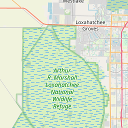
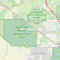
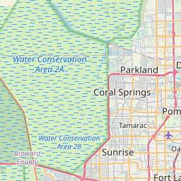
Ocean Ridge Map, Satellite view of Ocean Ridge, Florida
Ocean Ridge is a town located in Palm Beach County, Florida, USA.
Location informations of Ocean Ridge
Latitude of city of Ocean Ridge is 26.52702 and longitude of city of Ocean Ridge is -80.04837- What Country is Ocean Ridge In? Ocean Ridge is located in the United States of America.
- What State is Ocean Ridge located in? Ocean Ridge is located in Florida.
- What County is Ocean Ridge In? The County of Ocean Ridge is Palm Beach County
Ocean Ridge, Florida (FL), USA Geographic Information
| Country | United States |
| Country Code | US |
| State Name | Florida |
| Latitude | 26.52702 |
| Longitude | -80.04837 |
| DMS Lat | 26°31'37.272" N |
| DMS Long | 80°2'54.132" W |
| DMS coordinates : | 26°31'37.272" N 80°2'54.132" W |
Current Date and Time in Ocean Ridge, Florida, USA
| Ocean Ridge Time Zone : America/New_York |
What day is it in Ocean Ridge right now?Friday (May 23, 2025) |
What time is it?Current local time and date at Ocean Ridge is 5/23/2025 - 3:23:51 AM |
Postcode / zip code of Ocean Ridge
Ocean Ridge is the actual or alternate city name associated with 1 ZIP Codes by the US Postal Service.
List of all postal codes in Ocean Ridge, Florida, United States.
33435 Zip Code
Online Map of Ocean Ridge - road map, satellite view and street view


Check out our interactive map of Ocean Ridge, Florida and you'll easily find your way around the Ocean Ridge major roads and highways.
Satellite Map of Ocean Ridge, FL, USA
This is online map of the address Ocean Ridge, FL, United States. You may use button to move and zoom in / out. The map information is for reference only.
Bethesda Memorial Hospital Heliport (3.34 Km / 2.07 Miles)
Palm Beach County Park Airport (8.20 Km / 5.09 Miles)
Jfk Medical Center Heliport (9.13 Km / 5.67 Miles)
Palm Beach Community College Heliport (10.09 Km / 6.27 Miles)
Hardrives Delta Nr 3 Helistop (11.40 Km / 7.08 Miles)
Antiquers Aerodrome (12.20 Km / 7.58 Miles)
Delray Medical Center Emergency Helistop (12.66 Km / 7.87 Miles)
Le Lac Heliport (15.58 Km / 9.68 Miles)
Mar-a-Lago Helipad (16.69 Km / 10.37 Miles)
Willis Gliderport (16.72 Km / 10.39 Miles)
Boca Raton Airport (17.54 Km / 10.90 Miles)
The Murphy Company Heliport (17.84 Km / 11.09 Miles)
Palm Beach International Airport (17.99 Km / 11.18 Miles)
AIM Heliport (18.31 Km / 11.38 Miles)
Wellington Medical Center Heliport (19.80 Km / 12.31 Miles)
West Palm Beach Police Station Heliport (20.85 Km / 12.95 Miles)
WPTV Heliport (20.86 Km / 12.96 Miles)
Palm Beach County Judicial Center Heliport (20.96 Km / 13.03 Miles)
Nitv Heliport (21.15 Km / 13.14 Miles)
Good Samaritan Medical Center Heliport (22.05 Km / 13.70 Miles)
POINCIANA STEM ELEMENTARY MAGNET SCHOOL (2.04 Km / 1.27 Miles)
GALAXY ELEMENTARY SCHOOL (2.31 Km / 1.44 Miles)
FOREST PARK ELEMENTARY SCHOOL (2.47 Km / 1.54 Miles)
ROLLING GREEN ELEMENTARY SCHOOL (3.54 Km / 2.20 Miles)
BOYNTON BEACH COMMUNITY HIGH (3.85 Km / 2.39 Miles)
QUANTUM HIGH SCHOOL (4.19 Km / 2.60 Miles)
ED VENTURE CHARTER SCHOOL (4.32 Km / 2.68 Miles)
CONGRESS COMMUNITY MIDDLE SCHOOL (4.47 Km / 2.78 Miles)
IMAGINE SCHOOLS CHANCELLOR CAMPUS (4.73 Km / 2.94 Miles)
PLUMOSA SCHOOL OF THE ARTS (4.78 Km / 2.97 Miles)
SOUTH TECH ACADEMY (4.83 Km / 3.00 Miles)
SOUTH TECH PREPARATORY ACADEMY (4.94 Km / 3.07 Miles)
Robert Fiance Beauty Schools (1.90 Km / 1.18 Miles)
Florida Career College-Boynton Beach (4.70 Km / 2.92 Miles)
List of places near to Ocean Ridge
| Name | Distance |
|---|---|
| Boynton Beach | 1.81 Km / 1.12 Miles |
| Briny Breezes | 2.08 Km / 1.29 Miles |
| Gulf Stream | 3.77 Km / 2.34 Miles |
| Hypoluxo | 4.41 Km / 2.74 Miles |
| San Castle | 4.42 Km / 2.75 Miles |
| Manalapan | 4.71 Km / 2.93 Miles |
| Lantana | 6.65 Km / 4.13 Miles |
| Golf | 6.78 Km / 4.21 Miles |
| South Palm Beach | 6.95 Km / 4.32 Miles |
| Delray Beach | 7.69 Km / 4.78 Miles |
| Seminole Manor | 8.15 Km / 5.06 Miles |
| Atlantis | 8.82 Km / 5.48 Miles |
| Lake Worth | 9.92 Km / 6.16 Miles |
| Kenwood Estates | 13.00 Km / 8.08 Miles |
| Palm Springs | 13.01 Km / 8.08 Miles |
| Greenacres | 13.19 Km / 8.20 Miles |
| Lake Clarke Shores | 13.44 Km / 8.35 Miles |
| Highland Beach | 14.28 Km / 8.87 Miles |
| Acacia Villas | 14.57 Km / 9.05 Miles |
| Pine Air | 15.77 Km / 9.80 Miles |
| Glen Ridge | 16.05 Km / 9.97 Miles |
| Cloud Lake | 16.78 Km / 10.43 Miles |
| Gun Club Estates | 17.50 Km / 10.87 Miles |
| Royal Palm Estates | 18.82 Km / 11.69 Miles |
| Boca Raton | 19.03 Km / 11.82 Miles |
| Haverhill | 19.60 Km / 12.18 Miles |
| Palm Beach | 19.89 Km / 12.36 Miles |
| Lake Belvedere Estates | 19.92 Km / 12.38 Miles |
| Westgate | 20.14 Km / 12.51 Miles |
| Stacey Street | 20.47 Km / 12.72 Miles |
| West Palm Beach | 20.95 Km / 13.02 Miles |
| Plantation Mobile Home Park | 21.28 Km / 13.22 Miles |
| Schall Circle | 21.99 Km / 13.66 Miles |
| Deerfield Beach | 23.75 Km / 14.76 Miles |
| Wellington | 24.14 Km / 15.00 Miles |