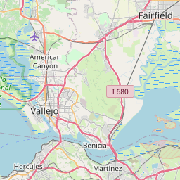
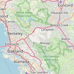
Pacheco Map, Satellite view of Pacheco, California
Pacheco is a census-designated place (CDP) located in Contra Costa County, California, USA.
Location informations of Pacheco
Latitude of city of Pacheco is 37.98353 and longitude of city of Pacheco is -122.07524- What Country is Pacheco In? Pacheco is located in the United States of America.
- What State is Pacheco located in? Pacheco is located in California.
- What County is Pacheco In? The County of Pacheco is Contra Costa County
Pacheco, California (CA), USA Geographic Information
| Country | United States |
| Country Code | US |
| State Name | California |
| Latitude | 37.98353 |
| Longitude | -122.07524 |
| DMS Lat | 37°59'0.708" N |
| DMS Long | 122°4'30.864" W |
| DMS coordinates : | 37°59'0.708" N 122°4'30.864" W |
Current Date and Time in Pacheco, California, USA
| Pacheco Time Zone : America/Los_Angeles |
What day is it in Pacheco right now?Tuesday (May 27, 2025) |
What time is it?Current local time and date at Pacheco is 21:41:22 (05/27/2025) : (America/Los_Angeles) |
Postcode / zip code of Pacheco
Pacheco is the actual or alternate city name associated with 1 ZIP Codes by the US Postal Service.
List of all postal codes in Pacheco, California, United States.
94553 Zip Code
Online Map of Pacheco - road map, satellite view and street view


Check out our interactive map of Pacheco, California and you'll easily find your way around the Pacheco major roads and highways.
Satellite Map of Pacheco, CA, USA
This is online map of the address Pacheco, CA, United States. You may use button to move and zoom in / out. The map information is for reference only.
Buchanan Field (1.74 Km / 1.08 Miles)
Maltby Airstrip (1.94 Km / 1.20 Miles)
Sherman Field (4.17 Km / 2.59 Miles)
Concord Naval Weapons Station Airfield (5.04 Km / 3.13 Miles)
Martinez Airport (6.68 Km / 4.15 Miles)
Concord Airport (1927) (7.21 Km / 4.48 Miles)
John Muir Walnut Creek Medical Center Heliport (8.40 Km / 5.22 Miles)
Q Area Heliport (9.07 Km / 5.64 Miles)
Lafayette Heliport (11.54 Km / 7.17 Miles)
Sandhill Heliport (12.65 Km / 7.86 Miles)
Benicia Airport (14.22 Km / 8.83 Miles)
Little Hands Airport (20.45 Km / 12.71 Miles)
Mare Island Naval Shipyard Airfield (20.84 Km / 12.95 Miles)
Garibaldi Brothers Airport (21.54 Km / 13.39 Miles)
Berkeley Municipal Airport (1929) (23.06 Km / 14.33 Miles)
Doctors Medical Center Heliport (23.21 Km / 14.42 Miles)
Stan's Airpark (23.44 Km / 14.56 Miles)
Children's Hospital Oakland Heliport (23.47 Km / 14.58 Miles)
U of C - Richmond Field Station Heliport (23.81 Km / 14.80 Miles)
Sutter Delta Medical Center Heliport (23.99 Km / 14.91 Miles)
Hidden Valley Elementary (1.22 Km / 0.76 Miles)
Mt. McKinley (1.24 Km / 0.77 Miles)
Valhalla Elementary (1.84 Km / 1.15 Miles)
Valley View Middle (2.14 Km / 1.33 Miles)
College Park High (2.16 Km / 1.34 Miles)
Gregory Gardens Elementary (2.64 Km / 1.64 Miles)
Floyd I. Marchus (2.80 Km / 1.74 Miles)
Morello Park Elementary (2.87 Km / 1.78 Miles)
Las Juntas Elementary (3.15 Km / 1.96 Miles)
Mt. Diablo High (3.45 Km / 2.15 Miles)
Meadow Homes Elementary (3.68 Km / 2.29 Miles)
Strandwood Elementary (3.69 Km / 2.29 Miles)
Olympic Continuation High (4.14 Km / 2.57 Miles)
Cambridge Elementary (4.17 Km / 2.59 Miles)
John Swett Elementary (4.31 Km / 2.68 Miles)
John Muir Elementary (4.34 Km / 2.70 Miles)
Holbrook Language Academy (4.36 Km / 2.71 Miles)
Sequoia Middle (4.37 Km / 2.72 Miles)
Sequoia Elementary (4.42 Km / 2.74 Miles)
Sun Terrace Elementary (4.43 Km / 2.75 Miles)
Diablo Valley College (1.68 Km / 1.04 Miles)
Carrington College-Pleasant Hill Campus (2.34 Km / 1.45 Miles)
Urban Barber College (3.29 Km / 2.04 Miles)
John F. Kennedy University (3.49 Km / 2.17 Miles)
Paul Mitchell the School-East Bay (4.47 Km / 2.77 Miles)
Mt. Diablo Adult Education-Mt. Diablo USD (4.55 Km / 2.83 Miles)
List of places near to Pacheco
| Name | Distance |
|---|---|
| Vine Hill | 3.33 Km / 2.07 Miles |
| Concord | 3.92 Km / 2.44 Miles |
| Pleasant Hill | 4.15 Km / 2.58 Miles |
| Mountain View | 4.65 Km / 2.89 Miles |
| Alhambra Valley | 5.31 Km / 3.30 Miles |
| Reliez Valley | 5.42 Km / 3.37 Miles |
| Clyde | 6.15 Km / 3.82 Miles |
| Contra Costa Centre | 6.41 Km / 3.98 Miles |
| Martinez | 6.52 Km / 4.05 Miles |
| Walnut Creek | 8.63 Km / 5.36 Miles |
| Acalanes Ridge | 8.77 Km / 5.45 Miles |
| Shell Ridge | 9.34 Km / 5.80 Miles |
| Benicia | 10.34 Km / 6.42 Miles |
| North Gate | 10.94 Km / 6.80 Miles |
| Saranap | 10.97 Km / 6.82 Miles |
| San Miguel | 11.28 Km / 7.01 Miles |
| Lafayette | 11.50 Km / 7.15 Miles |
| Port Costa | 11.76 Km / 7.31 Miles |
| Castle Hill | 12.40 Km / 7.71 Miles |
| Bay Point | 12.63 Km / 7.85 Miles |
| Clayton | 13.11 Km / 8.15 Miles |
| Crockett | 14.30 Km / 8.89 Miles |
| Orinda | 14.96 Km / 9.30 Miles |
| Alamo | 15.30 Km / 9.51 Miles |
| Moraga | 17.20 Km / 10.69 Miles |
| Pittsburg | 17.41 Km / 10.82 Miles |
| Rodeo | 17.67 Km / 10.98 Miles |
| Hercules | 19.06 Km / 11.84 Miles |
| Danville | 19.18 Km / 11.92 Miles |
| El Sobrante | 19.30 Km / 11.99 Miles |
| Diablo | 19.46 Km / 12.09 Miles |
| Kensington | 19.73 Km / 12.26 Miles |
| Pinole | 19.73 Km / 12.26 Miles |
| Vallejo | 20.79 Km / 12.92 Miles |
| Tara Hills | 21.16 Km / 13.15 Miles |
| East Richmond Heights | 21.33 Km / 13.25 Miles |
| Berkeley | 21.33 Km / 13.25 Miles |
| Bayview | 21.50 Km / 13.36 Miles |
| El Cerrito | 22.06 Km / 13.71 Miles |
| Albany | 22.28 Km / 13.84 Miles |
| Montalvin Manor | 22.39 Km / 13.91 Miles |
| Piedmont | 22.39 Km / 13.91 Miles |
| Rollingwood | 22.42 Km / 13.93 Miles |
| Blackhawk | 23.31 Km / 14.48 Miles |
| Antioch | 23.73 Km / 14.75 Miles |
| San Pablo | 23.81 Km / 14.79 Miles |
| San Ramon | 24.19 Km / 15.03 Miles |
| Richmond | 24.47 Km / 15.20 Miles |