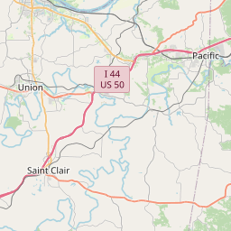
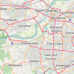
Pacific Map, Satellite view of Pacific, Missouri
Pacific is a city located in Franklin County, St. Louis County, Missouri, USA.
Location informations of Pacific
Latitude of city of Pacific is 38.48168 and longitude of city of Pacific is -90.75464- What Country is Pacific In? Pacific is located in the United States of America.
- What State is Pacific located in? Pacific is located in Missouri.
- What County is Pacific In? Pacific, Missouri sits in Two different counties: Franklin County, St. Louis County
Pacific, Missouri (MO), USA Geographic Information
| Country | United States |
| Country Code | US |
| State Name | Missouri |
| Latitude | 38.48168 |
| Longitude | -90.75464 |
| DMS Lat | 38°28'54.048" N |
| DMS Long | 90°45'16.704" W |
| DMS coordinates : | 38°28'54.048" N 90°45'16.704" W |
Current Date and Time in Pacific, Missouri, USA
| Pacific Time Zone : America/Chicago |
What day is it in Pacific right now?Wednesday (March 26, 2025) |
What time is it?Current local time and date at Pacific is 04:56:00 (03/26/2025) : (America/Chicago) |
Postcode / zip code of Pacific
Pacific is the actual or alternate city name associated with 1 ZIP Codes by the US Postal Service.
List of all postal codes in Pacific, Missouri, United States.
63069 Zip Code
Online Map of Pacific - road map, satellite view and street view


Check out our interactive map of Pacific, Missouri and you'll easily find your way around the Pacific major roads and highways.
Satellite Map of Pacific, MO, USA
This is online map of the address Pacific, MO, United States. You may use button to move and zoom in / out. The map information is for reference only.
Fox Run Heliport (13.52 Km / 8.40 Miles)
Maune Ultralight Flightpark (13.89 Km / 8.63 Miles)
Moders Airport (16.26 Km / 10.11 Miles)
Spirit of St Louis Airport (21.96 Km / 13.64 Miles)
St Clair Regional Airport (22.19 Km / 13.79 Miles)
Washington Regional Airport (23.90 Km / 14.85 Miles)
SSM Health St. Clare Hospital-Fenton Heliport (24.76 Km / 15.39 Miles)
ZITZMAN ELEM. (103 m / 0.06 Miles)
MERAMEC VALLEY MIDDLE (191 m / 0.12 Miles)
DORIS HOFFMAN EARLY LEARNING C (788 m / 0.49 Miles)
MERAMEC VALLEY EARLY CHILD. (1.38 Km / 0.86 Miles)
RIVERBEND SCH. (2.10 Km / 1.31 Miles)
TRUMAN ELEM. (2.26 Km / 1.40 Miles)
PACIFIC HIGH (2.30 Km / 1.43 Miles)
MISSOURI EASTERN CORR CENTER (4.78 Km / 2.97 Miles)
List of places near to Pacific
| Name | Distance |
|---|---|
| Gray Summit | 5.48 Km / 3.41 Miles |
| Lake Tekakwitha | 5.51 Km / 3.42 Miles |
| LaBarque Creek | 9.05 Km / 5.62 Miles |
| Eureka | 11.27 Km / 7.00 Miles |
| Villa Ridge | 11.55 Km / 7.18 Miles |
| Wildwood | 13.79 Km / 8.57 Miles |
| Augusta | 15.00 Km / 9.32 Miles |
| Byrnes Mill | 15.82 Km / 9.83 Miles |
| Defiance | 16.87 Km / 10.48 Miles |
| Scotsdale | 17.23 Km / 10.71 Miles |
| Cedar Hill | 17.35 Km / 10.78 Miles |
| Peaceful Village | 18.51 Km / 11.50 Miles |
| Cedar Hill Lakes | 18.89 Km / 11.74 Miles |
| Ellisville | 19.09 Km / 11.86 Miles |
| High Ridge | 19.16 Km / 11.91 Miles |
| Parkdale | 20.20 Km / 12.55 Miles |
| Clarkson Valley | 20.92 Km / 13.00 Miles |
| Ballwin | 22.08 Km / 13.72 Miles |
| Union | 22.38 Km / 13.91 Miles |
| Three Creeks | 23.07 Km / 14.34 Miles |
| Winchester | 23.13 Km / 14.37 Miles |
| Murphy | 23.31 Km / 14.48 Miles |
| Washington | 23.96 Km / 14.89 Miles |
| Valley Park | 24.00 Km / 14.91 Miles |
| Twin Oaks | 24.28 Km / 15.09 Miles |
| Parkway | 24.63 Km / 15.30 Miles |
| St. Clair | 24.87 Km / 15.45 Miles |
| Manchester | 24.90 Km / 15.47 Miles |