Pawleys Island Map, Satellite view of Pawleys Island, South Carolina
Pawleys Island is a town located in Georgetown County, South Carolina, USA.
Location informations of Pawleys Island
Latitude of city of Pawleys Island is 33.43322 and longitude of city of Pawleys Island is -79.12143- What Country is Pawleys Island In? Pawleys Island is located in the United States of America.
- What State is Pawleys Island located in? Pawleys Island is located in South Carolina.
- What County is Pawleys Island In? The County of Pawleys Island is Georgetown County
Pawleys Island, South Carolina (SC), USA Geographic Information
| Country | United States |
| Country Code | US |
| State Name | South Carolina |
| Latitude | 33.43322 |
| Longitude | -79.12143 |
| DMS Lat | 33°25'59.592" N |
| DMS Long | 79°7'17.148" W |
| DMS coordinates : | 33°25'59.592" N 79°7'17.148" W |
Current Date and Time in Pawleys Island, South Carolina, USA
| Pawleys Island Time Zone : America/New_York |
What day is it in Pawleys Island right now?Monday (June 16, 2025) |
What time is it?Current local time and date at Pawleys Island is 6/16/2025 - 11:35:46 AM |
Postcode / zip code of Pawleys Island
Pawleys Island is the actual or alternate city name associated with 1 ZIP Codes by the US Postal Service.
List of all postal codes in Pawleys Island, South Carolina, United States.
29585 Zip Code
Area Codes Pawleys Island, South Carolina, USA
Pawleys Island, South Carolina covers 1 Area Codes
843 Area CodeOnline Map of Pawleys Island - road map, satellite view and street view
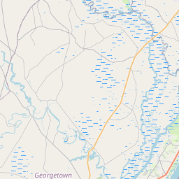


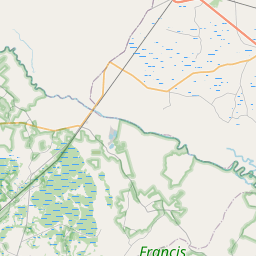


Leaflet | © OpenStreetMap contributors
Check out our interactive map of Pawleys Island, South Carolina and you'll easily find your way around the Pawleys Island major roads and highways.
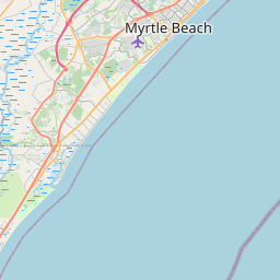
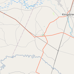
Satellite Map of Pawleys Island, SC, USA
This is online map of the address Pawleys Island, SC, United States. You may use button to move and zoom in / out. The map information is for reference only.
Search distance between two cities
Georgetown County Airport (22.83 Km / 14.19 Miles)
Waccamaw Elementary (2.79 Km / 1.73 Miles)
Waccamaw High (3.05 Km / 1.90 Miles)
Coastal Montessori Charter (4.93 Km / 3.06 Miles)
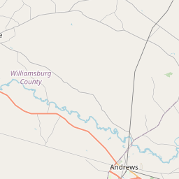
Cities or Towns near Pawleys Island
List of places near to Pawleys Island
| Name | Distance |
|---|---|
| Murrells Inlet | 15.05 Km / 9.35 Miles |
| Georgetown | 17.25 Km / 10.72 Miles |
| Garden City | 20.61 Km / 12.81 Miles |
| Surfside Beach | 23.63 Km / 14.68 Miles |