Pennsville (Township) Map, Satellite view of Pennsville (Township), New Jersey
Pennsville (Township) is a township located in Salem County, New Jersey, USA.
Location informations of Pennsville (Township)
Latitude of city of Pennsville (Township) is 39.62634 and longitude of city of Pennsville (Township) is -75.50345- What Country is Pennsville (Township) In? Pennsville (Township) is located in the United States of America.
- What State is Pennsville (Township) located in? Pennsville (Township) is located in New Jersey.
- What County is Pennsville (Township) In? The County of Pennsville (Township) is Salem County
Pennsville (Township), New Jersey (NJ), USA Geographic Information
| Country | United States |
| Country Code | US |
| State Name | New Jersey |
| Latitude | 39.62634 |
| Longitude | -75.50345 |
| DMS Lat | 39°37'34.824" N |
| DMS Long | 75°30'12.42" W |
| DMS coordinates : | 39°37'34.824" N 75°30'12.42" W |
Current Date and Time in Pennsville (Township), New Jersey, USA
| Pennsville (Township) Time Zone : America/New_York |
What day is it in Pennsville (Township) right now?Saturday (July 26, 2025) |
What time is it?Current local time and date at Pennsville (Township) is 17:39:04 (07/26/2025) : (America/New_York) |
Postcode / zip code of Pennsville (Township)
Pennsville (Township) is the actual or alternate city name associated with 2 ZIP Codes by the US Postal Service.
List of all postal codes in Pennsville (Township), New Jersey, United States.
08023 Zip Code 08070 Zip Code
Area Codes Pennsville (Township), New Jersey, USA
Pennsville (Township), New Jersey covers 1 Area Codes
856 Area CodeOnline Map of Pennsville (Township) - road map, satellite view and street view
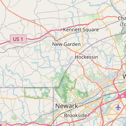
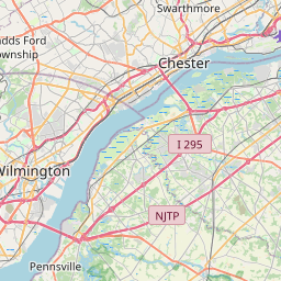
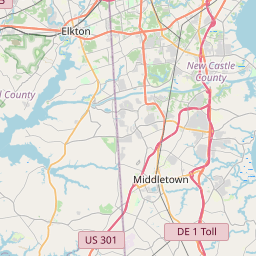
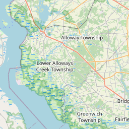
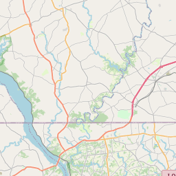

Check out our interactive map of Pennsville (Township), New Jersey and you'll easily find your way around the Pennsville (Township) major roads and highways.
Satellite Map of Pennsville (Township), NJ, USA
This is online map of the address Pennsville (Township), NJ, United States. You may use button to move and zoom in / out. The map information is for reference only.
Rainbow's End Airport (5.06 Km / 3.15 Miles)
Seabrook Heliport (5.61 Km / 3.49 Miles)
Deepwater Station Heliport (6.44 Km / 4.00 Miles)
Southern Training Center Heliport (7.51 Km / 4.66 Miles)
Deepwater Heliport (7.96 Km / 4.94 Miles)
Salem Airfield (8.46 Km / 5.25 Miles)
New Castle Airport (10.57 Km / 6.57 Miles)
Paruszewski Farm Strip (10.86 Km / 6.75 Miles)
Bracebridge Iii Heliport (12.45 Km / 7.74 Miles)
Wilmington Hospital Heliport (14.45 Km / 8.98 Miles)
Spitfire Aerodrome (15.15 Km / 9.41 Miles)
Christina Hospital Heliport (15.59 Km / 9.68 Miles)
Eagle Run Heliport (15.85 Km / 9.85 Miles)
Strawbridge Christiana Mall Heliport (16.13 Km / 10.02 Miles)
Taildragger Acres Airport (16.25 Km / 10.09 Miles)
Greenville Heliport (17.04 Km / 10.59 Miles)
A M Classics Heliport (17.19 Km / 10.68 Miles)
Nemours A I Dupont Children's Hospital Rooftop Heliport (17.57 Km / 10.92 Miles)
Nemours A I Dupont Children's Hospital Ground Heliport (17.76 Km / 11.04 Miles)
Stoe Creek Farm Airport (18.19 Km / 11.30 Miles)
Valley Park Elementary School (867 m / 0.54 Miles)
Pennsville Middle School (2.74 Km / 1.70 Miles)
Penn Beach Elementary (2.79 Km / 1.73 Miles)
Pennsville Memorial High School (2.98 Km / 1.85 Miles)
Central Park Elementary School (3.89 Km / 2.42 Miles)
List of places near to Pennsville (Township)
| Name | Distance |
|---|---|
| Pennsville | 3.22 Km / 2.00 Miles |
| New Castle | 6.69 Km / 4.16 Miles |
| Salem | 6.82 Km / 4.24 Miles |
| Mannington | 7.61 Km / 4.73 Miles |
| Delaware City | 9.08 Km / 5.64 Miles |
| Carneys Point (Township) | 9.10 Km / 5.65 Miles |
| Wilmington Manor | 9.65 Km / 6.00 Miles |
| Carneys Point | 9.86 Km / 6.13 Miles |
| Pilesgrove | 10.14 Km / 6.30 Miles |
| Elsinboro | 10.35 Km / 6.43 Miles |
| Quinton | 11.86 Km / 7.37 Miles |
| Penns Grove | 11.87 Km / 7.38 Miles |
| Bear | 13.26 Km / 8.24 Miles |
| Newport | 13.29 Km / 8.26 Miles |
| Edgemoor | 13.77 Km / 8.56 Miles |
| Wilmington | 13.80 Km / 8.57 Miles |
| Hancocks Bridge | 13.91 Km / 8.64 Miles |
| Alloway | 14.10 Km / 8.76 Miles |
| Quinton (Township) | 14.39 Km / 8.94 Miles |
| Oldmans | 14.82 Km / 9.21 Miles |
| St. Georges | 14.86 Km / 9.23 Miles |
| Elsmere | 14.94 Km / 9.28 Miles |
| Woodstown | 15.26 Km / 9.48 Miles |
| Bellefonte | 15.56 Km / 9.67 Miles |
| Pedricktown | 16.93 Km / 10.52 Miles |
| Alloway (Township) | 17.62 Km / 10.95 Miles |
| Greenville | 18.81 Km / 11.69 Miles |
| Beckett | 18.91 Km / 11.75 Miles |
| Brookside | 19.66 Km / 12.22 Miles |
| Claymont | 19.74 Km / 12.27 Miles |
| Ardencroft | 19.81 Km / 12.31 Miles |
| Lower Alloways Creek | 19.94 Km / 12.39 Miles |
| Woolwich | 19.98 Km / 12.41 Miles |
| Ardentown | 20.33 Km / 12.63 Miles |
| Arden | 20.39 Km / 12.67 Miles |
| Pike Creek Valley | 20.67 Km / 12.84 Miles |
| Pike Creek | 20.74 Km / 12.89 Miles |
| Glasgow | 20.85 Km / 12.96 Miles |
| Swedesboro | 21.32 Km / 13.25 Miles |
| Newark | 22.02 Km / 13.68 Miles |
| Logan | 22.37 Km / 13.90 Miles |
| Lower Chichester | 22.58 Km / 14.03 Miles |
| South Harrison | 22.64 Km / 14.07 Miles |
| Marcus Hook | 22.65 Km / 14.07 Miles |
| Odessa | 23.16 Km / 14.39 Miles |
| Stow Creek | 23.21 Km / 14.42 Miles |
| Linwood | 23.23 Km / 14.43 Miles |
| Boothwyn | 23.27 Km / 14.46 Miles |
| Trainer | 23.64 Km / 14.69 Miles |
| North Star | 23.78 Km / 14.78 Miles |