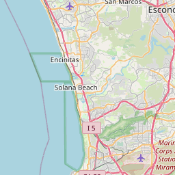
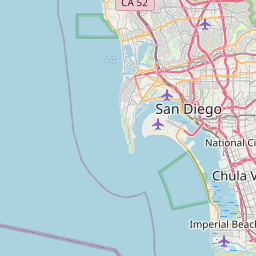
Poway Map, Satellite view of Poway, California
Poway is a city located in San Diego County, California, USA.
Location informations of Poway
Latitude of city of Poway is 32.96282 and longitude of city of Poway is -117.03586- What Country is Poway In? Poway is located in the United States of America.
- What State is Poway located in? Poway is located in California.
- What County is Poway In? The County of Poway is San Diego County
Poway, California (CA), USA Geographic Information
| Country | United States |
| Country Code | US |
| State Name | California |
| Latitude | 32.96282 |
| Longitude | -117.03586 |
| DMS Lat | 32°57'46.152" N |
| DMS Long | 117°2'9.096" W |
| DMS coordinates : | 32°57'46.152" N 117°2'9.096" W |
Current Date and Time in Poway, California, USA
| Poway Time Zone : America/Los_Angeles |
What day is it in Poway right now?Friday (May 23, 2025) |
What time is it?Current local time and date at Poway is 5/23/2025 - 8:35:09 AM |
Postcode / zip code of Poway
Poway is the actual or alternate city name associated with 4 ZIP Codes by the US Postal Service.
List of all postal codes in Poway, California, United States.
92025 Zip Code 92064 Zip Code 92065 Zip Code 92074 Zip Code
Online Map of Poway - road map, satellite view and street view


Check out our interactive map of Poway, California and you'll easily find your way around the Poway major roads and highways.
Satellite Map of Poway, CA, USA
This is online map of the address Poway, CA, United States. You may use button to move and zoom in / out. The map information is for reference only.
Poway Field Gliderport (2.39 Km / 1.48 Miles)
Pomerado Hospital Heliport (4.40 Km / 2.73 Miles)
NOLF Hourglass Field (9.98 Km / 6.20 Miles)
Ramona Airport (14.11 Km / 8.77 Miles)
Miramar Marine Corps Air Station - Mitscher Field (14.50 Km / 9.01 Miles)
Gillespie Field (16.32 Km / 10.14 Miles)
Qualcomm Building N Heliport (16.68 Km / 10.37 Miles)
Qualcomm Building T Helipad (16.75 Km / 10.41 Miles)
San Diego Heliport (17.19 Km / 10.68 Miles)
Palomar Medical Center Downtown Heliport (18.36 Km / 11.41 Miles)
La Jolla Center II Helipad (18.70 Km / 11.62 Miles)
La Jolla Center I Helipad (18.73 Km / 11.64 Miles)
Escondido Engle Airport (18.74 Km / 11.64 Miles)
Montgomery-Gibbs Executive Airport (19.03 Km / 11.82 Miles)
Northern Trust Tower Helipad (19.11 Km / 11.88 Miles)
Smith Barney Tower Helipad (19.22 Km / 11.94 Miles)
4250 Executive Square Helipad (19.40 Km / 12.05 Miles)
4275 Executive Square Helipad (19.44 Km / 12.08 Miles)
Palomar Medical Center Escondido Helipad (19.47 Km / 12.10 Miles)
La Jolla Executive Tower Helipad (19.49 Km / 12.11 Miles)
Midland Elementary (470 m / 0.29 Miles)
Valley Elementary (1.38 Km / 0.86 Miles)
Twin Peaks Middle (1.90 Km / 1.18 Miles)
Tierra Bonita Elementary (2.11 Km / 1.31 Miles)
Garden Road Elementary (2.34 Km / 1.45 Miles)
Abraxas Continuation High (2.66 Km / 1.65 Miles)
Pomerado Elementary (2.69 Km / 1.67 Miles)
Meadowbrook Middle (2.72 Km / 1.69 Miles)
Highland Ranch Elementary (4.12 Km / 2.56 Miles)
Poway High (4.14 Km / 2.57 Miles)
Creekside Elementary (4.31 Km / 2.68 Miles)
Shoal Creek Elementary (4.33 Km / 2.69 Miles)
Rancho Bernardo High (4.60 Km / 2.86 Miles)
Bernardo Heights Middle (4.77 Km / 2.97 Miles)
Bellus Academy-Poway (883 m / 0.55 Miles)
Poway Adult School (1.78 Km / 1.10 Miles)
List of places near to Poway
| Name | Distance |
|---|---|
| Eucalyptus Hills | 12.43 Km / 7.72 Miles |
| Fairbanks Ranch | 14.42 Km / 8.96 Miles |
| Santee | 15.00 Km / 9.32 Miles |
| Lakeside | 15.82 Km / 9.83 Miles |
| Rancho Santa Fe | 16.83 Km / 10.46 Miles |
| Winter Gardens | 17.49 Km / 10.87 Miles |
| Ramona | 17.94 Km / 11.15 Miles |
| Escondido | 18.02 Km / 11.20 Miles |
| Bostonia | 19.60 Km / 12.18 Miles |
| El Cajon | 19.90 Km / 12.37 Miles |
| Del Mar | 21.41 Km / 13.30 Miles |
| Granite Hills | 21.57 Km / 13.40 Miles |
| La Mesa | 21.72 Km / 13.50 Miles |
| Solana Beach | 22.17 Km / 13.78 Miles |
| Casa de Oro-Mount Helix | 22.98 Km / 14.28 Miles |
| Crest | 23.34 Km / 14.50 Miles |
| San Marcos | 23.46 Km / 14.58 Miles |
| San Diego Country Estates | 24.03 Km / 14.93 Miles |
| Lake San Marcos | 24.26 Km / 15.07 Miles |
| Spring Valley | 24.49 Km / 15.22 Miles |
| Lemon Grove | 24.50 Km / 15.22 Miles |
| Harbison Canyon | 24.91 Km / 15.48 Miles |