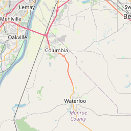
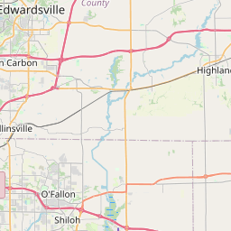
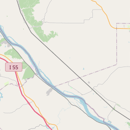
Prairie Du Long Map, Satellite view of Prairie Du Long, Illinois
Prairie Du Long is a township located in St. Clair County, Illinois, USA.
Location informations of Prairie Du Long
Latitude of city of Prairie Du Long is 38.35309 and longitude of city of Prairie Du Long is -89.98826- What Country is Prairie Du Long In? Prairie Du Long is located in the United States of America.
- What State is Prairie Du Long located in? Prairie Du Long is located in Illinois.
- What County is Prairie Du Long In? The County of Prairie Du Long is St. Clair County
Prairie Du Long, Illinois (IL), USA Geographic Information
| Country | United States |
| Country Code | US |
| State Name | Illinois |
| Latitude | 38.35309 |
| Longitude | -89.98826 |
| DMS Lat | 38°21'11.124" N |
| DMS Long | 89°59'17.736" W |
| DMS coordinates : | 38°21'11.124" N 89°59'17.736" W |
Current Date and Time in Prairie Du Long, Illinois, USA
| Prairie Du Long Time Zone : America/Chicago |
What day is it in Prairie Du Long right now?Thursday (June 12, 2025) |
What time is it?Current local time and date at Prairie Du Long is 6/12/2025 - 10:48:23 PM |
Postcode / zip code of Prairie Du Long
Prairie Du Long is the actual or alternate city name associated with 4 ZIP Codes by the US Postal Service.
List of all postal codes in Prairie Du Long, Illinois, United States.
62243 Zip Code 62264 Zip Code 62285 Zip Code 62298 Zip Code
Area Codes Prairie Du Long, Illinois, USA
Prairie Du Long, Illinois covers 1 Area Codes
618 Area CodeOnline Map of Prairie Du Long - road map, satellite view and street view


Check out our interactive map of Prairie Du Long, Illinois and you'll easily find your way around the Prairie Du Long major roads and highways.
Satellite Map of Prairie Du Long, IL, USA
This is online map of the address Prairie Du Long, IL, United States. You may use button to move and zoom in / out. The map information is for reference only.
Smith Restricted Landing Area (11.40 Km / 7.08 Miles)
Wildy Field (12.70 Km / 7.89 Miles)
Lindauer Airport (12.85 Km / 7.99 Miles)
Schaller Airport (13.43 Km / 8.34 Miles)
Flight Park Inc Airport (14.44 Km / 8.97 Miles)
Voges Airstrip (15.21 Km / 9.45 Miles)
Monroe County Ambulance Service Heliport (15.27 Km / 9.49 Miles)
Red Bud Regional Hospital Heliport (15.96 Km / 9.92 Miles)
Duclos RLA Restricted Landing Area (16.59 Km / 10.31 Miles)
St Elizabeth's Hospital Heliport (17.41 Km / 10.82 Miles)
Crook Restricted Landing Area (18.14 Km / 11.27 Miles)
Ben Emge Airport (18.36 Km / 11.41 Miles)
Bickel Airport (19.16 Km / 11.91 Miles)
Harold Emmerich Airport (19.64 Km / 12.20 Miles)
Aero Estates Airport (19.98 Km / 12.41 Miles)
Memorial Hospital Heliport (22.19 Km / 13.79 Miles)
Sackman Field (24.15 Km / 15.01 Miles)
Redpath Restricted Landing Area (24.67 Km / 15.33 Miles)
List of places near to Prairie Du Long
| Name | Distance |
|---|---|
| Paderborn | 4.81 Km / 2.99 Miles |
| Hecker | 5.26 Km / 3.27 Miles |
| Smithton | 6.19 Km / 3.85 Miles |
| Floraville | 6.47 Km / 4.02 Miles |
| Smithton (Township) | 9.02 Km / 5.60 Miles |
| New Athens | 10.14 Km / 6.30 Miles |
| Freeburg | 10.52 Km / 6.54 Miles |
| New Athens (Township) | 10.66 Km / 6.62 Miles |
| Millstadt (Township) | 11.22 Km / 6.97 Miles |
| Lenzburg (Township) | 13.88 Km / 8.62 Miles |
| Freeburg (Township) | 14.08 Km / 8.75 Miles |
| Waterloo | 14.22 Km / 8.84 Miles |
| Millstadt | 15.05 Km / 9.35 Miles |
| Red Bud | 15.73 Km / 9.77 Miles |
| Lenzburg | 16.61 Km / 10.32 Miles |
| Fayetteville | 17.03 Km / 10.58 Miles |
| Rentchler | 18.36 Km / 11.41 Miles |
| Belleville | 18.57 Km / 11.54 Miles |
| Fayetteville (Township) | 20.10 Km / 12.49 Miles |
| Swansea | 20.11 Km / 12.50 Miles |
| St. Clair | 20.15 Km / 12.52 Miles |
| Stookey | 20.54 Km / 12.76 Miles |
| Engelmann | 21.76 Km / 13.52 Miles |
| Shiloh Valley | 21.88 Km / 13.60 Miles |
| Marissa (Township) | 22.54 Km / 14.01 Miles |
| Darmstadt | 22.66 Km / 14.08 Miles |
| Baldwin | 22.78 Km / 14.15 Miles |
| Mascoutah | 22.84 Km / 14.19 Miles |
| Columbia | 23.02 Km / 14.30 Miles |
| Marissa | 23.73 Km / 14.75 Miles |
| Scott AFB | 24.21 Km / 15.04 Miles |
| Ruma | 24.26 Km / 15.07 Miles |
| St. Libory | 24.30 Km / 15.10 Miles |
| Shiloh | 24.48 Km / 15.21 Miles |
| Sugar Loaf | 24.96 Km / 15.51 Miles |