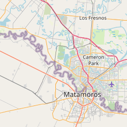
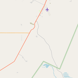
Reid Hope King Map, Satellite view of Reid Hope King, Texas
Reid Hope King is a census-designated place (CDP) located in Cameron County, Texas, USA.
Location informations of Reid Hope King
Latitude of city of Reid Hope King is 25.92130 and longitude of city of Reid Hope King is -97.41477- What Country is Reid Hope King In? Reid Hope King is located in the United States of America.
- What State is Reid Hope King located in? Reid Hope King is located in Texas.
- What County is Reid Hope King In? The County of Reid Hope King is Cameron County
Reid Hope King, Texas (TX), USA Geographic Information
| Country | United States |
| Country Code | US |
| State Name | Texas |
| Latitude | 25.9213 |
| Longitude | -97.41477 |
| DMS Lat | 25°55'16.68" N |
| DMS Long | 97°24'53.172" W |
| DMS coordinates : | 25°55'16.68" N 97°24'53.172" W |
Current Date and Time in Reid Hope King, Texas, USA
| Reid Hope King Time Zone : America/Chicago |
What day is it in Reid Hope King right now?Saturday (May 31, 2025) |
What time is it?Current local time and date at Reid Hope King is 23:22:08 (05/31/2025) : (America/Chicago) |
Postcode / zip code of Reid Hope King
Reid Hope King is the actual or alternate city name associated with 1 ZIP Codes by the US Postal Service.
List of all postal codes in Reid Hope King, Texas, United States.
78521 Zip Code
Online Map of Reid Hope King - road map, satellite view and street view


Check out our interactive map of Reid Hope King, Texas and you'll easily find your way around the Reid Hope King major roads and highways.
Satellite Map of Reid Hope King, TX, USA
This is online map of the address Reid Hope King, TX, United States. You may use button to move and zoom in / out. The map information is for reference only.
Resaca Airstrip (860 m / 0.53 Miles)
Brownsville South Padre Island International Airport (1.96 Km / 1.22 Miles)
Valley Baptist Medical Center Brownsville Helipad (9.45 Km / 5.87 Miles)
Mauldin Airport (11.43 Km / 7.10 Miles)
Valley Regional Medical Center Helipad (11.91 Km / 7.40 Miles)
US Border Patrol Brownsville Heliport (14.37 Km / 8.93 Miles)
Los Fresnos Airport (16.78 Km / 10.42 Miles)
Ag-Air Inc. Airport (20.87 Km / 12.96 Miles)
Drennan Farm Airport (22.27 Km / 13.84 Miles)
Laguna Vista Heliport (23.80 Km / 14.79 Miles)
LUCIO MIDDLE (281 m / 0.17 Miles)
EL JARDIN EL (407 m / 0.25 Miles)
RIVERA EARLY COLLEGE H S (2.03 Km / 1.26 Miles)
VERMILLION ROAD EL (2.07 Km / 1.29 Miles)
BRITE EL (2.68 Km / 1.66 Miles)
CHAMPION EL (2.75 Km / 1.71 Miles)
PERKINS MIDDLE (3.17 Km / 1.97 Miles)
GARCIA MIDDLE (3.20 Km / 1.99 Miles)
MORNINGSIDE EL (3.73 Km / 2.32 Miles)
SOUTHMOST EL (3.95 Km / 2.46 Miles)
GONZALEZ EL (4.02 Km / 2.50 Miles)
IDEA FRONTIER ACADEMY (4.04 Km / 2.51 Miles)
IDEA FRONTIER COLLEGE PREPARATORY (4.04 Km / 2.51 Miles)
PENA EL (4.34 Km / 2.70 Miles)
LOPEZ EARLY COLLEGE H S (4.38 Km / 2.72 Miles)
DEL CASTILLO EL (4.57 Km / 2.84 Miles)
JUBILEE LEADERSHIP ACADEMY (4.71 Km / 2.93 Miles)
GARZA EL (4.73 Km / 2.94 Miles)
List of places near to Reid Hope King
| Name | Distance |
|---|---|
| Villa Pancho | 4.12 Km / 2.56 Miles |
| South Point | 6.63 Km / 4.12 Miles |
| Cameron Park | 8.32 Km / 5.17 Miles |
| Brownsville | 8.55 Km / 5.31 Miles |
| Del Mar Heights | 15.12 Km / 9.40 Miles |
| Olmito | 16.34 Km / 10.15 Miles |
| Chula Vista | 17.15 Km / 10.66 Miles |
| Orason | 17.29 Km / 10.74 Miles |
| Los Fresnos | 17.83 Km / 11.08 Miles |
| Rancho Viejo | 19.32 Km / 12.00 Miles |
| San Pedro | 19.36 Km / 12.03 Miles |
| Indian Lake | 20.63 Km / 12.82 Miles |
| Laureles | 22.35 Km / 13.89 Miles |
| Bayview | 23.12 Km / 14.37 Miles |
| Laguna Vista | 23.53 Km / 14.62 Miles |
| Laguna Heights | 23.88 Km / 14.84 Miles |