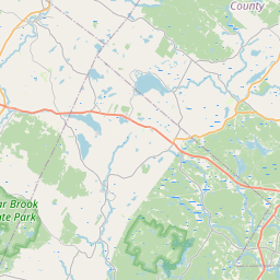
Rochester Map, Satellite view of Rochester, New Hampshire
Rochester is a city located in Strafford County, New Hampshire, USA.
Location informations of Rochester
Latitude of city of Rochester is 43.30453 and longitude of city of Rochester is -70.97562- What Country is Rochester In? Rochester is located in the United States of America.
- What State is Rochester located in? Rochester is located in New Hampshire.
- What County is Rochester In? The County of Rochester is Strafford County
Rochester, New Hampshire (NH), USA Geographic Information
| Country | United States |
| Country Code | US |
| State Name | New Hampshire |
| Latitude | 43.30453 |
| Longitude | -70.97562 |
| DMS Lat | 43°18'16.308" N |
| DMS Long | 70°58'32.232" W |
| DMS coordinates : | 43°18'16.308" N 70°58'32.232" W |
Current Date and Time in Rochester, New Hampshire, USA
| Rochester Time Zone : America/New_York |
What day is it in Rochester right now?Monday (June 9, 2025) |
What time is it?Current local time and date at Rochester is 6/9/2025 - 6:33:47 PM |
Postcode / zip code of Rochester
Rochester is the actual or alternate city name associated with 4 ZIP Codes by the US Postal Service.
List of all postal codes in Rochester, New Hampshire, United States.
03839 Zip Code 03866 Zip Code 03867 Zip Code 03868 Zip Code
Online Map of Rochester - road map, satellite view and street view


Check out our interactive map of Rochester, New Hampshire and you'll easily find your way around the Rochester major roads and highways.
Satellite Map of Rochester, NH, USA
This is online map of the address Rochester, NH, United States. You may use button to move and zoom in / out. The map information is for reference only.
Skyhaven Airport (4.38 Km / 2.72 Miles)
Salmon Falls Airport (6.14 Km / 3.81 Miles)
Skydive Lebanon Airport (8.69 Km / 5.40 Miles)
Perrotti Skyranch Airfield (10.58 Km / 6.57 Miles)
Wentworth-Douglass Heliport (13.13 Km / 8.16 Miles)
Trayport Heliport (14.77 Km / 9.18 Miles)
Murphy-Sherwood Park Airport (19.08 Km / 11.86 Miles)
Leinsing Heliport (19.93 Km / 12.38 Miles)
Bauneg Beg Seaplane Base (20.36 Km / 12.65 Miles)
Therriaults Landing Airport (20.70 Km / 12.86 Miles)
Bellamy River Seaplane Base (20.91 Km / 12.99 Miles)
Northwood Airport (22.62 Km / 14.06 Miles)
Locke Lake Airport (22.76 Km / 14.14 Miles)
Southern Maine Health Care/Sanford Heliport (23.17 Km / 14.40 Miles)
Skybast Heliport (23.80 Km / 14.79 Miles)
Sanford Seacoast Regional Airport (23.81 Km / 14.80 Miles)
Johnson's Heliport (24.03 Km / 14.93 Miles)
Littlebrook Air Park (24.36 Km / 15.14 Miles)
William Allen School (497 m / 0.31 Miles)
School Street School (655 m / 0.41 Miles)
Maple Street Magnet School (668 m / 0.42 Miles)
Spaulding High School (969 m / 0.60 Miles)
Bud Carlson Academy (1.31 Km / 0.81 Miles)
Chamberlain Street School (1.42 Km / 0.88 Miles)
McClelland School (1.43 Km / 0.89 Miles)
Rochester Middle School (1.70 Km / 1.06 Miles)
Gonic School (3.27 Km / 2.03 Miles)
East Rochester School (3.69 Km / 2.29 Miles)
Nancy Loud School (4.46 Km / 2.77 Miles)
List of places near to Rochester
| Name | Distance |
|---|---|
| Farmington | 9.87 Km / 6.13 Miles |
| Berwick (CDP) | 9.97 Km / 6.20 Miles |
| Somersworth | 10.12 Km / 6.29 Miles |
| Berwick | 10.82 Km / 6.72 Miles |
| Barrington | 11.14 Km / 6.92 Miles |
| Milton (CDP) | 11.75 Km / 7.30 Miles |
| Lebanon | 11.76 Km / 7.31 Miles |
| Farmington (CDP) | 11.93 Km / 7.41 Miles |
| Rollinsford | 14.28 Km / 8.87 Miles |
| Dover | 14.45 Km / 8.98 Miles |
| Madbury | 14.71 Km / 9.14 Miles |
| Strafford | 16.06 Km / 9.98 Miles |
| Milton | 16.72 Km / 10.39 Miles |
| North Berwick | 16.73 Km / 10.40 Miles |
| Durham (CDP) | 19.38 Km / 12.04 Miles |
| North Berwick (CDP) | 19.60 Km / 12.18 Miles |
| South Berwick | 19.85 Km / 12.33 Miles |
| Lee | 20.76 Km / 12.90 Miles |
| Union | 21.14 Km / 13.14 Miles |
| Middleton | 21.28 Km / 13.22 Miles |
| Durham | 21.35 Km / 13.27 Miles |
| Milton Mills | 21.89 Km / 13.60 Miles |
| Sanford | 22.12 Km / 13.74 Miles |
| Northwood | 22.56 Km / 14.02 Miles |
| New Durham | 22.73 Km / 14.12 Miles |
| Nottingham | 23.19 Km / 14.41 Miles |
| Barnstead | 23.27 Km / 14.46 Miles |
| Eliot | 23.97 Km / 14.89 Miles |
| Newmarket (CDP) | 24.87 Km / 15.45 Miles |