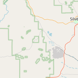
Rosedale Map, Satellite view of Rosedale, New Mexico
Rosedale is a census-designated place (CDP) located in Grant County, New Mexico, USA.
Location informations of Rosedale
Latitude of city of Rosedale is 32.76466 and longitude of city of Rosedale is -108.24348- What Country is Rosedale In? Rosedale is located in the United States of America.
- What State is Rosedale located in? Rosedale is located in New Mexico.
- What County is Rosedale In? The County of Rosedale is Grant County
Rosedale, New Mexico (NM), USA Geographic Information
| Country | United States |
| Country Code | US |
| State Name | New Mexico |
| Latitude | 32.76466 |
| Longitude | -108.24348 |
| DMS Lat | 32°45'52.776" N |
| DMS Long | 108°14'36.528" W |
| DMS coordinates : | 32°45'52.776" N 108°14'36.528" W |
Current Date and Time in Rosedale, New Mexico, USA
| Rosedale Time Zone : America/Denver |
What day is it in Rosedale right now?Sunday (May 25, 2025) |
What time is it?Current local time and date at Rosedale is 20:48:11 (05/25/2025) : (America/Denver) |
Postcode / zip code of Rosedale
Rosedale is the actual or alternate city name associated with 1 ZIP Codes by the US Postal Service.
List of all postal codes in Rosedale, New Mexico, United States.
88061 Zip Code
Online Map of Rosedale - road map, satellite view and street view


Check out our interactive map of Rosedale, New Mexico and you'll easily find your way around the Rosedale major roads and highways.
Satellite Map of Rosedale, NM, USA
This is online map of the address Rosedale, NM, United States. You may use button to move and zoom in / out. The map information is for reference only.
Whiskey Creek Airport (3.22 Km / 2.00 Miles)
Gila Regional Heliport (4.06 Km / 2.52 Miles)
Turner Ridgeport Airport (4.87 Km / 3.02 Miles)
Turner Ranch Airport (7.44 Km / 4.62 Miles)
Grant County Airport (16.92 Km / 10.51 Miles)
White Signal Airport (24.96 Km / 15.51 Miles)
ALDO LEOPOLD CHARTER (2.73 Km / 1.70 Miles)
SIXTH STREET ELEMENTARY (3.48 Km / 2.16 Miles)
G.W.STOUT ELEMENTARY (3.77 Km / 2.34 Miles)
JOSE BARRIOS ELEMENTARY (3.87 Km / 2.41 Miles)
HARRISON SCHMITT ELEMENTARY (3.97 Km / 2.46 Miles)
SILVER HIGH (4.15 Km / 2.58 Miles)
OPPORTUNITY HIGH SCHOOL (4.24 Km / 2.64 Miles)
LA PLATA MIDDLE (4.30 Km / 2.67 Miles)
Western New Mexico University (3.96 Km / 2.46 Miles)
List of places near to Rosedale
| Name | Distance |
|---|---|
| Silver City | 3.50 Km / 2.17 Miles |
| Arenas Valley | 6.43 Km / 4.00 Miles |
| Tyrone | 8.20 Km / 5.10 Miles |
| Santa Clara | 8.87 Km / 5.51 Miles |
| Bayard | 10.56 Km / 6.56 Miles |
| Pinos Altos | 11.17 Km / 6.94 Miles |
| North Hurley | 11.37 Km / 7.06 Miles |
| Cobre | 12.42 Km / 7.72 Miles |
| Hurley | 12.72 Km / 7.90 Miles |
| Hanover | 15.24 Km / 9.47 Miles |