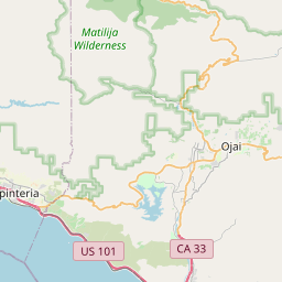
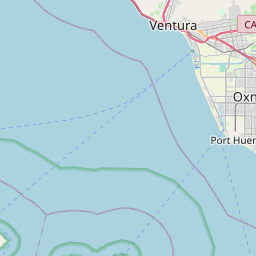
San Buenaventura (Ventura) Map, Satellite view of San Buenaventura (Ventura), California
San Buenaventura (Ventura) is a city located in Ventura County, California, USA.
Location informations of San Buenaventura (Ventura)
Latitude of city of San Buenaventura (Ventura) is 34.26778 and longitude of city of San Buenaventura (Ventura) is -119.25421- What Country is San Buenaventura (Ventura) In? San Buenaventura (Ventura) is located in the United States of America.
- What State is San Buenaventura (Ventura) located in? San Buenaventura (Ventura) is located in California.
- What County is San Buenaventura (Ventura) In? The County of San Buenaventura (Ventura) is Ventura County
San Buenaventura (Ventura), California (CA), USA Geographic Information
| Country | United States |
| Country Code | US |
| State Name | California |
| Latitude | 34.26778 |
| Longitude | -119.25421 |
| DMS Lat | 34°16'4.008" N |
| DMS Long | 119°15'15.156" W |
| DMS coordinates : | 34°16'4.008" N 119°15'15.156" W |
Current Date and Time in San Buenaventura (Ventura), California, USA
| San Buenaventura (Ventura) Time Zone : America/Los_Angeles |
What day is it in San Buenaventura (Ventura) right now?Monday (August 18, 2025) |
What time is it?Current local time and date at San Buenaventura (Ventura) is 8/18/2025 - 3:57:05 PM |
Postcode / zip code of San Buenaventura (Ventura)
San Buenaventura (Ventura) is the actual or alternate city name associated with 8 ZIP Codes by the US Postal Service.
List of all postal codes in San Buenaventura (Ventura), California, United States.
93001 Zip Code 93002 Zip Code 93003 Zip Code 93004 Zip Code 93005 Zip Code 93006 Zip Code 93007 Zip Code 93009 Zip Code
Area Codes San Buenaventura (Ventura), California, USA
San Buenaventura (Ventura), California covers 1 Area Codes
805 Area CodeOnline Map of San Buenaventura (Ventura) - road map, satellite view and street view


Check out our interactive map of San Buenaventura (Ventura), California and you'll easily find your way around the San Buenaventura (Ventura) major roads and highways.
Satellite Map of San Buenaventura (Ventura), CA, USA
This is online map of the address San Buenaventura (Ventura), CA, United States. You may use button to move and zoom in / out. The map information is for reference only.
Community Memorial Hospital Heliport (895 m / 0.56 Miles)
Ventura County Medical Center Helipad (987 m / 0.61 Miles)
Ventura Airpark (1.32 Km / 0.82 Miles)
SCE Northern Division Heliport (7.95 Km / 4.94 Miles)
Oxnard Airport (8.62 Km / 5.36 Miles)
Rotor-Aids Maintenance Hangar Heliport (8.68 Km / 5.39 Miles)
St John's Regional Medical Center Heliport (10.57 Km / 6.57 Miles)
Majlar Heliport (14.68 Km / 9.12 Miles)
Camarillo International Airport (15.91 Km / 9.88 Miles)
Platform Gina Helipad (16.86 Km / 10.47 Miles)
Platform Gilda Helipad (17.92 Km / 11.13 Miles)
Henderson Field (18.06 Km / 11.22 Miles)
Santa Paula Airport (19.82 Km / 12.32 Miles)
Point Mugu Naval Air Station (Naval Base Ventura Co) (20.47 Km / 12.72 Miles)
Santa Paula Hospital Heliport (20.59 Km / 12.79 Miles)
Platform Gail Helipad (20.84 Km / 12.95 Miles)
Platform Grace Helipad (22.06 Km / 13.71 Miles)
Parsons Airport (24.43 Km / 15.18 Miles)
Blanche Reynolds Elementary (292 m / 0.18 Miles)
Homestead (Alternative) (301 m / 0.19 Miles)
Anacapa Middle (829 m / 0.52 Miles)
Will Rogers Elementary (894 m / 0.56 Miles)
Pacific High (1.08 Km / 0.67 Miles)
Loma Vista Elementary (1.27 Km / 0.79 Miles)
Ventura High (1.72 Km / 1.07 Miles)
Pierpont Elementary (1.76 Km / 1.09 Miles)
Cabrillo Middle (2.57 Km / 1.59 Miles)
Elmhurst Elementary (2.59 Km / 1.61 Miles)
El Camino High (2.69 Km / 1.67 Miles)
Foothill Technology High (2.84 Km / 1.77 Miles)
Lincoln Elementary (3.00 Km / 1.86 Miles)
Buena High (3.63 Km / 2.25 Miles)
Poinsettia Elementary (4.02 Km / 2.50 Miles)
Balboa Middle (4.15 Km / 2.58 Miles)
Mound Elementary (4.17 Km / 2.59 Miles)
Montalvo Elementary (4.55 Km / 2.83 Miles)
Portola Elementary (4.83 Km / 3.00 Miles)
The Santa Barbara and Ventura Colleges of Law at Ventura (2.26 Km / 1.41 Miles)
Ventura College (2.42 Km / 1.50 Miles)
Ventura Adult and Continuing Education (3.44 Km / 2.14 Miles)
Lu Ross Academy (3.83 Km / 2.38 Miles)
List of places near to San Buenaventura (Ventura)
| Name | Distance |
|---|---|
| El Rio | 9.04 Km / 5.62 Miles |
| Saticoy | 9.74 Km / 6.05 Miles |
| Oxnard | 10.55 Km / 6.56 Miles |
| Channel Islands Beach | 12.53 Km / 7.79 Miles |
| Port Hueneme | 14.41 Km / 8.95 Miles |
| Oak View | 15.29 Km / 9.50 Miles |
| Mira Monte | 18.66 Km / 11.59 Miles |
| Meiners Oaks | 20.05 Km / 12.46 Miles |
| Ojai | 20.07 Km / 12.47 Miles |
| Santa Paula | 20.32 Km / 12.63 Miles |
| Camarillo | 20.71 Km / 12.87 Miles |