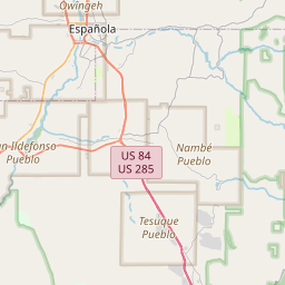
Santa Fe Map, Satellite view of Santa Fe, New Mexico
Santa Fe is a city located in Santa Fe County, New Mexico, USA.
Location informations of Santa Fe
Latitude of city of Santa Fe is 35.68698 and longitude of city of Santa Fe is -105.93780- What Country is Santa Fe In? Santa Fe is located in the United States of America.
- What State is Santa Fe located in? Santa Fe is located in New Mexico.
- What County is Santa Fe In? The County of Santa Fe is Santa Fe County
Santa Fe, New Mexico (NM), USA Geographic Information
| Country | United States |
| Country Code | US |
| State Name | New Mexico |
| Latitude | 35.68698 |
| Longitude | -105.9378 |
| DMS Lat | 35°41'13.128" N |
| DMS Long | 105°56'16.08" W |
| DMS coordinates : | 35°41'13.128" N 105°56'16.08" W |
Current Date and Time in Santa Fe, New Mexico, USA
| Santa Fe Time Zone : America/Denver |
What day is it in Santa Fe right now?Saturday (May 31, 2025) |
What time is it?Current local time and date at Santa Fe is 16:25:35 (05/31/2025) : (America/Denver) |
Postcode / zip code of Santa Fe
Santa Fe is the actual or alternate city name associated with 11 ZIP Codes by the US Postal Service.
List of all postal codes in Santa Fe, New Mexico, United States.
87501 Zip Code 87502 Zip Code 87503 Zip Code 87504 Zip Code 87505 Zip Code 87506 Zip Code 87507 Zip Code 87508 Zip Code 87509 Zip Code 87592 Zip Code 87594 Zip Code
Online Map of Santa Fe - road map, satellite view and street view


Check out our interactive map of Santa Fe, New Mexico and you'll easily find your way around the Santa Fe major roads and highways.
Satellite Map of Santa Fe, NM, USA
This is online map of the address Santa Fe, NM, United States. You may use button to move and zoom in / out. The map information is for reference only.
Governor's Residence Heliport (2.27 Km / 1.41 Miles)
St Johns College Helispot Heliport (3.06 Km / 1.90 Miles)
St Vincent Hospital Heliport (3.14 Km / 1.95 Miles)
Presbyterian Santa Fe Medical Center Heliport (11.22 Km / 6.97 Miles)
Santa Fe Municipal Airport (15.72 Km / 9.77 Miles)
NM SCHOOL FOR THE ARTS (390 m / 0.24 Miles)
CARLOS GILBERT ELEMENTARY (688 m / 0.43 Miles)
WOOD-GORMLEY ELEMENTARY (840 m / 0.52 Miles)
ACEQUIA MADRE ELEMENTARY (1.04 Km / 0.65 Miles)
GONZALES ELEMENTARY (1.66 Km / 1.03 Miles)
NM SCHOOL FOR THE DEAF (2.06 Km / 1.28 Miles)
SANTA FE ENGAGE (2.09 Km / 1.30 Miles)
ASPEN COMMUNITY SCHOOL (2.26 Km / 1.41 Miles)
E.J. MARTINEZ ELEMENTARY (2.72 Km / 1.69 Miles)
ATALAYA ELEMENTARY (2.76 Km / 1.71 Miles)
Santa Fe Indian School (3.07 Km / 1.91 Miles)
MANDELA INTERNATIONAL MAGNET (MIMS) (3.30 Km / 2.05 Miles)
SALAZAR ELEMENTARY (4.55 Km / 2.82 Miles)
MILAGRO MIDDLE (4.63 Km / 2.88 Miles)
St. John's College (3.19 Km / 1.98 Miles)
Southwest Acupuncture College-Santa Fe (3.33 Km / 2.07 Miles)
List of places near to Santa Fe
| Name | Distance |
|---|---|
| Tesuque | 8.32 Km / 5.17 Miles |
| Agua Fria | 8.44 Km / 5.24 Miles |
| Peak Place | 11.60 Km / 7.21 Miles |
| Cañada de los Alamos | 12.64 Km / 7.85 Miles |
| Tesuque Pueblo | 13.29 Km / 8.26 Miles |
| Chupadero | 15.19 Km / 9.44 Miles |
| Rio en Medio | 15.66 Km / 9.73 Miles |
| Eldorado at Santa Fe | 17.76 Km / 11.04 Miles |
| Cuyamungue Grant | 18.46 Km / 11.47 Miles |
| Glorieta | 19.06 Km / 11.84 Miles |
| Cuyamungue | 21.19 Km / 13.17 Miles |
| La Cienega | 22.25 Km / 13.83 Miles |
| Nambe | 23.30 Km / 14.48 Miles |
| Lamy | 23.45 Km / 14.57 Miles |
| Pojoaque | 24.14 Km / 15.00 Miles |
| Jacona | 24.52 Km / 15.24 Miles |
| Jaconita | 24.74 Km / 15.37 Miles |