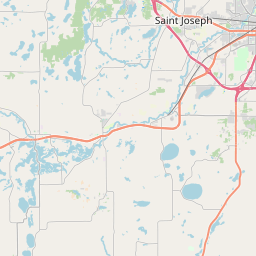
Sartell Map, Satellite view of Sartell, Minnesota
Sartell is a city located in Benton County, Stearns County, Minnesota, USA.
Location informations of Sartell
Latitude of city of Sartell is 45.61809 and longitude of city of Sartell is -94.21215- What Country is Sartell In? Sartell is located in the United States of America.
- What State is Sartell located in? Sartell is located in Minnesota.
- What County is Sartell In? Sartell, Minnesota sits in Two different counties: Benton County, Stearns County
Sartell, Minnesota (MN), USA Geographic Information
| Country | United States |
| Country Code | US |
| State Name | Minnesota |
| Latitude | 45.61809 |
| Longitude | -94.21215 |
| DMS Lat | 45°37'5.124" N |
| DMS Long | 94°12'43.74" W |
| DMS coordinates : | 45°37'5.124" N 94°12'43.74" W |
Current Date and Time in Sartell, Minnesota, USA
| Sartell Time Zone : America/Chicago |
What day is it in Sartell right now?Thursday (May 22, 2025) |
What time is it?Current local time and date at Sartell is 21:52:24 (05/22/2025) : (America/Chicago) |
Postcode / zip code of Sartell
Sartell is the actual or alternate city name associated with 4 ZIP Codes by the US Postal Service.
List of all postal codes in Sartell, Minnesota, United States.
56303 Zip Code 56374 Zip Code 56377 Zip Code 56379 Zip Code
Online Map of Sartell - road map, satellite view and street view


Check out our interactive map of Sartell, Minnesota and you'll easily find your way around the Sartell major roads and highways.
Satellite Map of Sartell, MN, USA
This is online map of the address Sartell, MN, United States. You may use button to move and zoom in / out. The map information is for reference only.
Guggenberger Airport (1.49 Km / 0.93 Miles)
Thens Private Airstrip (3.16 Km / 1.96 Miles)
Saint Cloud Hospital Heliport (5.90 Km / 3.67 Miles)
Mosquito Heliport (7.63 Km / 4.74 Miles)
Little Rock/Rock Port Airport (11.75 Km / 7.30 Miles)
Aysta Field (12.68 Km / 7.88 Miles)
Saint Cloud Regional Airport (14.27 Km / 8.87 Miles)
Fussy Airport (21.73 Km / 13.50 Miles)
Fedor Airport (24.98 Km / 15.52 Miles)
BENTON-STEARNS ED DISTRICT EC (220 m / 0.14 Miles)
BENTON-STEARNS ED. DISTRICT (263 m / 0.16 Miles)
SARTELL EC SERVICE CENTER (595 m / 0.37 Miles)
CENTRAL MN ALC SARTELL (607 m / 0.38 Miles)
SARTELL MIDDLE (1.09 Km / 0.68 Miles)
SARTELL SENIOR HIGH (1.28 Km / 0.80 Miles)
PINE MEADOW ELEMENTARY (1.50 Km / 0.93 Miles)
PLEASANT VIEW ELEMENTARY (3.73 Km / 2.32 Miles)
OAK RIDGE ELEMENTARY (4.47 Km / 2.78 Miles)
SAINT CLOUD MATH AND SCIENCE ACADEM (4.84 Km / 3.01 Miles)
SAUK RAPIDS ECFE (4.90 Km / 3.04 Miles)
List of places near to Sartell
| Name | Distance |
|---|---|
| Sauk Rapids (Township) | 4.07 Km / 2.53 Miles |
| Le Sauk | 4.18 Km / 2.60 Miles |
| Sauk Rapids | 4.62 Km / 2.87 Miles |
| Waite Park | 6.84 Km / 4.25 Miles |
| Watab | 8.62 Km / 5.36 Miles |
| St. Wendel | 9.59 Km / 5.96 Miles |
| St. Joseph | 10.16 Km / 6.31 Miles |
| St. Stephen | 10.58 Km / 6.57 Miles |
| St. Cloud | 10.66 Km / 6.62 Miles |
| Minden | 11.60 Km / 7.21 Miles |
| St. Joseph (Township) | 12.94 Km / 8.04 Miles |
| Mayhew Lake | 13.43 Km / 8.35 Miles |
| Brockway | 13.57 Km / 8.43 Miles |
| Rice | 14.89 Km / 9.25 Miles |
| Haven | 15.45 Km / 9.60 Miles |
| Langola | 18.11 Km / 11.25 Miles |
| Avon (Township) | 18.60 Km / 11.56 Miles |
| Avon | 18.66 Km / 11.59 Miles |
| St. Augusta | 18.73 Km / 11.64 Miles |
| Rockville | 19.10 Km / 11.87 Miles |
| Collegeville | 19.67 Km / 12.22 Miles |
| St. George | 20.14 Km / 12.51 Miles |
| Graham | 21.07 Km / 13.09 Miles |
| Holding | 21.75 Km / 13.51 Miles |
| Gilmanton | 22.12 Km / 13.74 Miles |
| Palmer | 23.36 Km / 14.52 Miles |
| Holdingford | 23.65 Km / 14.70 Miles |
| Foley | 24.08 Km / 14.96 Miles |
| Gilman | 24.23 Km / 15.06 Miles |
| Royalton | 24.41 Km / 15.17 Miles |
| Cold Spring | 24.71 Km / 15.35 Miles |