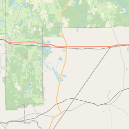
Selmont-West Selmont Map, Satellite view of Selmont-West Selmont, Alabama
Selmont-West Selmont is a census-designated place (CDP) located in Dallas County, Alabama, USA.
Location informations of Selmont-West Selmont
Latitude of city of Selmont-West Selmont is 32.37825 and longitude of city of Selmont-West Selmont is -87.00690- What Country is Selmont-West Selmont In? Selmont-West Selmont is located in the United States of America.
- What State is Selmont-West Selmont located in? Selmont-West Selmont is located in Alabama.
- What County is Selmont-West Selmont In? The County of Selmont-West Selmont is Dallas County
Selmont-West Selmont, Alabama (AL), USA Geographic Information
| Country | United States |
| Country Code | US |
| State Name | Alabama |
| Latitude | 32.37825 |
| Longitude | -87.0069 |
| DMS Lat | 32°22'41.7" N |
| DMS Long | 87°0'24.84" W |
| DMS coordinates : | 32°22'41.7" N 87°0'24.84" W |
Current Date and Time in Selmont-West Selmont, Alabama, USA
| Selmont-West Selmont Time Zone : America/Chicago |
What day is it in Selmont-West Selmont right now?Wednesday (June 11, 2025) |
What time is it?Current local time and date at Selmont-West Selmont is 6/11/2025 - 6:37:29 AM |
Postcode / zip code of Selmont-West Selmont
Selmont-West Selmont is the actual or alternate city name associated with 2 ZIP Codes by the US Postal Service.
List of all postal codes in Selmont-West Selmont, Alabama, United States.
36701 Zip Code 36703 Zip Code
Area Codes Selmont-West Selmont, Alabama, USA
Selmont-West Selmont, Alabama covers 1 Area Codes
334 Area CodeOnline Map of Selmont-West Selmont - road map, satellite view and street view


Check out our interactive map of Selmont-West Selmont, Alabama and you'll easily find your way around the Selmont-West Selmont major roads and highways.
Satellite Map of Selmont-West Selmont, AL, USA
This is online map of the address Selmont-West Selmont, AL, United States. You may use button to move and zoom in / out. The map information is for reference only.
Craig Field (4.22 Km / 2.62 Miles)
Vaughan Hospital Heliport (5.46 Km / 3.39 Miles)
Selma Medical Center Heliport (7.33 Km / 4.55 Miles)
Skyharbor Airport (9.23 Km / 5.73 Miles)
Dallas County Career Technical Center (1.15 Km / 0.71 Miles)
Tipton Durant Middle School (1.19 Km / 0.74 Miles)
Southside Primary School (2.40 Km / 1.49 Miles)
Bruce K Craig Elementary School (2.72 Km / 1.69 Miles)
Phoenix School (3.36 Km / 2.09 Miles)
Clark Elementary School (3.91 Km / 2.43 Miles)
School Of Discovery Genesis Center (3.94 Km / 2.45 Miles)
Sophia P Kingston Elementary School (3.96 Km / 2.46 Miles)
Byrd First Class Early Learning Center (4.29 Km / 2.67 Miles)
Knox Elementary School (4.61 Km / 2.87 Miles)
Payne Elementary School (4.84 Km / 3.01 Miles)
List of places near to Selmont-West Selmont
| Name | Distance |
|---|---|
| Selma | 3.50 Km / 2.17 Miles |
| Valley Grande | 14.65 Km / 9.10 Miles |
| Benton | 19.46 Km / 12.09 Miles |
| Orrville | 23.81 Km / 14.79 Miles |