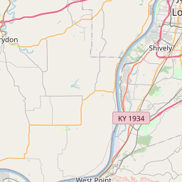
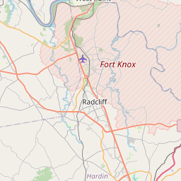
Shepherdsville Map, Satellite view of Shepherdsville, Kentucky
Shepherdsville is a city located in Bullitt County, Kentucky, USA.
Location informations of Shepherdsville
Latitude of city of Shepherdsville is 37.98840 and longitude of city of Shepherdsville is -85.71579- What Country is Shepherdsville In? Shepherdsville is located in the United States of America.
- What State is Shepherdsville located in? Shepherdsville is located in Kentucky.
- What County is Shepherdsville In? The County of Shepherdsville is Bullitt County
Shepherdsville, Kentucky (KY), USA Geographic Information
| Country | United States |
| Country Code | US |
| State Name | Kentucky |
| Latitude | 37.9884 |
| Longitude | -85.71579 |
| DMS Lat | 37°59'18.24" N |
| DMS Long | 85°42'56.844" W |
| DMS coordinates : | 37°59'18.24" N 85°42'56.844" W |
Current Date and Time in Shepherdsville, Kentucky, USA
| Shepherdsville Time Zone : America/New_York |
What day is it in Shepherdsville right now?Friday (June 13, 2025) |
What time is it?Current local time and date at Shepherdsville is 6/13/2025 - 3:43:33 AM |
Postcode / zip code of Shepherdsville
Shepherdsville is the actual or alternate city name associated with 2 ZIP Codes by the US Postal Service.
List of all postal codes in Shepherdsville, Kentucky, United States.
40150 Zip Code 40165 Zip Code
Online Map of Shepherdsville - road map, satellite view and street view


Check out our interactive map of Shepherdsville, Kentucky and you'll easily find your way around the Shepherdsville major roads and highways.
Satellite Map of Shepherdsville, KY, USA
This is online map of the address Shepherdsville, KY, United States. You may use button to move and zoom in / out. The map information is for reference only.
Shady Acres Airport (5.02 Km / 3.12 Miles)
Brooks Field (8.97 Km / 5.57 Miles)
Blue Lick Airport (10.44 Km / 6.49 Miles)
Samuels Springs Airport (17.31 Km / 10.76 Miles)
Southwest Hospital Heliport (17.66 Km / 10.97 Miles)
Central Government Center Heliport (18.36 Km / 11.41 Miles)
Switch Pad Heliport (19.87 Km / 12.34 Miles)
Southwest Government Center Heliport (20.71 Km / 12.87 Miles)
Louisville Muhammad Ali International Airport (20.76 Km / 12.90 Miles)
Flaget Memorial Hospital Heliport (22.04 Km / 13.70 Miles)
Godman Army Air Field (24.22 Km / 15.05 Miles)
Churchill Downs Heliport (24.30 Km / 15.10 Miles)
Greene County Parachute Center Airport (24.67 Km / 15.33 Miles)
Bardstown Landing Strip (24.73 Km / 15.37 Miles)
Shepherdsville Elementary (990 m / 0.62 Miles)
Bullitt Lick Middle School (1.15 Km / 0.71 Miles)
Roby Elementary School (1.53 Km / 0.95 Miles)
Bullitt Central High School (2.02 Km / 1.25 Miles)
Riverview Opportunity Center (2.04 Km / 1.27 Miles)
Bullitt Alternative Center (2.04 Km / 1.27 Miles)
Bullitt County Area Technology Center (2.05 Km / 1.28 Miles)
Cedar Grove Elementary (3.29 Km / 2.05 Miles)
List of places near to Shepherdsville
| Name | Distance |
|---|---|
| Fox Chase | 6.68 Km / 4.15 Miles |
| Hebron Estates | 8.07 Km / 5.01 Miles |
| Brooks | 8.11 Km / 5.04 Miles |
| Pioneer Village | 8.69 Km / 5.40 Miles |
| Hillview | 9.43 Km / 5.86 Miles |
| Hunters Hollow | 10.10 Km / 6.28 Miles |
| Hollyvilla | 11.99 Km / 7.45 Miles |
| South Park View | 14.46 Km / 8.99 Miles |
| Heritage Creek | 15.05 Km / 9.35 Miles |
| Mount Washington | 16.39 Km / 10.18 Miles |
| Lebanon Junction | 17.17 Km / 10.67 Miles |
| Spring Mill | 18.77 Km / 11.66 Miles |
| Hollow Creek | 19.93 Km / 12.38 Miles |
| West Point | 20.00 Km / 12.43 Miles |
| Poplar Hills | 21.13 Km / 13.13 Miles |
| Lynnview | 21.13 Km / 13.13 Miles |
| Boston | 22.65 Km / 14.07 Miles |
| Watterson Park | 22.85 Km / 14.20 Miles |
| West Buechel | 23.65 Km / 14.70 Miles |
| Audubon Park | 23.98 Km / 14.90 Miles |
| Fort Knox | 24.53 Km / 15.24 Miles |
| Muldraugh | 24.92 Km / 15.48 Miles |