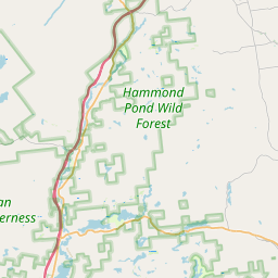
Shoreham Map, Satellite view of Shoreham, Vermont
Shoreham is a town located in Addison County, Vermont, USA.
Location informations of Shoreham
Latitude of city of Shoreham is 43.89924 and longitude of city of Shoreham is -73.31531- What Country is Shoreham In? Shoreham is located in the United States of America.
- What State is Shoreham located in? Shoreham is located in Vermont.
- What County is Shoreham In? The County of Shoreham is Addison County
Shoreham, Vermont (VT), USA Geographic Information
| Country | United States |
| Country Code | US |
| State Name | Vermont |
| Latitude | 43.89924 |
| Longitude | -73.31531 |
| DMS Lat | 43°53'57.264" N |
| DMS Long | 73°18'55.116" W |
| DMS coordinates : | 43°53'57.264" N 73°18'55.116" W |
Current Date and Time in Shoreham, Vermont, USA
| Shoreham Time Zone : America/New_York |
What day is it in Shoreham right now?Saturday (May 24, 2025) |
What time is it?Current local time and date at Shoreham is 12:32:13 (05/24/2025) : (America/New_York) |
Postcode / zip code of Shoreham
Shoreham is the actual or alternate city name associated with 3 ZIP Codes by the US Postal Service.
List of all postal codes in Shoreham, Vermont, United States.
05734 Zip Code 05770 Zip Code 05778 Zip Code
Online Map of Shoreham - road map, satellite view and street view


Check out our interactive map of Shoreham, Vermont and you'll easily find your way around the Shoreham major roads and highways.
Satellite Map of Shoreham, VT, USA
This is online map of the address Shoreham, VT, United States. You may use button to move and zoom in / out. The map information is for reference only.
Symon Airport (2.96 Km / 1.84 Miles)
Brisson Airport (3.41 Km / 2.12 Miles)
Melrose Springs Airfield (5.07 Km / 3.15 Miles)
Torrey Airport (5.70 Km / 3.54 Miles)
Ticonderoga Municipal Airport (8.21 Km / 5.10 Miles)
Manning Personal Airstrip (10.73 Km / 6.67 Miles)
Quesnel Farm Property Heliport (11.12 Km / 6.91 Miles)
UVMHN-Elizabethtown Community Hospital Heliport (11.18 Km / 6.95 Miles)
Foote Farm Association RLA Heliport (11.71 Km / 7.28 Miles)
BLSG Leicester Heliport (17.12 Km / 10.64 Miles)
Monument Farms Dairy Bittersweet Falls Road Heliport (17.29 Km / 10.74 Miles)
Axinn Airport (19.09 Km / 11.86 Miles)
Ass-Pirin Acres Airport (19.41 Km / 12.06 Miles)
BLSG Brandon Heliport (19.49 Km / 12.11 Miles)
Middlebury State Airport (19.98 Km / 12.41 Miles)
Yankee Kingdom Airport (23.49 Km / 14.59 Miles)
Spencer Airport (23.92 Km / 14.86 Miles)
Bailey Airport (24.81 Km / 15.41 Miles)
Shoreham Elementary School (826 m / 0.51 Miles)
List of places near to Shoreham
| Name | Distance |
|---|---|
| Whiting | 8.62 Km / 5.36 Miles |
| Bridport | 9.27 Km / 5.76 Miles |
| Ticonderoga (CDP) | 10.33 Km / 6.42 Miles |
| Orwell | 10.46 Km / 6.50 Miles |
| Cornwall | 10.55 Km / 6.56 Miles |
| Sudbury | 15.94 Km / 9.90 Miles |
| Salisbury | 16.58 Km / 10.30 Miles |
| Weybridge | 17.35 Km / 10.78 Miles |
| Leicester | 17.49 Km / 10.87 Miles |
| Middlebury (CDP) | 17.52 Km / 10.89 Miles |
| Addison | 17.77 Km / 11.04 Miles |
| East Middlebury | 18.66 Km / 11.59 Miles |
| Putnam | 18.82 Km / 11.69 Miles |
| Middlebury | 19.42 Km / 12.07 Miles |
| Port Henry | 20.22 Km / 12.56 Miles |
| Ticonderoga | 20.31 Km / 12.62 Miles |
| Benson | 21.06 Km / 13.09 Miles |
| Benson (CDP) | 21.38 Km / 13.28 Miles |
| Brandon (CDP) | 21.44 Km / 13.32 Miles |
| Brandon | 21.89 Km / 13.60 Miles |
| Hubbardton | 22.05 Km / 13.70 Miles |
| Crown Point | 22.63 Km / 14.06 Miles |
| Moriah | 24.54 Km / 15.25 Miles |