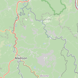
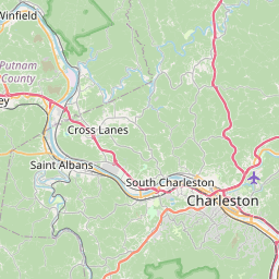
Shrewsbury Map, Satellite view of Shrewsbury, West Virginia
Shrewsbury is a census-designated place (CDP) located in Kanawha County, West Virginia, USA.
Location informations of Shrewsbury
Latitude of city of Shrewsbury is 38.20621 and longitude of city of Shrewsbury is -81.47151- What Country is Shrewsbury In? Shrewsbury is located in the United States of America.
- What State is Shrewsbury located in? Shrewsbury is located in West Virginia.
- What County is Shrewsbury In? The County of Shrewsbury is Kanawha County
Shrewsbury, West Virginia (WV), USA Geographic Information
| Country | United States |
| Country Code | US |
| State Name | West Virginia |
| Latitude | 38.20621 |
| Longitude | -81.47151 |
| DMS Lat | 38°12'22.356" N |
| DMS Long | 81°28'17.436" W |
| DMS coordinates : | 38°12'22.356" N 81°28'17.436" W |
Current Date and Time in Shrewsbury, West Virginia, USA
| Shrewsbury Time Zone : America/New_York |
What day is it in Shrewsbury right now?Sunday (June 8, 2025) |
What time is it?Current local time and date at Shrewsbury is 6/8/2025 - 12:45:03 AM |
Postcode / zip code of Shrewsbury
Shrewsbury is the actual or alternate city name associated with 1 ZIP Codes by the US Postal Service.
List of all postal codes in Shrewsbury, West Virginia, United States.
25015 Zip Code
Area Codes Shrewsbury, West Virginia, USA
Shrewsbury, West Virginia covers 1 Area Codes
304 Area CodeOnline Map of Shrewsbury - road map, satellite view and street view


Check out our interactive map of Shrewsbury, West Virginia and you'll easily find your way around the Shrewsbury major roads and highways.
Satellite Map of Shrewsbury, WV, USA
This is online map of the address Shrewsbury, WV, United States. You may use button to move and zoom in / out. The map information is for reference only.
Island Airport (5.52 Km / 3.43 Miles)
Walker I Heliport (5.88 Km / 3.65 Miles)
Mcs-Pad Heliport (12.79 Km / 7.95 Miles)
Alloy Heliport (18.54 Km / 11.52 Miles)
Camc-Memorial Heliport (20.80 Km / 12.93 Miles)
Yeager Airport (21.38 Km / 13.29 Miles)
EAST BANK MIDDLE SCHOOL (1.99 Km / 1.23 Miles)
RIVERSIDE HIGH SCHOOL (3.64 Km / 2.26 Miles)
MIDLAND TRAIL ELEMENTARY SCHOOL (3.86 Km / 2.40 Miles)
CEDAR GROVE MIDDLE SCHOOL (3.92 Km / 2.44 Miles)
CEDAR GROVE ELEMENTARY SCHOOL (3.92 Km / 2.44 Miles)
CHESAPEAKE ELEMENTARY SCHOOL (4.90 Km / 3.05 Miles)
List of places near to Shrewsbury
| Name | Distance |
|---|---|
| Chelyan | 2.08 Km / 1.29 Miles |
| East Bank | 2.83 Km / 1.76 Miles |
| Cedar Grove | 4.16 Km / 2.58 Miles |
| Glasgow | 4.23 Km / 2.63 Miles |
| Chesapeake | 5.97 Km / 3.71 Miles |
| Belle | 6.45 Km / 4.01 Miles |
| Pratt | 7.66 Km / 4.76 Miles |
| Marmet | 9.41 Km / 5.85 Miles |
| Handley | 9.52 Km / 5.92 Miles |
| Rand | 11.62 Km / 7.22 Miles |
| Coal Fork | 13.12 Km / 8.15 Miles |
| Montgomery | 13.75 Km / 8.54 Miles |
| Comfort | 15.16 Km / 9.42 Miles |
| Smithers | 15.86 Km / 9.85 Miles |
| Kimberly | 16.72 Km / 10.39 Miles |
| Boomer | 17.24 Km / 10.71 Miles |
| Powellton | 17.56 Km / 10.91 Miles |
| Mount Carbon | 17.93 Km / 11.14 Miles |
| Racine | 17.99 Km / 11.18 Miles |
| Deep Water | 20.20 Km / 12.55 Miles |
| Charleston | 21.28 Km / 13.22 Miles |
| Falls View | 21.61 Km / 13.43 Miles |
| Pinch | 22.53 Km / 14.00 Miles |
| Charlton Heights | 22.70 Km / 14.11 Miles |
| Big Chimney | 22.87 Km / 14.21 Miles |
| Sylvester | 23.04 Km / 14.32 Miles |
| Glen Ferris | 23.20 Km / 14.42 Miles |
| Page | 24.53 Km / 15.24 Miles |
| Gauley Bridge | 24.54 Km / 15.25 Miles |
| Belva | 24.57 Km / 15.27 Miles |
| Dixie | 24.72 Km / 15.36 Miles |