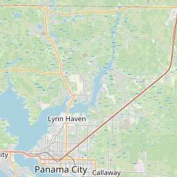
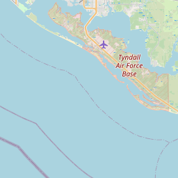
Springfield Map, Satellite view of Springfield, Florida
Springfield is a city located in Bay County, Florida, USA.
Location informations of Springfield
Latitude of city of Springfield is 30.15326 and longitude of city of Springfield is -85.61132- What Country is Springfield In? Springfield is located in the United States of America.
- What State is Springfield located in? Springfield is located in Florida.
- What County is Springfield In? The County of Springfield is Bay County
Springfield, Florida (FL), USA Geographic Information
| Country | United States |
| Country Code | US |
| State Name | Florida |
| Latitude | 30.15326 |
| Longitude | -85.61132 |
| DMS Lat | 30°9'11.736" N |
| DMS Long | 85°36'40.752" W |
| DMS coordinates : | 30°9'11.736" N 85°36'40.752" W |
Current Date and Time in Springfield, Florida, USA
| Springfield Time Zone : America/Chicago |
What day is it in Springfield right now?Friday (May 23, 2025) |
What time is it?Current local time and date at Springfield is 5/23/2025 - 8:27:04 PM |
Postcode / zip code of Springfield
Springfield is the actual or alternate city name associated with 3 ZIP Codes by the US Postal Service.
List of all postal codes in Springfield, Florida, United States.
32401 Zip Code 32404 Zip Code 32405 Zip Code
Online Map of Springfield - road map, satellite view and street view


Check out our interactive map of Springfield, Florida and you'll easily find your way around the Springfield major roads and highways.
Satellite Map of Springfield, FL, USA
This is online map of the address Springfield, FL, United States. You may use button to move and zoom in / out. The map information is for reference only.
Bay Medical Center Heliport (3.70 Km / 2.30 Miles)
Bay Helicopters Heliport (6.59 Km / 4.09 Miles)
Post Electric Inc Heliport (8.69 Km / 5.40 Miles)
Panama City-Bay Co International Airport (9.49 Km / 5.89 Miles)
Tyndall Air Force Base (9.92 Km / 6.17 Miles)
Heli-Tech Inc Heliport (10.06 Km / 6.25 Miles)
Gulf Coast Helicopters Heliport (10.82 Km / 6.73 Miles)
Grand Lagoon Seaplane Base (11.98 Km / 7.44 Miles)
Bay Seaplanes Seaplane Base (13.78 Km / 8.56 Miles)
Coastal Systems Station Heliport (13.85 Km / 8.60 Miles)
Sandy Creek Airpark (13.87 Km / 8.62 Miles)
Tyndall AFB Drone Runway (15.19 Km / 9.44 Miles)
Coastal Helicopters Inc Heliport (15.82 Km / 9.83 Miles)
Tyndall AFB Silver Flag Runway (18.36 Km / 11.41 Miles)
Panama City Beach Airstrip (20.86 Km / 12.96 Miles)
Yellow Whirley Bird Heliport (21.48 Km / 13.34 Miles)
Beach Mosquito Control District Heliport (21.81 Km / 13.55 Miles)
SPRINGFIELD ELEMENTARY SCHOOL (598 m / 0.37 Miles)
EVERITT MIDDLE SCHOOL (822 m / 0.51 Miles)
MARGARET K. LEWIS IN MILLVILLE (1.44 Km / 0.90 Miles)
RUTHERFORD HIGH SCHOOL (1.53 Km / 0.95 Miles)
PARKER ELEMENTARY SCHOOL (2.18 Km / 1.36 Miles)
CEDAR GROVE ELEMENTARY SCHOOL (2.56 Km / 1.59 Miles)
OSCAR PATTERSON ELEMENTARY MAGNET (3.01 Km / 1.87 Miles)
C C WASHINGTON ACADEMY (3.18 Km / 1.98 Miles)
ROSENWALD HIGH SCHOOL (3.19 Km / 1.98 Miles)
MERRIAM CHERRY STREET ELEMENTARY (3.37 Km / 2.09 Miles)
CALLAWAY ELEMENTARY SCHOOL (4.07 Km / 2.53 Miles)
BAY REGIONAL JUVENILE DETENTION CENTER (4.45 Km / 2.76 Miles)
PANAMA CITY MARINE INSTITUTE (4.78 Km / 2.97 Miles)
CHAUTAUQUA CHARTER SCHOOL (4.84 Km / 3.01 Miles)
BAY HIGH SCHOOL (5.00 Km / 3.10 Miles)
List of places near to Springfield
| Name | Distance |
|---|---|
| Cedar Grove | 2.38 Km / 1.48 Miles |
| Parker | 2.59 Km / 1.61 Miles |
| Callaway | 3.98 Km / 2.47 Miles |
| Panama City | 4.74 Km / 2.95 Miles |
| Tyndall AFB | 7.20 Km / 4.47 Miles |
| Pretty Bayou | 9.51 Km / 5.91 Miles |
| Lynn Haven | 10.85 Km / 6.74 Miles |
| Upper Grand Lagoon | 12.49 Km / 7.76 Miles |
| Lower Grand Lagoon | 13.45 Km / 8.36 Miles |
| Panama City Beach | 18.85 Km / 11.71 Miles |