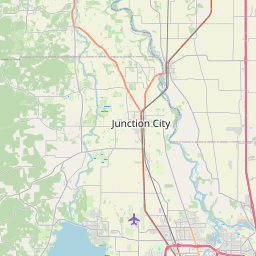
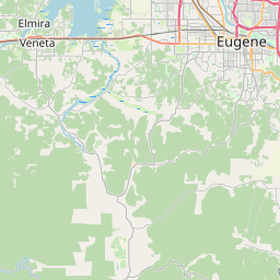
Springfield Map, Satellite view of Springfield, Oregon
Springfield is a city located in Lane County, Oregon, USA.
Location informations of Springfield
Latitude of city of Springfield is 44.04624 and longitude of city of Springfield is -123.02203- What Country is Springfield In? Springfield is located in the United States of America.
- What State is Springfield located in? Springfield is located in Oregon.
- What County is Springfield In? The County of Springfield is Lane County
Springfield, Oregon (OR), USA Geographic Information
| Country | United States |
| Country Code | US |
| State Name | Oregon |
| Latitude | 44.04624 |
| Longitude | -123.02203 |
| DMS Lat | 44°2'46.464" N |
| DMS Long | 123°1'19.308" W |
| DMS coordinates : | 44°2'46.464" N 123°1'19.308" W |
Current Date and Time in Springfield, Oregon, USA
| Springfield Time Zone : America/Los_Angeles |
What day is it in Springfield right now?Thursday (May 22, 2025) |
What time is it?Current local time and date at Springfield is 05:29:52 (05/22/2025) : (America/Los_Angeles) |
Postcode / zip code of Springfield
Springfield is the actual or alternate city name associated with 5 ZIP Codes by the US Postal Service.
List of all postal codes in Springfield, Oregon, United States.
97403 Zip Code 97475 Zip Code 97477 Zip Code 97478 Zip Code 97482 Zip Code
Online Map of Springfield - road map, satellite view and street view


Check out our interactive map of Springfield, Oregon and you'll easily find your way around the Springfield major roads and highways.
Satellite Map of Springfield, OR, USA
This is online map of the address Springfield, OR, United States. You may use button to move and zoom in / out. The map information is for reference only.
McKenzie-Willamette Medical Center Heliport (1.69 Km / 1.05 Miles)
Springfield Airport (2.85 Km / 1.77 Miles)
River Bend Hospital Heliport (3.91 Km / 2.43 Miles)
Sacred Heart General Hospital Heliport (4.31 Km / 2.68 Miles)
Saxon's Heliport (5.60 Km / 3.48 Miles)
Eugene Airpark (7.49 Km / 4.66 Miles)
Eugene Fire Station #2 Heliport (7.87 Km / 4.89 Miles)
Drill Field Pad Heliport (7.89 Km / 4.90 Miles)
Coburg South Airport (9.63 Km / 5.98 Miles)
Heli-Jet Heliport (9.98 Km / 6.20 Miles)
Coburg North Airport (11.57 Km / 7.19 Miles)
Papé Bros Inc Heliport (11.67 Km / 7.25 Miles)
Jasper Ridge Airstrip (12.32 Km / 7.65 Miles)
Briggs Airport (12.39 Km / 7.70 Miles)
T-Bird Airport (12.88 Km / 8.01 Miles)
Hobby Field (12.89 Km / 8.01 Miles)
Mazama Timber Pad Heliport (14.46 Km / 8.98 Miles)
West Point Airport (16.99 Km / 10.56 Miles)
Greer Airport (17.13 Km / 10.64 Miles)
Mahlon Sweet Field (17.50 Km / 10.87 Miles)
Academy of Arts and Academics (317 m / 0.20 Miles)
Gateways High School (396 m / 0.25 Miles)
Springfield High School (947 m / 0.59 Miles)
Two Rivers Dos Rios Elementary (1.14 Km / 0.71 Miles)
Hamlin Middle School (1.28 Km / 0.80 Miles)
Centennial Elementary School (2.01 Km / 1.25 Miles)
Maple Elementary School (2.46 Km / 1.53 Miles)
Twin Rivers Charter School (2.71 Km / 1.68 Miles)
Elizabeth Page Elementary School (2.84 Km / 1.76 Miles)
Guy Lee Elementary School (2.95 Km / 1.83 Miles)
Agnes Stewart Middle School (3.33 Km / 2.07 Miles)
Briggs Middle School (3.80 Km / 2.36 Miles)
Holt Elementary School (3.83 Km / 2.38 Miles)
Douglas Gardens Elementary School (3.90 Km / 2.42 Miles)
Yolanda Elementary School (3.93 Km / 2.44 Miles)
Eugene Education Options (4.09 Km / 2.54 Miles)
Edison Elementary School (4.19 Km / 2.61 Miles)
Mt Vernon Elementary School (4.70 Km / 2.92 Miles)
Monroe Middle School (4.75 Km / 2.95 Miles)
Camas Ridge Community Elementary (4.90 Km / 3.04 Miles)
Northwest College-Eugene (4.03 Km / 2.50 Miles)
Lane Community College (4.19 Km / 2.60 Miles)
University of Oregon (4.30 Km / 2.67 Miles)
Bushnell University (4.62 Km / 2.87 Miles)
List of places near to Springfield
| Name | Distance |
|---|---|
| Eugene | 5.21 Km / 3.24 Miles |
| Coburg | 10.71 Km / 6.65 Miles |
| Creswell | 14.27 Km / 8.87 Miles |
| Lowell | 23.78 Km / 14.78 Miles |
| Junction City | 24.19 Km / 15.03 Miles |