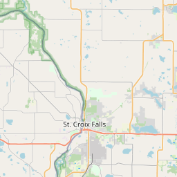
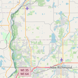
St. Croix Falls Map, Satellite view of St. Croix Falls, Wisconsin
St. Croix Falls is a city located in Polk County, Wisconsin, USA.
Location informations of St. Croix Falls
Latitude of city of St. Croix Falls is 45.40996 and longitude of city of St. Croix Falls is -92.63965- What Country is St. Croix Falls In? St. Croix Falls is located in the United States of America.
- What State is St. Croix Falls located in? St. Croix Falls is located in Wisconsin.
- What County is St. Croix Falls In? The County of St. Croix Falls is Polk County
St. Croix Falls, Wisconsin (WI), USA Geographic Information
| Country | United States |
| Country Code | US |
| State Name | Wisconsin |
| Latitude | 45.40996 |
| Longitude | -92.63965 |
| DMS Lat | 45°24'35.856" N |
| DMS Long | 92°38'22.74" W |
| DMS coordinates : | 45°24'35.856" N 92°38'22.74" W |
Current Date and Time in St. Croix Falls, Wisconsin, USA
| St. Croix Falls Time Zone : America/Chicago |
What day is it in St. Croix Falls right now?Friday (June 6, 2025) |
What time is it?Current local time and date at St. Croix Falls is 6/6/2025 - 4:46:23 AM |
Postcode / zip code of St. Croix Falls
St. Croix Falls is the actual or alternate city name associated with 2 ZIP Codes by the US Postal Service.
List of all postal codes in St. Croix Falls, Wisconsin, United States.
54009 Zip Code 54024 Zip Code
Area Codes St. Croix Falls, Wisconsin, USA
St. Croix Falls, Wisconsin covers 1 Area Codes
715 Area CodeOnline Map of St. Croix Falls - road map, satellite view and street view


Check out our interactive map of St. Croix Falls, Wisconsin and you'll easily find your way around the St. Croix Falls major roads and highways.
Satellite Map of St. Croix Falls, WI, USA
This is online map of the address St. Croix Falls, WI, United States. You may use button to move and zoom in / out. The map information is for reference only.
Flying J Airport (2.96 Km / 1.84 Miles)
Taylors Falls Airport (4.61 Km / 2.86 Miles)
Beskar Airport (5.33 Km / 3.31 Miles)
Kroy-Osceola Heliport (10.68 Km / 6.64 Miles)
Viking Gas Transmission County Heliport (11.53 Km / 7.17 Miles)
L O Simenstad Municipal Airport (11.84 Km / 7.36 Miles)
North Center Lake Seaplane Base (15.05 Km / 9.35 Miles)
Barnes Airport (15.52 Km / 9.64 Miles)
St Croix Valley Airport (16.30 Km / 10.13 Miles)
David Randall Airport (21.05 Km / 13.08 Miles)
Dupre's Airport (21.90 Km / 13.61 Miles)
Ceder Lake Seaplane Base (22.22 Km / 13.80 Miles)
Danielson Field Airport (23.47 Km / 14.58 Miles)
Meister's Heliport (24.00 Km / 14.91 Miles)
Saint Croix Falls Elementary (353 m / 0.22 Miles)
Saint Croix Falls Middle (531 m / 0.33 Miles)
Saint Croix Falls High (534 m / 0.33 Miles)
TAYLORS FALLS ELEMENTARY (1.30 Km / 0.81 Miles)
List of places near to St. Croix Falls
| Name | Distance |
|---|---|
| Taylors Falls | 1.34 Km / 0.83 Miles |
| St. Croix Falls (Town) | 5.28 Km / 3.28 Miles |
| Dresser | 6.01 Km / 3.73 Miles |
| Shafer (Township) | 6.22 Km / 3.86 Miles |
| Osceola (Town) | 7.66 Km / 4.76 Miles |
| Centuria | 8.11 Km / 5.04 Miles |
| Shafer | 8.82 Km / 5.48 Miles |
| Osceola | 11.18 Km / 6.95 Miles |
| Franconia | 11.94 Km / 7.42 Miles |
| Eureka | 12.29 Km / 7.64 Miles |
| Balsam Lake (Town) | 12.52 Km / 7.78 Miles |
| Garfield | 13.69 Km / 8.51 Miles |
| Center City | 13.93 Km / 8.66 Miles |
| Amador | 14.80 Km / 9.20 Miles |
| Balsam Lake | 15.18 Km / 9.43 Miles |
| Lindstrom | 16.43 Km / 10.21 Miles |
| Milltown | 16.47 Km / 10.23 Miles |
| Farmington | 17.00 Km / 10.56 Miles |
| Milltown (Town) | 17.69 Km / 10.99 Miles |
| Chisago Lake | 19.57 Km / 12.16 Miles |
| Chisago City | 19.96 Km / 12.40 Miles |
| Alden | 20.25 Km / 12.58 Miles |
| Laketown | 20.51 Km / 12.74 Miles |
| Scandia | 21.70 Km / 13.48 Miles |
| Luck | 22.15 Km / 13.76 Miles |
| Apple River | 22.32 Km / 13.87 Miles |
| Lincoln | 23.91 Km / 14.86 Miles |
| Sterling | 24.21 Km / 15.04 Miles |
| Amery | 24.52 Km / 15.24 Miles |
| Lent | 24.89 Km / 15.47 Miles |