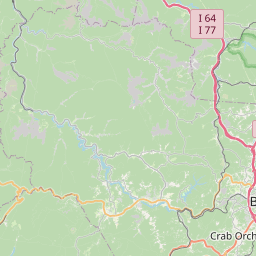
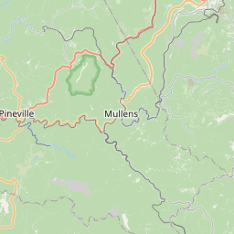
Stanaford Map, Satellite view of Stanaford, West Virginia
Stanaford is a census-designated place (CDP) located in Raleigh County, West Virginia, USA.
Location informations of Stanaford
Latitude of city of Stanaford is 37.81595 and longitude of city of Stanaford is -81.15232- What Country is Stanaford In? Stanaford is located in the United States of America.
- What State is Stanaford located in? Stanaford is located in West Virginia.
- What County is Stanaford In? The County of Stanaford is Raleigh County
Stanaford, West Virginia (WV), USA Geographic Information
| Country | United States |
| Country Code | US |
| State Name | West Virginia |
| Latitude | 37.81595 |
| Longitude | -81.15232 |
| DMS Lat | 37°48'57.42" N |
| DMS Long | 81°9'8.352" W |
| DMS coordinates : | 37°48'57.42" N 81°9'8.352" W |
Current Date and Time in Stanaford, West Virginia, USA
| Stanaford Time Zone : America/New_York |
What day is it in Stanaford right now?Friday (June 6, 2025) |
What time is it?Current local time and date at Stanaford is 6/6/2025 - 4:27:27 AM |
Postcode / zip code of Stanaford
Stanaford is the actual or alternate city name associated with 2 ZIP Codes by the US Postal Service.
List of all postal codes in Stanaford, West Virginia, United States.
25801 Zip Code 25927 Zip Code
Online Map of Stanaford - road map, satellite view and street view


Check out our interactive map of Stanaford, West Virginia and you'll easily find your way around the Stanaford major roads and highways.
Satellite Map of Stanaford, WV, USA
This is online map of the address Stanaford, WV, United States. You may use button to move and zoom in / out. The map information is for reference only.
Beckley ARH Hospital Heliport (2.28 Km / 1.41 Miles)
Raleigh County Memorial Airport (4.03 Km / 2.50 Miles)
Air Evac 121 Heliport (4.39 Km / 2.73 Miles)
Lee Norse Nr 2 Heliport (4.80 Km / 2.98 Miles)
Beckley Hotel Heliport (5.86 Km / 3.64 Miles)
Walker Iii Heliport (9.71 Km / 6.03 Miles)
Glade Springs Heliport (11.26 Km / 7.00 Miles)
Fayette Airport (23.62 Km / 14.68 Miles)
STANAFORD ELEMENTARY SCHOOL (415 m / 0.26 Miles)
WOODROW WILSON HIGH SCHOOL (2.18 Km / 1.36 Miles)
ACADEMY OF CAREERS AND TECHNOLOGY (2.57 Km / 1.60 Miles)
BECKLEY-STRATTON MIDDLE SCHOOL (3.45 Km / 2.14 Miles)
CRANBERRY-PROSPERITY ELEMENTARY (3.47 Km / 2.16 Miles)
BECKLEY ELEMENTARY (3.66 Km / 2.27 Miles)
BECKLEY CENTER (3.75 Km / 2.33 Miles)
MAXWELL HILL ELEMENTARY (4.07 Km / 2.53 Miles)
Academy of Careers and Technology (2.57 Km / 1.60 Miles)
Valley College-Beckley (4.29 Km / 2.66 Miles)
List of places near to Stanaford
| Name | Distance |
|---|---|
| Piney View | 2.73 Km / 1.70 Miles |
| Prosperity | 4.91 Km / 3.05 Miles |
| Beckley | 5.25 Km / 3.26 Miles |
| Bradley | 6.60 Km / 4.10 Miles |
| Mabscott | 7.02 Km / 4.36 Miles |
| Beaver | 7.65 Km / 4.75 Miles |
| MacArthur | 8.30 Km / 5.16 Miles |
| Daniels | 8.50 Km / 5.28 Miles |
| Mount Hope | 8.90 Km / 5.53 Miles |
| Prince | 9.89 Km / 6.15 Miles |
| Eccles | 10.63 Km / 6.61 Miles |
| Crab Orchard | 10.84 Km / 6.74 Miles |
| Glen Jean | 12.29 Km / 7.64 Miles |
| Shady Spring | 13.15 Km / 8.17 Miles |
| Hilltop | 14.12 Km / 8.77 Miles |
| Pax | 14.34 Km / 8.91 Miles |
| Glen White | 14.70 Km / 9.13 Miles |
| Sophia | 14.83 Km / 9.21 Miles |
| Scarbro | 15.30 Km / 9.51 Miles |
| Lester | 15.77 Km / 9.80 Miles |
| Coal City | 16.06 Km / 9.98 Miles |
| Thurmond | 17.31 Km / 10.76 Miles |
| Oak Hill | 17.39 Km / 10.81 Miles |
| Ghent | 22.36 Km / 13.89 Miles |
| Bolt | 23.61 Km / 14.67 Miles |
| Helen | 24.65 Km / 15.32 Miles |