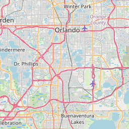
Taft Map, Satellite view of Taft, Florida
Taft is a census-designated place (CDP) located in Orange County, Florida, USA.
Location informations of Taft
Latitude of city of Taft is 28.42973 and longitude of city of Taft is -81.36507- What Country is Taft In? Taft is located in the United States of America.
- What State is Taft located in? Taft is located in Florida.
- What County is Taft In? The County of Taft is Orange County
Taft, Florida (FL), USA Geographic Information
| Country | United States |
| Country Code | US |
| State Name | Florida |
| Latitude | 28.42973 |
| Longitude | -81.36507 |
| DMS Lat | 28°25'47.028" N |
| DMS Long | 81°21'54.252" W |
| DMS coordinates : | 28°25'47.028" N 81°21'54.252" W |
Current Date and Time in Taft, Florida, USA
| Taft Time Zone : America/New_York |
What day is it in Taft right now?Monday (May 12, 2025) |
What time is it?Current local time and date at Taft is 12:25:41 (05/12/2025) : (America/New_York) |
Postcode / zip code of Taft
Taft is the actual or alternate city name associated with 1 ZIP Codes by the US Postal Service.
List of all postal codes in Taft, Florida, United States.
32824 Zip Code
Online Map of Taft - road map, satellite view and street view


Check out our interactive map of Taft, Florida and you'll easily find your way around the Taft major roads and highways.
Satellite Map of Taft, FL, USA
This is online map of the address Taft, FL, United States. You may use button to move and zoom in / out. The map information is for reference only.
Sequiam Heliport (1.98 Km / 1.23 Miles)
Lake Conway South Seaplane Base (3.54 Km / 2.20 Miles)
Orlando International Airport (5.48 Km / 3.41 Miles)
Lake Conway North Seaplane Base (5.51 Km / 3.42 Miles)
Ritz Carlton Grande Lakes Seaplane Base (7.66 Km / 4.76 Miles)
Orange County Convention Center Heliport (8.92 Km / 5.54 Miles)
Hoequist Airport (8.94 Km / 5.55 Miles)
Brooksville International Airways, Inc. Heliport (9.28 Km / 5.76 Miles)
Orlando Crossings Heliport (9.55 Km / 5.93 Miles)
Orange County Sheriff's Office Heliport (9.85 Km / 6.12 Miles)
Yelvington Heliport (10.04 Km / 6.24 Miles)
Helicopters International Heliport (10.05 Km / 6.24 Miles)
UCF Lake Nona Medical Center Heliport (10.39 Km / 6.46 Miles)
Orlando Health ER & Medical Pavilion Heliport (10.42 Km / 6.48 Miles)
Arnold Palmer Hospital Heliport (10.49 Km / 6.52 Miles)
Air Orlando Heliport (10.58 Km / 6.58 Miles)
Nemours Childrens Hospital Heliport (10.60 Km / 6.59 Miles)
Orlando Regional Medical Center Heliport (10.68 Km / 6.64 Miles)
Dr. P. Phillips Hospital Heliport (10.95 Km / 6.81 Miles)
Meyer Heliport (11.11 Km / 6.90 Miles)
SALLY RIDE ELEMENTARY (684 m / 0.43 Miles)
DURRANCE ELEMENTARY (2.96 Km / 1.84 Miles)
PINECREST PREPARATORY CHARTER (2.96 Km / 1.84 Miles)
WINEGARD ELEMENTARY (3.19 Km / 1.98 Miles)
JUDSON B WALKER MIDDLE (3.62 Km / 2.25 Miles)
LANCASTER ELEMENTARY (3.76 Km / 2.33 Miles)
WETHERBEE ELEMENTARY (4.02 Km / 2.50 Miles)
PROJECT COMPASS (4.40 Km / 2.73 Miles)
SOUTH CREEK MIDDLE (4.43 Km / 2.75 Miles)
CORNERSTONE CHARTER ACADEMY HIGH SCHOOL (4.82 Km / 3.00 Miles)
CORNERSTONE ACADEMY CHARTER (4.83 Km / 3.00 Miles)
CHANCERY HIGH CHARTER (4.88 Km / 3.03 Miles)
FREEDOM HIGH (4.91 Km / 3.05 Miles)
PERSHING PINE CASTLE ELEMENTARY (4.94 Km / 3.07 Miles)
Southern Technical College (3.98 Km / 2.47 Miles)
Universal Technical Institute-Auto Motorcycle & Marine Mechanics Institute Division-Orlando (4.41 Km / 2.74 Miles)
List of places near to Taft
| Name | Distance |
|---|---|
| Belle Isle | 3.23 Km / 2.01 Miles |
| Sky Lake | 4.00 Km / 2.49 Miles |
| Southchase | 4.45 Km / 2.77 Miles |
| Pine Castle | 4.70 Km / 2.92 Miles |
| Meadow Woods | 4.91 Km / 3.05 Miles |
| Edgewood | 6.31 Km / 3.92 Miles |
| Oak Ridge | 7.41 Km / 4.60 Miles |
| Holden Heights | 7.77 Km / 4.83 Miles |
| Williamsburg | 7.79 Km / 4.84 Miles |
| Tangelo Park | 8.42 Km / 5.23 Miles |
| Conway | 8.79 Km / 5.46 Miles |
| Hunters Creek | 9.51 Km / 5.91 Miles |
| Buenaventura Lakes | 10.51 Km / 6.53 Miles |
| Orlando | 12.16 Km / 7.56 Miles |
| Doctor Phillips | 12.63 Km / 7.85 Miles |
| Lake Hart | 12.85 Km / 7.98 Miles |
| Azalea Park | 13.89 Km / 8.63 Miles |
| Rio Pinar | 14.21 Km / 8.83 Miles |
| Orlovista | 15.25 Km / 9.48 Miles |
| Bay Hill | 15.38 Km / 9.56 Miles |
| Kissimmee | 15.87 Km / 9.86 Miles |
| Pine Hills | 16.65 Km / 10.35 Miles |
| Union Park | 17.21 Km / 10.69 Miles |
| Lake Buena Vista | 17.45 Km / 10.84 Miles |
| Windermere | 18.13 Km / 11.27 Miles |
| Fairview Shores | 18.17 Km / 11.29 Miles |
| Gotha | 18.91 Km / 11.75 Miles |
| Lake Butler | 18.96 Km / 11.78 Miles |
| Winter Park | 19.10 Km / 11.87 Miles |
| Lake Mary Jane | 19.88 Km / 12.35 Miles |
| Celebration | 20.13 Km / 12.51 Miles |
| Bay Lake | 20.17 Km / 12.53 Miles |
| Eatonville | 20.63 Km / 12.82 Miles |
| Campbell | 21.00 Km / 13.05 Miles |
| Alafaya | 21.18 Km / 13.16 Miles |
| Goldenrod | 21.50 Km / 13.36 Miles |
| St. Cloud | 21.72 Km / 13.50 Miles |
| Maitland | 22.02 Km / 13.68 Miles |
| Lockhart | 22.41 Km / 13.92 Miles |
| Ocoee | 23.37 Km / 14.52 Miles |
| University | 23.99 Km / 14.91 Miles |
| Clarcona | 24.18 Km / 15.02 Miles |
| Horizon West | 24.31 Km / 15.11 Miles |
| Fern Park | 24.44 Km / 15.19 Miles |