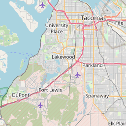
Tanglewilde Map, Satellite view of Tanglewilde, Washington
Tanglewilde is a census-designated place (CDP) located in Thurston County, Washington, USA.
Location informations of Tanglewilde
Latitude of city of Tanglewilde is 47.05150 and longitude of city of Tanglewilde is -122.78241- What Country is Tanglewilde In? Tanglewilde is located in the United States of America.
- What State is Tanglewilde located in? Tanglewilde is located in Washington.
- What County is Tanglewilde In? The County of Tanglewilde is Thurston County
Tanglewilde, Washington (WA), USA Geographic Information
| Country | United States |
| Country Code | US |
| State Name | Washington |
| Latitude | 47.0515 |
| Longitude | -122.78241 |
| DMS Lat | 47°3'5.4" N |
| DMS Long | 122°46'56.676" W |
| DMS coordinates : | 47°3'5.4" N 122°46'56.676" W |
Current Date and Time in Tanglewilde, Washington, USA
| Tanglewilde Time Zone : America/Los_Angeles |
What day is it in Tanglewilde right now?Monday (April 28, 2025) |
What time is it?Current local time and date at Tanglewilde is 4/28/2025 - 8:45:34 PM |
Postcode / zip code of Tanglewilde
Tanglewilde is the actual or alternate city name associated with 2 ZIP Codes by the US Postal Service.
List of all postal codes in Tanglewilde, Washington, United States.
98503 Zip Code 98516 Zip Code
Online Map of Tanglewilde - road map, satellite view and street view


Check out our interactive map of Tanglewilde, Washington and you'll easily find your way around the Tanglewilde major roads and highways.
Satellite Map of Tanglewilde, WA, USA
This is online map of the address Tanglewilde, WA, United States. You may use button to move and zoom in / out. The map information is for reference only.
Providence St Peters Hospital Helipad (4.92 Km / 3.06 Miles)
Gower Field (7.28 Km / 4.53 Miles)
Hoskins Field (7.42 Km / 4.61 Miles)
Stonehedge Heliport (8.52 Km / 5.30 Miles)
Lz Ranch Airport (9.62 Km / 5.98 Miles)
Kari Field (9.63 Km / 5.98 Miles)
Flying Carpet Airport (9.94 Km / 6.18 Miles)
P-L Ranch Airport (10.04 Km / 6.24 Miles)
Northwest Helicopters Heliport (12.34 Km / 7.67 Miles)
Fishtrap Heliport (12.74 Km / 7.91 Miles)
Olympia Heliport (12.79 Km / 7.95 Miles)
Capitol Medical Center Heliport (12.81 Km / 7.96 Miles)
Olympia Regional Airport (12.92 Km / 8.03 Miles)
Howell Airport (14.13 Km / 8.78 Miles)
Gray Army Air Field (15.56 Km / 9.67 Miles)
Fort Lewis Auxiliary Airfield Number 2 (18.27 Km / 11.35 Miles)
Mc Neil Island Emergency Pad Heliport (18.51 Km / 11.50 Miles)
Madigan Hospital Heliport (18.63 Km / 11.58 Miles)
Taylor Airport (19.12 Km / 11.88 Miles)
American Lake Seaplane Base (19.52 Km / 12.13 Miles)
Lydia Hawk Elementary (576 m / 0.36 Miles)
Olympic View Elementary (874 m / 0.54 Miles)
Nisqually Middle School (1.23 Km / 0.76 Miles)
River Ridge High School (2.36 Km / 1.47 Miles)
Seven Oaks Elementary (2.70 Km / 1.68 Miles)
Lacey Elementary (2.91 Km / 1.81 Miles)
South Sound High School (3.17 Km / 1.97 Miles)
Meadows Elementary (3.25 Km / 2.02 Miles)
Chinook Middle School (3.38 Km / 2.10 Miles)
Pleasant Glade Elementary (3.47 Km / 2.15 Miles)
North Thurston High School (3.79 Km / 2.35 Miles)
Salish Middle School (3.79 Km / 2.36 Miles)
Mountain View Elementary (3.95 Km / 2.45 Miles)
Evergreen Forest Elementary (3.96 Km / 2.46 Miles)
Saint Martin's University (2.82 Km / 1.75 Miles)
List of places near to Tanglewilde
| Name | Distance |
|---|---|
| Lacey | 3.64 Km / 2.26 Miles |
| Nisqually Indian Community | 8.12 Km / 5.05 Miles |
| Olympia | 9.09 Km / 5.65 Miles |
| Tumwater | 10.80 Km / 6.71 Miles |
| DuPont | 12.51 Km / 7.77 Miles |
| Anderson Island | 13.33 Km / 8.28 Miles |
| Ketron Island | 16.18 Km / 10.05 Miles |
| North Fort Lewis | 16.20 Km / 10.07 Miles |
| North Yelm | 16.79 Km / 10.43 Miles |
| Fort Lewis | 17.01 Km / 10.57 Miles |
| Longbranch | 17.62 Km / 10.95 Miles |
| Yelm | 18.09 Km / 11.24 Miles |
| Steilacoom | 18.93 Km / 11.76 Miles |
| Roy | 19.12 Km / 11.88 Miles |
| Rainier | 19.51 Km / 12.12 Miles |
| McKenna | 21.49 Km / 13.35 Miles |
| Tenino | 22.30 Km / 13.86 Miles |
| McChord AFB | 23.78 Km / 14.78 Miles |
| Lakewood | 24.04 Km / 14.94 Miles |
| Herron Island | 24.04 Km / 14.94 Miles |
| Home | 24.87 Km / 15.45 Miles |