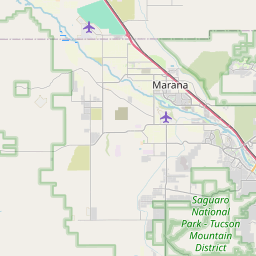
Tucson Estates Map, Satellite view of Tucson Estates, Arizona
Tucson Estates is a census-designated place (CDP) located in Pima County, Arizona, USA.
Location informations of Tucson Estates
Latitude of city of Tucson Estates is 32.18758 and longitude of city of Tucson Estates is -111.09093- What Country is Tucson Estates In? Tucson Estates is located in the United States of America.
- What State is Tucson Estates located in? Tucson Estates is located in Arizona.
- What County is Tucson Estates In? The County of Tucson Estates is Pima County
Tucson Estates, Arizona (AZ), USA Geographic Information
| Country | United States |
| Country Code | US |
| State Name | Arizona |
| Latitude | 32.18758 |
| Longitude | -111.09093 |
| DMS Lat | 32°11'15.288" N |
| DMS Long | 111°5'27.348" W |
| DMS coordinates : | 32°11'15.288" N 111°5'27.348" W |
Current Date and Time in Tucson Estates, Arizona, USA
| Tucson Estates Time Zone : America/Phoenix |
What day is it in Tucson Estates right now?Tuesday (April 29, 2025) |
What time is it?Current local time and date at Tucson Estates is 09:46:36 (04/29/2025) : (America/Phoenix) |
Postcode / zip code of Tucson Estates
Tucson Estates is the actual or alternate city name associated with 2 ZIP Codes by the US Postal Service.
List of all postal codes in Tucson Estates, Arizona, United States.
85713 Zip Code 85735 Zip Code
Online Map of Tucson Estates - road map, satellite view and street view


Check out our interactive map of Tucson Estates, Arizona and you'll easily find your way around the Tucson Estates major roads and highways.
Satellite Map of Tucson Estates, AZ, USA
This is online map of the address Tucson Estates, AZ, United States. You may use button to move and zoom in / out. The map information is for reference only.
Haarman Field (8.90 Km / 5.53 Miles)
Ryan Field (9.39 Km / 5.83 Miles)
Carondelet St Mary's Hospital Helistop (9.73 Km / 6.05 Miles)
Tucson Airpark (10.96 Km / 6.81 Miles)
Tucson Police Department Helipad (11.69 Km / 7.27 Miles)
Tucson Municipal Airport / Macauley Field / Mayse Field (11.92 Km / 7.41 Miles)
Tucson VA Medical Center Helipad (11.95 Km / 7.43 Miles)
Freeway Airport (12.61 Km / 7.84 Miles)
Tucson Downtown Airport (13.20 Km / 8.20 Miles)
Pima County Sheriff's Heliport (13.66 Km / 8.49 Miles)
University Medical Center Hospital Heliport (14.89 Km / 9.25 Miles)
University Medical Center South Heliport (15.09 Km / 9.38 Miles)
Northwest Medical Center Helipad (16.48 Km / 10.24 Miles)
Ina Road Heliport (16.50 Km / 10.25 Miles)
Tucson International Airport / Morris Air National Guard Base (16.50 Km / 10.25 Miles)
Schuk Toak Farms Landing Field (17.21 Km / 10.69 Miles)
Neff Field (17.66 Km / 10.97 Miles)
Davis Monthan Air Force Base (19.71 Km / 12.25 Miles)
Tucson Medical Center Heliport (21.17 Km / 13.16 Miles)
La Paloma Heliport (21.88 Km / 13.60 Miles)
Vesey Elementary School (3.46 Km / 2.15 Miles)
Valencia Middle School (4.07 Km / 2.53 Miles)
Laura N. Banks Elementary (4.72 Km / 2.93 Miles)
List of places near to Tucson Estates
| Name | Distance |
|---|---|
| Valencia West | 6.14 Km / 3.82 Miles |
| Drexel Heights | 7.82 Km / 4.86 Miles |
| South Tucson | 11.60 Km / 7.21 Miles |
| Flowing Wells | 14.08 Km / 8.75 Miles |
| Tucson | 15.93 Km / 9.90 Miles |
| Casas Adobes | 17.59 Km / 10.93 Miles |
| Summit | 18.77 Km / 11.66 Miles |
| Catalina Foothills | 20.32 Km / 12.63 Miles |
| Picture Rocks | 22.87 Km / 14.21 Miles |
| Three Points | 24.33 Km / 15.12 Miles |