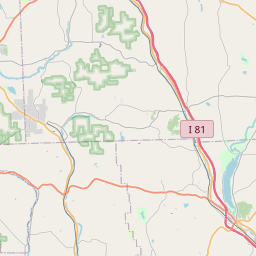
Union Map, Satellite view of Union, New York
Union is a town located in Broome County, New York, USA.
Location informations of Union
Latitude of city of Union is 42.12662 and longitude of city of Union is -76.03324- What Country is Union In? Union is located in the United States of America.
- What State is Union located in? Union is located in New York.
- What County is Union In? The County of Union is Broome County
Union, New York (NY), USA Geographic Information
| Country | United States |
| Country Code | US |
| State Name | New York |
| Latitude | 42.12662 |
| Longitude | -76.03324 |
| DMS Lat | 42°7'35.832" N |
| DMS Long | 76°1'59.664" W |
| DMS coordinates : | 42°7'35.832" N 76°1'59.664" W |
Current Date and Time in Union, New York, USA
| Union Time Zone : America/New_York |
What day is it in Union right now?Sunday (May 18, 2025) |
What time is it?Current local time and date at Union is 11:02:07 (05/18/2025) : (America/New_York) |
Postcode / zip code of Union
Union is the actual or alternate city name associated with 5 ZIP Codes by the US Postal Service.
List of all postal codes in Union, New York, United States.
13760 Zip Code 13762 Zip Code 13790 Zip Code 13850 Zip Code 13905 Zip Code
Online Map of Union - road map, satellite view and street view


Check out our interactive map of Union, New York and you'll easily find your way around the Union major roads and highways.
Satellite Map of Union, NY, USA
This is online map of the address Union, NY, United States. You may use button to move and zoom in / out. The map information is for reference only.
Wilson Memorial Regional Medical Center Heliport (6.38 Km / 3.97 Miles)
Tri Cities Airport (7.46 Km / 4.64 Miles)
Greater Binghamton/Edwin A Link field (10.13 Km / 6.30 Miles)
Luke Airport (13.06 Km / 8.11 Miles)
IBM Owego Heliport (15.88 Km / 9.87 Miles)
Susquehanna Heliport (16.03 Km / 9.96 Miles)
Chenango Bridge Airport (17.40 Km / 10.81 Miles)
GEORGE F JOHNSON ELEMENTARY SCHOOL (785 m / 0.49 Miles)
MAINE-ENDWELL SENIOR HIGH SCHOOL (891 m / 0.55 Miles)
MAINE-ENDWELL MIDDLE SCHOOL (1.15 Km / 0.71 Miles)
HOMER BRINK SCHOOL (1.66 Km / 1.03 Miles)
UNION-ENDICOTT HIGH SCHOOL (3.44 Km / 2.14 Miles)
LINNAEUS W WEST SCHOOL (3.50 Km / 2.17 Miles)
ANN G MCGUINNESS ELEMENTAR SCHOOL (3.64 Km / 2.26 Miles)
JENNIE F SNAPP MIDDLE SCHOOL (4.00 Km / 2.48 Miles)
VESTAL MIDDLE SCHOOL (4.60 Km / 2.86 Miles)
AFRICAN ROAD ELEMENTARY SCHOOL (4.60 Km / 2.86 Miles)
VESTAL SENIOR HIGH SCHOOL (4.67 Km / 2.90 Miles)
CLAYTON AVENUE ELEMENTARY SCHOOL (4.80 Km / 2.98 Miles)
List of places near to Union
| Name | Distance |
|---|---|
| Endwell | 1.83 Km / 1.14 Miles |
| Endicott | 3.41 Km / 2.12 Miles |
| Johnson City | 6.26 Km / 3.89 Miles |
| Binghamton University | 6.78 Km / 4.21 Miles |
| Maine | 7.85 Km / 4.88 Miles |
| Vestal | 8.68 Km / 5.39 Miles |
| Dickinson | 9.50 Km / 5.90 Miles |
| Binghamton | 10.00 Km / 6.21 Miles |
| Port Dickinson | 11.32 Km / 7.03 Miles |
| Apalachin | 11.86 Km / 7.37 Miles |
| Owego (Town) | 14.11 Km / 8.77 Miles |
| Chenango | 14.65 Km / 9.10 Miles |
| Binghamton (Town) | 14.65 Km / 9.10 Miles |
| Chenango Bridge | 14.77 Km / 9.18 Miles |
| Glen Aubrey | 14.82 Km / 9.21 Miles |
| Newark Valley (Town) | 16.16 Km / 10.04 Miles |
| Newark Valley | 16.41 Km / 10.20 Miles |
| Little Meadows | 17.13 Km / 10.64 Miles |
| Nanticoke | 17.61 Km / 10.94 Miles |
| Barker | 18.38 Km / 11.42 Miles |
| Conklin | 18.94 Km / 11.77 Miles |
| Owego | 19.06 Km / 11.84 Miles |
| Kirkwood | 19.75 Km / 12.27 Miles |
| Apolacon | 19.77 Km / 12.28 Miles |
| Choconut | 19.87 Km / 12.35 Miles |
| Fenton | 20.70 Km / 12.86 Miles |
| Silver Lake | 20.96 Km / 13.02 Miles |
| Berkshire | 21.83 Km / 13.56 Miles |
| Whitney Point | 23.14 Km / 14.38 Miles |
| Warren | 23.23 Km / 14.43 Miles |
| Friendsville | 23.33 Km / 14.50 Miles |
| Liberty | 23.78 Km / 14.78 Miles |