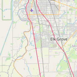
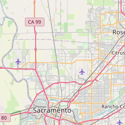
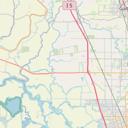
Vineyard Map, Satellite view of Vineyard, California
Vineyard is a census-designated place (CDP) located in Sacramento County, California, USA.
Location informations of Vineyard
Latitude of city of Vineyard is 38.46449 and longitude of city of Vineyard is -121.34692- What Country is Vineyard In? Vineyard is located in the United States of America.
- What State is Vineyard located in? Vineyard is located in California.
- What County is Vineyard In? The County of Vineyard is Sacramento County
Vineyard, California (CA), USA Geographic Information
| Country | United States |
| Country Code | US |
| State Name | California |
| Latitude | 38.46449 |
| Longitude | -121.34692 |
| DMS Lat | 38°27'52.164" N |
| DMS Long | 121°20'48.912" W |
| DMS coordinates : | 38°27'52.164" N 121°20'48.912" W |
Current Date and Time in Vineyard, California, USA
| Vineyard Time Zone : America/Los_Angeles |
What day is it in Vineyard right now?Thursday (May 29, 2025) |
What time is it?Current local time and date at Vineyard is 5/29/2025 - 1:40:25 PM |
Postcode / zip code of Vineyard
Vineyard is the actual or alternate city name associated with 2 ZIP Codes by the US Postal Service.
List of all postal codes in Vineyard, California, United States.
95829 Zip Code 95830 Zip Code
Online Map of Vineyard - road map, satellite view and street view


Check out our interactive map of Vineyard, California and you'll easily find your way around the Vineyard major roads and highways.
Satellite Map of Vineyard, CA, USA
This is online map of the address Vineyard, CA, United States. You may use button to move and zoom in / out. The map information is for reference only.
Mosier Airport (4.21 Km / 2.62 Miles)
Kaiser Permanente South Sacramento Heliport (6.45 Km / 4.01 Miles)
Reed Army Airfield (7.32 Km / 4.55 Miles)
Elk Grove Airport (8.14 Km / 5.05 Miles)
Sacramento Sky Ranch Airport (8.62 Km / 5.36 Miles)
Lake Park Helistop (9.69 Km / 6.02 Miles)
Skyline / Perkins Airport (9.84 Km / 6.11 Miles)
Sacramento Mather Airport (10.82 Km / 6.72 Miles)
Lucchetti Ranch Airport (11.40 Km / 7.08 Miles)
Sky Way Estates Airport (11.44 Km / 7.11 Miles)
Uc Davis Medical Center Life Flight Base Heliport (13.22 Km / 8.21 Miles)
Sacramento Executive Airport (13.79 Km / 8.57 Miles)
UC Davis Medical Center Tower II Heliport (13.79 Km / 8.57 Miles)
Borges - Clarksburg Airport (14.31 Km / 8.89 Miles)
Alta Mesa Airpark (14.46 Km / 8.98 Miles)
Jensen Airport (14.67 Km / 9.11 Miles)
Mustang Airport (14.94 Km / 9.28 Miles)
Flying B Ranch Airport (15.79 Km / 9.81 Miles)
Boeckmann Ranch Airport (15.80 Km / 9.82 Miles)
Sutter Medical Center Heliport (15.90 Km / 9.88 Miles)
Robert J. Fite Elementary (526 m / 0.33 Miles)
T. R. Smedberg Middle (590 m / 0.37 Miles)
Sheldon High (919 m / 0.57 Miles)
Maeola E. Beitzel Elementary (1.64 Km / 1.02 Miles)
Arnold Adreani Elementary (2.05 Km / 1.27 Miles)
Arthur C. Butler Elementary (2.13 Km / 1.32 Miles)
Mary Tsukamoto Elementary (2.88 Km / 1.79 Miles)
Calvine High (3.04 Km / 1.89 Miles)
Florin High (4.02 Km / 2.49 Miles)
Raymond Case Elementary (4.09 Km / 2.54 Miles)
Pleasant Grove High (4.30 Km / 2.67 Miles)
Katherine L. Albiani Middle (4.34 Km / 2.70 Miles)
Isabelle Jackson Elementary (4.34 Km / 2.70 Miles)
Edward Harris Jr. Middle (4.47 Km / 2.78 Miles)
Gerber Jr./Sr. High (4.57 Km / 2.84 Miles)
Monterey Trail High (4.78 Km / 2.97 Miles)
Pleasant Grove Elementary (4.79 Km / 2.98 Miles)
Roy Herburger Elementary (4.84 Km / 3.01 Miles)
List of places near to Vineyard
| Name | Distance |
|---|---|
| Florin | 6.43 Km / 4.00 Miles |
| Elk Grove | 6.56 Km / 4.08 Miles |
| Wilton | 8.75 Km / 5.44 Miles |
| Rosemont | 9.84 Km / 6.11 Miles |
| Parkway | 10.35 Km / 6.43 Miles |
| Mather | 10.82 Km / 6.72 Miles |
| Lemon Hill | 11.25 Km / 6.99 Miles |
| La Riviera | 11.41 Km / 7.09 Miles |
| Fruitridge Pocket | 12.13 Km / 7.54 Miles |
| Franklin | 13.34 Km / 8.29 Miles |
| Freeport | 13.47 Km / 8.37 Miles |
| Rancho Cordova | 14.38 Km / 8.94 Miles |
| Arden-Arcade | 15.71 Km / 9.76 Miles |
| Clarksburg | 16.44 Km / 10.22 Miles |
| Carmichael | 17.05 Km / 10.59 Miles |
| Sacramento | 18.28 Km / 11.36 Miles |
| Hood | 18.31 Km / 11.38 Miles |
| Gold River | 19.99 Km / 12.42 Miles |
| West Sacramento | 20.51 Km / 12.74 Miles |
| Herald | 20.78 Km / 12.91 Miles |
| Fair Oaks | 21.06 Km / 13.09 Miles |
| Clay | 21.71 Km / 13.49 Miles |
| Rancho Murieta | 22.35 Km / 13.89 Miles |
| McClellan Park | 22.59 Km / 14.04 Miles |
| Galt | 23.69 Km / 14.72 Miles |
| Foothill Farms | 23.83 Km / 14.81 Miles |
| Courtland | 24.36 Km / 15.14 Miles |
| North Highlands | 24.70 Km / 15.35 Miles |