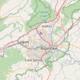
Vinton Map, Satellite view of Vinton, Virginia
Vinton is a town located in Roanoke County, Virginia, USA.
Location informations of Vinton
Latitude of city of Vinton is 37.28097 and longitude of city of Vinton is -79.89698- What Country is Vinton In? Vinton is located in the United States of America.
- What State is Vinton located in? Vinton is located in Virginia.
- What County is Vinton In? The County of Vinton is Roanoke County
Vinton, Virginia (VA), USA Geographic Information
| Country | United States |
| Country Code | US |
| State Name | Virginia |
| Latitude | 37.28097 |
| Longitude | -79.89698 |
| DMS Lat | 37°16'51.492" N |
| DMS Long | 79°53'49.128" W |
| DMS coordinates : | 37°16'51.492" N 79°53'49.128" W |
Current Date and Time in Vinton, Virginia, USA
| Vinton Time Zone : America/New_York |
What day is it in Vinton right now?Thursday (April 24, 2025) |
What time is it?Current local time and date at Vinton is 4/24/2025 - 6:44:25 PM |
Postcode / zip code of Vinton
Vinton is the actual or alternate city name associated with 1 ZIP Codes by the US Postal Service.
List of all postal codes in Vinton, Virginia, United States.
24179 Zip Code
Online Map of Vinton - road map, satellite view and street view


Check out our interactive map of Vinton, Virginia and you'll easily find your way around the Vinton major roads and highways.
Satellite Map of Vinton, VA, USA
This is online map of the address Vinton, VA, United States. You may use button to move and zoom in / out. The map information is for reference only.
Carilion Roanoke Memorial Hospital Heliport (4.71 Km / 2.93 Miles)
Carilion Roanoke Memorial Hospital Helipad (5.25 Km / 3.26 Miles)
Carilion Patient Transportation Services Heliport (5.67 Km / 3.52 Miles)
Roanoke–Blacksburg Regional Airport (8.52 Km / 5.30 Miles)
Summit Heliport (9.34 Km / 5.80 Miles)
Lewis Gale Clinic Inc. Heliport (11.89 Km / 7.38 Miles)
Lewis Gale Medical Center Heliport (11.98 Km / 7.44 Miles)
Summit Airport (15.21 Km / 9.45 Miles)
May Heliport (18.22 Km / 11.32 Miles)
State Police Division Six Heliport (20.48 Km / 12.73 Miles)
Ferguson Airport (20.65 Km / 12.83 Miles)
Barrows Airport (23.64 Km / 14.69 Miles)
Burnt Chimney Airport (23.72 Km / 14.74 Miles)
Carilion Westlake Center Heliport (24.24 Km / 15.06 Miles)
HERMAN L. HORN ELEM (1.26 Km / 0.78 Miles)
W.E. CUNDIFF ELEM (1.75 Km / 1.09 Miles)
FALLON PARK ELEM (1.84 Km / 1.14 Miles)
JOHN P. FISHWICK MIDDLE (3.10 Km / 1.92 Miles)
MORNINGSIDE ELEM (3.13 Km / 1.94 Miles)
WILLIAM BYRD MIDDLE (3.25 Km / 2.02 Miles)
WILLIAM BYRD HIGH (3.42 Km / 2.12 Miles)
REG ALTERNATIVE PLUS SELF PROJECT/ROANOKE CITY (3.82 Km / 2.37 Miles)
LINCOLN TERRACE ELEM (4.31 Km / 2.68 Miles)
LUCY ADDISON AEROSPACE MAGNET MIDDLE (4.49 Km / 2.79 Miles)
NOEL C. TAYLOR ACADEMY AT OAKLAND (4.58 Km / 2.85 Miles)
PRESTON PARK ELEM (4.58 Km / 2.85 Miles)
MT. PLEASANT ELEM (4.96 Km / 3.08 Miles)
Radford University-Carilion (4.12 Km / 2.56 Miles)
List of places near to Vinton
| Name | Distance |
|---|---|
| Roanoke | 4.09 Km / 2.54 Miles |
| Hollins | 8.55 Km / 5.31 Miles |
| Cloverdale | 9.39 Km / 5.83 Miles |
| Laymantown | 10.05 Km / 6.24 Miles |
| Cave Spring | 11.84 Km / 7.36 Miles |
| Blue Ridge | 13.45 Km / 8.36 Miles |
| Salem | 14.03 Km / 8.72 Miles |
| Daleville | 14.40 Km / 8.95 Miles |
| Troutville | 15.38 Km / 9.56 Miles |
| Montvale | 18.65 Km / 11.59 Miles |
| Boones Mill | 18.97 Km / 11.79 Miles |
| Glenvar | 20.98 Km / 13.04 Miles |
| Fincastle | 24.34 Km / 15.12 Miles |
| Westlake Corner | 24.77 Km / 15.39 Miles |