Wade Map, Satellite view of Wade, Illinois
Wade is a township located in Clinton County, Illinois, USA.
Location informations of Wade
Latitude of city of Wade is 38.60943 and longitude of city of Wade is -89.43613- What Country is Wade In? Wade is located in the United States of America.
- What State is Wade located in? Wade is located in Illinois.
- What County is Wade In? The County of Wade is Clinton County
Wade, Illinois (IL), USA Geographic Information
| Country | United States |
| Country Code | US |
| State Name | Illinois |
| Latitude | 38.60943 |
| Longitude | -89.43613 |
| DMS Lat | 38°36'33.948" N |
| DMS Long | 89°26'10.068" W |
| DMS coordinates : | 38°36'33.948" N 89°26'10.068" W |
Current Date and Time in Wade, Illinois, USA
| Wade Time Zone : America/Chicago |
What day is it in Wade right now?Saturday (May 24, 2025) |
What time is it?Current local time and date at Wade is 5/24/2025 - 6:07:53 AM |
Postcode / zip code of Wade
Wade is the actual or alternate city name associated with 4 ZIP Codes by the US Postal Service.
List of all postal codes in Wade, Illinois, United States.
62218 Zip Code 62219 Zip Code 62230 Zip Code 62231 Zip Code
Online Map of Wade - road map, satellite view and street view
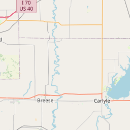
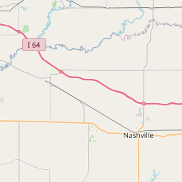
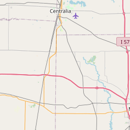
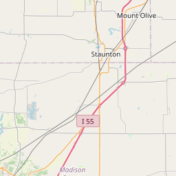


Check out our interactive map of Wade, Illinois and you'll easily find your way around the Wade major roads and highways.
Satellite Map of Wade, IL, USA
This is online map of the address Wade, IL, United States. You may use button to move and zoom in / out. The map information is for reference only.
Carlyle Airpark (4.54 Km / 2.82 Miles)
St Joseph's Hospital - Breese Heliport (7.84 Km / 4.87 Miles)
Twenhafel Field (12.00 Km / 7.46 Miles)
Centralia Correctional Center Heliport (21.72 Km / 13.49 Miles)
Smith Restricted Landing Area (22.76 Km / 14.14 Miles)
Fischer's RLA Restricted Landing Area (23.71 Km / 14.73 Miles)
Beckemeyer Elem School (782 m / 0.49 Miles)
List of places near to Wade
| Name | Distance |
|---|---|
| Beckemeyer | 0.43 Km / 0.27 Miles |
| Carlyle | 5.52 Km / 3.43 Miles |
| Carlyle (Township) | 6.67 Km / 4.14 Miles |
| Breese | 7.90 Km / 4.91 Miles |
| Bartelso | 8.53 Km / 5.30 Miles |
| Breese (Township) | 8.82 Km / 5.48 Miles |
| Santa Fe | 9.14 Km / 5.68 Miles |
| Wheatfield | 9.82 Km / 6.10 Miles |
| Germantown | 10.84 Km / 6.74 Miles |
| Huey | 12.61 Km / 7.84 Miles |
| St. Rose (Township) | 13.14 Km / 8.16 Miles |
| St. Rose | 13.22 Km / 8.21 Miles |
| Clement | 13.53 Km / 8.41 Miles |
| Germantown (Township) | 13.68 Km / 8.50 Miles |
| Lake | 13.98 Km / 8.69 Miles |
| Irishtown | 14.21 Km / 8.83 Miles |
| Aviston | 14.90 Km / 9.26 Miles |
| Hoffman | 16.79 Km / 10.43 Miles |
| Albers | 16.99 Km / 10.56 Miles |
| Covington | 19.01 Km / 11.81 Miles |
| Sugar Creek | 19.07 Km / 11.85 Miles |
| Damiansville | 19.40 Km / 12.05 Miles |
| New Minden | 19.54 Km / 12.14 Miles |
| Mills | 19.95 Km / 12.40 Miles |
| Meridian | 20.32 Km / 12.63 Miles |
| Hoyleton (Township) | 20.34 Km / 12.64 Miles |
| Brookside | 20.55 Km / 12.77 Miles |
| Keyesport | 20.75 Km / 12.89 Miles |
| Trenton | 21.37 Km / 13.28 Miles |
| Helvetia | 21.40 Km / 13.30 Miles |
| Okawville (Township) | 21.40 Km / 13.30 Miles |
| Tamalco | 21.73 Km / 13.50 Miles |
| Burgess | 21.78 Km / 13.53 Miles |
| East Fork | 21.83 Km / 13.56 Miles |
| Okawville | 21.87 Km / 13.59 Miles |
| Looking Glass | 22.49 Km / 13.97 Miles |
| Pierron | 23.23 Km / 14.43 Miles |
| Hoyleton | 23.37 Km / 14.52 Miles |
| Addieville | 24.69 Km / 15.34 Miles |
| New Baden | 24.91 Km / 15.48 Miles |