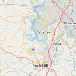
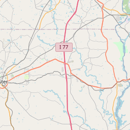
Waxhaw Map, Satellite view of Waxhaw, North Carolina
Waxhaw is a town located in Union County, North Carolina, USA.
Location informations of Waxhaw
Latitude of city of Waxhaw is 34.92459 and longitude of city of Waxhaw is -80.74340- What Country is Waxhaw In? Waxhaw is located in the United States of America.
- What State is Waxhaw located in? Waxhaw is located in North Carolina.
- What County is Waxhaw In? The County of Waxhaw is Union County
Waxhaw, North Carolina (NC), USA Geographic Information
| Country | United States |
| Country Code | US |
| State Name | North Carolina |
| Latitude | 34.92459 |
| Longitude | -80.7434 |
| DMS Lat | 34°55'28.524" N |
| DMS Long | 80°44'36.24" W |
| DMS coordinates : | 34°55'28.524" N 80°44'36.24" W |
Current Date and Time in Waxhaw, North Carolina, USA
| Waxhaw Time Zone : America/New_York |
What day is it in Waxhaw right now?Saturday (May 31, 2025) |
What time is it?Current local time and date at Waxhaw is 02:48:30 (05/31/2025) : (America/New_York) |
Postcode / zip code of Waxhaw
Waxhaw is the actual or alternate city name associated with 2 ZIP Codes by the US Postal Service.
List of all postal codes in Waxhaw, North Carolina, United States.
28112 Zip Code 28173 Zip Code
Area Codes Waxhaw, North Carolina, USA
Waxhaw, North Carolina covers 2 Area Codes
704 Area Code 980 Area CodeOnline Map of Waxhaw - road map, satellite view and street view


Check out our interactive map of Waxhaw, North Carolina and you'll easily find your way around the Waxhaw major roads and highways.
Satellite Map of Waxhaw, NC, USA
This is online map of the address Waxhaw, NC, United States. You may use button to move and zoom in / out. The map information is for reference only.
Atrium Health Waxhaw Heliport (4.65 Km / 2.89 Miles)
Jaars Townsend Airport (6.77 Km / 4.21 Miles)
Aero Plantation Airport (7.49 Km / 4.65 Miles)
Hawk's Knoll Airport (9.64 Km / 5.99 Miles)
Hawks Meadow Airport (10.19 Km / 6.33 Miles)
Lathan Strip (12.53 Km / 7.79 Miles)
Unity Aerodrome (14.73 Km / 9.15 Miles)
Charlotte-Monroe Executive Airport (15.35 Km / 9.54 Miles)
Fly I Heliport (17.78 Km / 11.05 Miles)
Union Memorial Hospital Inc Heliport (20.59 Km / 12.79 Miles)
Atrium Health Union Heliport (20.99 Km / 13.04 Miles)
Carolinas ContinueCARE Hospital at Pineville Heliport (22.16 Km / 13.77 Miles)
Edwards Airport (22.90 Km / 14.23 Miles)
Springs Memorial Heliport (23.18 Km / 14.40 Miles)
Lancaster County-Mc Whirter Field (24.62 Km / 15.30 Miles)
South Providence (397 m / 0.25 Miles)
Waxhaw Elementary (1.12 Km / 0.70 Miles)
Kensington Elementary (3.69 Km / 2.30 Miles)
Union Day School (3.77 Km / 2.34 Miles)
Apprentice Academy HS of NC (3.86 Km / 2.40 Miles)
Western Union Elementary (4.77 Km / 2.96 Miles)
List of places near to Waxhaw
| Name | Distance |
|---|---|
| JAARS | 6.77 Km / 4.21 Miles |
| Mineral Springs | 6.97 Km / 4.33 Miles |
| Marvin | 9.91 Km / 6.16 Miles |
| Weddington | 10.83 Km / 6.73 Miles |
| Wesley Chapel | 11.12 Km / 6.91 Miles |
| Van Wyck | 11.89 Km / 7.39 Miles |
| Catawba | 17.25 Km / 10.72 Miles |
| Indian Trail | 18.22 Km / 11.32 Miles |
| Monroe | 18.92 Km / 11.76 Miles |
| Lesslie | 19.79 Km / 12.30 Miles |
| Lake Park | 20.51 Km / 12.74 Miles |
| Fort Mill | 20.55 Km / 12.77 Miles |
| Matthews | 21.45 Km / 13.33 Miles |
| Stallings | 22.00 Km / 13.67 Miles |
| Pineville | 22.25 Km / 13.83 Miles |
| Lancaster | 22.84 Km / 14.19 Miles |
| Riverview | 23.23 Km / 14.43 Miles |
| Hemby Bridge | 23.92 Km / 14.86 Miles |