Westfield Map, Satellite view of Westfield, Massachusetts
Westfield is a city located in Hampden County, Massachusetts, USA.
Location informations of Westfield
Latitude of city of Westfield is 42.12509 and longitude of city of Westfield is -72.74954- What Country is Westfield In? Westfield is located in the United States of America.
- What State is Westfield located in? Westfield is located in Massachusetts.
- What County is Westfield In? The County of Westfield is Hampden County
Westfield, Massachusetts (MA), USA Geographic Information
| Country | United States |
| Country Code | US |
| State Name | Massachusetts |
| Latitude | 42.12509 |
| Longitude | -72.74954 |
| DMS Lat | 42°7'30.324" N |
| DMS Long | 72°44'58.344" W |
| DMS coordinates : | 42°7'30.324" N 72°44'58.344" W |
Current Date and Time in Westfield, Massachusetts, USA
| Westfield Time Zone : America/New_York |
What day is it in Westfield right now?Tuesday (June 3, 2025) |
What time is it?Current local time and date at Westfield is 21:56:01 (06/03/2025) : (America/New_York) |
Postcode / zip code of Westfield
Westfield is the actual or alternate city name associated with 2 ZIP Codes by the US Postal Service.
List of all postal codes in Westfield, Massachusetts, United States.
01085 Zip Code 01086 Zip Code
Online Map of Westfield - road map, satellite view and street view
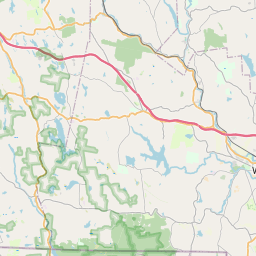


Check out our interactive map of Westfield, Massachusetts and you'll easily find your way around the Westfield major roads and highways.
Satellite Map of Westfield, MA, USA
This is online map of the address Westfield, MA, United States. You may use button to move and zoom in / out. The map information is for reference only.
Westfield-Barnes Regional Airport (4.59 Km / 2.85 Miles)
Mundale Airport (5.17 Km / 3.21 Miles)
Digital Heliport (6.01 Km / 3.73 Miles)
Micron Heliport (6.37 Km / 3.96 Miles)
Bear Hole Heliport (6.60 Km / 4.10 Miles)
Scibelli Heliport (7.22 Km / 4.48 Miles)
Cannizzaro Field (7.73 Km / 4.80 Miles)
Congamond Lake Heliport (10.23 Km / 6.36 Miles)
Vergnani Heliport (11.77 Km / 7.31 Miles)
Baystate Medical Ctr Heliport (12.26 Km / 7.62 Miles)
South Pond Seaplane Base (12.99 Km / 8.07 Miles)
Morehaven Airport (13.73 Km / 8.53 Miles)
Tgp Heliport (13.98 Km / 8.69 Miles)
Broad Street Heliport (14.20 Km / 8.82 Miles)
Laminated Heliport (15.10 Km / 9.38 Miles)
Chicopee Heliport (16.77 Km / 10.42 Miles)
Dow Jones Heliport (16.95 Km / 10.53 Miles)
Massachusetts Mutual Life Insurance Co Heliport (17.10 Km / 10.63 Miles)
Bootlegger's Seaplane Base (18.41 Km / 11.44 Miles)
Westover ARB/Metropolitan Airport (19.29 Km / 11.98 Miles)
Fort Meadow Early Childhood Center (654 m / 0.41 Miles)
Franklin Ave (757 m / 0.47 Miles)
Westfield Technical Academy (1.01 Km / 0.63 Miles)
Abner Gibbs (1.21 Km / 0.75 Miles)
Westfield Middle School (1.35 Km / 0.84 Miles)
Highland (1.74 Km / 1.08 Miles)
Westfield High (2.49 Km / 1.55 Miles)
Southampton Road (3.39 Km / 2.10 Miles)
Munger Hill (3.41 Km / 2.12 Miles)
North Middle School (3.57 Km / 2.22 Miles)
Paper Mill (3.76 Km / 2.34 Miles)
Westfield State University (3.96 Km / 2.46 Miles)
List of places near to Westfield
| Name | Distance |
|---|---|
| West Springfield Town | 8.23 Km / 5.11 Miles |
| Southwick | 8.38 Km / 5.21 Miles |
| Russell | 9.49 Km / 5.90 Miles |
| Agawam Town | 10.39 Km / 6.46 Miles |
| Southampton | 11.35 Km / 7.05 Miles |
| Russell (CDP) | 11.56 Km / 7.18 Miles |
| Chicopee | 11.97 Km / 7.44 Miles |
| Montgomery | 12.72 Km / 7.90 Miles |
| Springfield | 13.43 Km / 8.35 Miles |
| Granville | 13.76 Km / 8.55 Miles |
| Holyoke | 14.08 Km / 8.75 Miles |
| Suffield | 15.10 Km / 9.38 Miles |
| North Granby | 15.81 Km / 9.82 Miles |
| Blandford (CDP) | 15.90 Km / 9.88 Miles |
| Longmeadow (CDP) | 16.08 Km / 9.99 Miles |
| Huntington (CDP) | 16.16 Km / 10.04 Miles |
| Easthampton Town | 16.90 Km / 10.50 Miles |
| Longmeadow | 17.17 Km / 10.67 Miles |
| Suffield Depot | 17.99 Km / 11.18 Miles |
| Granby | 18.33 Km / 11.39 Miles |
| Blandford | 18.36 Km / 11.41 Miles |
| Thompsonville | 18.90 Km / 11.74 Miles |
| Salmon Brook | 19.13 Km / 11.89 Miles |
| Sherwood Manor | 19.70 Km / 12.24 Miles |
| Huntington | 19.76 Km / 12.28 Miles |
| South Hadley | 20.20 Km / 12.55 Miles |
| Westhampton | 21.14 Km / 13.14 Miles |
| East Granby | 21.73 Km / 13.50 Miles |
| Hartland | 21.79 Km / 13.54 Miles |
| East Longmeadow | 21.89 Km / 13.60 Miles |
| Chester | 22.15 Km / 13.76 Miles |
| Enfield | 22.42 Km / 13.93 Miles |
| Hazardville | 22.81 Km / 14.17 Miles |
| Southwood Acres | 23.29 Km / 14.47 Miles |
| Windsor Locks | 23.38 Km / 14.53 Miles |
| Tolland | 23.65 Km / 14.70 Miles |
| Northampton | 23.96 Km / 14.89 Miles |
| Windsor Locks (CDP) | 24.00 Km / 14.91 Miles |
| Tariffville | 24.08 Km / 14.96 Miles |
| Granby (CDP) | 24.15 Km / 15.01 Miles |
| Granby | 24.49 Km / 15.22 Miles |
| Ludlow | 24.91 Km / 15.48 Miles |