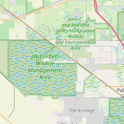
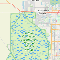
Westlake Map, Satellite view of Westlake, Florida
Westlake is a city located in Palm Beach County, Florida, USA.
Location informations of Westlake
Latitude of city of Westlake is 26.75820 and longitude of city of Westlake is -80.30727- What Country is Westlake In? Westlake is located in the United States of America.
- What State is Westlake located in? Westlake is located in Florida.
- What County is Westlake In? The County of Westlake is Palm Beach County
Westlake, Florida (FL), USA Geographic Information
| Country | United States |
| Country Code | US |
| State Name | Florida |
| Latitude | 26.7582 |
| Longitude | -80.30727 |
| DMS Lat | 26°45'29.52" N |
| DMS Long | 80°18'26.172" W |
| DMS coordinates : | 26°45'29.52" N 80°18'26.172" W |
Current Date and Time in Westlake, Florida, USA
| Westlake Time Zone : America/New_York |
What day is it in Westlake right now?Friday (May 23, 2025) |
What time is it?Current local time and date at Westlake is 23:36:01 (05/23/2025) : (America/New_York) |
Postcode / zip code of Westlake
Westlake is the actual or alternate city name associated with 2 ZIP Codes by the US Postal Service.
List of all postal codes in Westlake, Florida, United States.
33411 Zip Code 33470 Zip Code
Online Map of Westlake - road map, satellite view and street view


Check out our interactive map of Westlake, Florida and you'll easily find your way around the Westlake major roads and highways.
Satellite Map of Westlake, FL, USA
This is online map of the address Westlake, FL, United States. You may use button to move and zoom in / out. The map information is for reference only.
Palms West Hospital Heliport (9.87 Km / 6.13 Miles)
Palm Beach Sheriff's Range Heliport (11.61 Km / 7.22 Miles)
Wellington Aero Club Airport (12.49 Km / 7.76 Miles)
North Palm Beach County General Aviation Airport (12.83 Km / 7.97 Miles)
Ranger Heliport (14.57 Km / 9.05 Miles)
Loxahatchee Airport (15.08 Km / 9.37 Miles)
Nitv Heliport (16.09 Km / 10.00 Miles)
FPL Jupiter West Office Complex Heliport (16.56 Km / 10.29 Miles)
William P Gwinn Airport (16.84 Km / 10.46 Miles)
Wellington Medical Center Heliport (16.85 Km / 10.47 Miles)
Pga National Heliport (18.26 Km / 11.34 Miles)
BR Ranch Airport (20.08 Km / 12.48 Miles)
Flying H Heliport (20.66 Km / 12.84 Miles)
Palm Beach International Airport (22.62 Km / 14.05 Miles)
Palm Beach Gardens Medical Center Heliport (23.38 Km / 14.53 Miles)
Freedom Wpec Inc Heliport (23.50 Km / 14.60 Miles)
Palm Beach Children's Hospital Heliport (24.42 Km / 15.18 Miles)
WPTV Heliport (24.66 Km / 15.32 Miles)
SEMINOLE RIDGE COMMUNITY HIGH SCHOOL (1.35 Km / 0.84 Miles)
FRONTIER ELEMENTARY SCHOOL (2.77 Km / 1.72 Miles)
OSCEOLA CREEK MIDDLE SCHOOL (3.00 Km / 1.87 Miles)
WESTERN PINES COMMUNITY MIDDLE (4.06 Km / 2.52 Miles)
GOLDEN GROVE ELEMENTARY SCHOOL (4.14 Km / 2.57 Miles)
ACREAGE PINES ELEMENTARY SCHOOL (4.76 Km / 2.96 Miles)
List of places near to Westlake
| Name | Distance |
|---|---|
| The Acreage | 5.61 Km / 3.49 Miles |
| Loxahatchee Groves | 8.72 Km / 5.42 Miles |
| Royal Palm Beach | 9.41 Km / 5.85 Miles |
| Wellington | 12.85 Km / 7.98 Miles |
| Palm Beach Gardens | 18.24 Km / 11.33 Miles |
| Plantation Mobile Home Park | 18.43 Km / 11.45 Miles |
| Lake Belvedere Estates | 18.90 Km / 11.74 Miles |
| Stacey Street | 19.41 Km / 12.06 Miles |
| Schall Circle | 19.67 Km / 12.22 Miles |
| Royal Palm Estates | 20.00 Km / 12.43 Miles |
| Haverhill | 20.03 Km / 12.45 Miles |
| Jupiter Farms | 20.30 Km / 12.61 Miles |
| Westgate | 21.67 Km / 13.47 Miles |
| Gun Club Estates | 21.90 Km / 13.61 Miles |
| Pine Air | 22.74 Km / 14.13 Miles |
| Mangonia Park | 23.20 Km / 14.42 Miles |
| Acacia Villas | 23.21 Km / 14.42 Miles |
| North Palm Beach | 23.32 Km / 14.49 Miles |
| Greenacres | 23.46 Km / 14.58 Miles |
| Kenwood Estates | 23.99 Km / 14.91 Miles |
| Lake Park | 24.36 Km / 15.14 Miles |
| Cabana Colony | 24.43 Km / 15.18 Miles |
| Riviera Beach | 24.81 Km / 15.42 Miles |
| Cloud Lake | 24.91 Km / 15.48 Miles |
| Palm Springs | 25.00 Km / 15.53 Miles |