Wheatfield Map, Satellite view of Wheatfield, New York
Wheatfield is a town located in Niagara County, New York, USA.
Location informations of Wheatfield
Latitude of city of Wheatfield is 43.09540 and longitude of city of Wheatfield is -78.88538- What Country is Wheatfield In? Wheatfield is located in the United States of America.
- What State is Wheatfield located in? Wheatfield is located in New York.
- What County is Wheatfield In? The County of Wheatfield is Niagara County
Wheatfield, New York (NY), USA Geographic Information
| Country | United States |
| Country Code | US |
| State Name | New York |
| Latitude | 43.0954 |
| Longitude | -78.88538 |
| DMS Lat | 43°5'43.44" N |
| DMS Long | 78°53'7.368" W |
| DMS coordinates : | 43°5'43.44" N 78°53'7.368" W |
Current Date and Time in Wheatfield, New York, USA
| Wheatfield Time Zone : America/New_York |
What day is it in Wheatfield right now?Friday (May 30, 2025) |
What time is it?Current local time and date at Wheatfield is 02:22:33 (05/30/2025) : (America/New_York) |
Postcode / zip code of Wheatfield
Wheatfield is the actual or alternate city name associated with 4 ZIP Codes by the US Postal Service.
List of all postal codes in Wheatfield, New York, United States.
14094 Zip Code 14120 Zip Code 14132 Zip Code 14304 Zip Code
Online Map of Wheatfield - road map, satellite view and street view
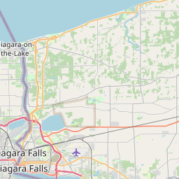
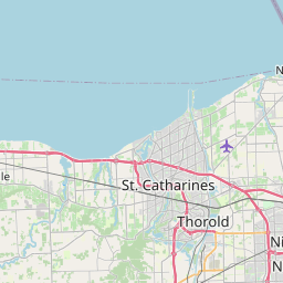

Check out our interactive map of Wheatfield, New York and you'll easily find your way around the Wheatfield major roads and highways.
Satellite Map of Wheatfield, NY, USA
This is online map of the address Wheatfield, NY, United States. You may use button to move and zoom in / out. The map information is for reference only.
Ross Heliport (4.90 Km / 3.04 Miles)
Niagara Falls International Airport (5.11 Km / 3.18 Miles)
Smith Airport (6.08 Km / 3.78 Miles)
Flying F Airport (7.16 Km / 4.45 Miles)
Taylor Johnson Airport (7.76 Km / 4.82 Miles)
Best Western Red Jacket Inn Heliport (8.50 Km / 5.28 Miles)
Pendleton Airpark (8.74 Km / 5.43 Miles)
Bassett Field (11.68 Km / 7.26 Miles)
Cambria Airport (13.01 Km / 8.08 Miles)
St Marys Heliport (13.41 Km / 8.33 Miles)
Niagara Falls Memorial Parking Ramp Heliport (13.47 Km / 8.37 Miles)
Mesmer Airport (14.05 Km / 8.73 Miles)
Rainbow Air Heliport (14.38 Km / 8.94 Miles)
North Buffalo Suburban Airport (14.81 Km / 9.20 Miles)
Clarence Aerodrome (16.74 Km / 10.40 Miles)
Hibbard's Airport (17.28 Km / 10.74 Miles)
Potoczak Airport (18.58 Km / 11.55 Miles)
Erie County Medical Center Heliport (19.24 Km / 11.95 Miles)
Shear Airport (19.35 Km / 12.02 Miles)
Women And Children'S Hospital Heliport (20.72 Km / 12.87 Miles)
ERRICK ROAD ELEMENTARY SCHOOL (460 m / 0.29 Miles)
DRAKE SCHOOL (3.59 Km / 2.23 Miles)
NORTH TONAWANDA MIDDLE SCHOOL (3.99 Km / 2.48 Miles)
OHIO ELEMENTARY SCHOOL (4.44 Km / 2.76 Miles)
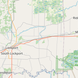
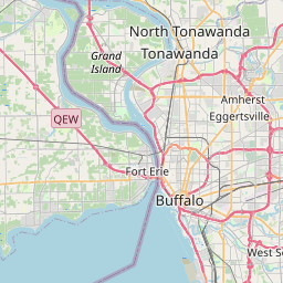
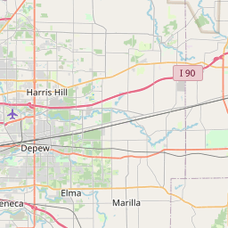
List of places near to Wheatfield
| Name | Distance |
|---|---|
| Sanborn | 4.59 Km / 2.85 Miles |
| North Tonawanda | 6.54 Km / 4.06 Miles |
| Niagara | 8.07 Km / 5.01 Miles |
| Tonawanda (CDP) | 8.36 Km / 5.19 Miles |
| Tonawanda | 8.36 Km / 5.19 Miles |
| Pendleton | 9.86 Km / 6.13 Miles |
| Cambria | 10.46 Km / 6.50 Miles |
| Grand Island | 10.66 Km / 6.62 Miles |
| Lewiston (Town) | 11.23 Km / 6.98 Miles |
| Grandyle Village | 12.37 Km / 7.69 Miles |
| Tonawanda (Town) | 12.48 Km / 7.75 Miles |
| University at Buffalo | 13.11 Km / 8.15 Miles |
| Niagara Falls | 13.91 Km / 8.64 Miles |
| Amherst | 13.97 Km / 8.68 Miles |
| Kenmore | 14.45 Km / 8.98 Miles |
| Lewiston | 14.92 Km / 9.27 Miles |
| Ransomville | 16.05 Km / 9.97 Miles |
| Eggertsville | 16.10 Km / 10.00 Miles |
| South Lockport | 16.48 Km / 10.24 Miles |
| Lockport (Town) | 17.04 Km / 10.59 Miles |
| Lockport | 17.90 Km / 11.12 Miles |
| Williamsville | 18.91 Km / 11.75 Miles |
| Porter | 19.33 Km / 12.01 Miles |
| Rapids | 19.86 Km / 12.34 Miles |
| Wilson (Town) | 20.57 Km / 12.78 Miles |
| Clarence | 20.99 Km / 13.04 Miles |
| Youngstown | 21.53 Km / 13.38 Miles |
| Clarence Center | 22.24 Km / 13.82 Miles |
| Harris Hill | 22.28 Km / 13.84 Miles |
| Buffalo | 23.24 Km / 14.44 Miles |
| Sloan | 23.66 Km / 14.70 Miles |
| Cheektowaga | 23.69 Km / 14.72 Miles |
| Cheektowaga (CDP) | 23.85 Km / 14.82 Miles |
| Wilson | 24.32 Km / 15.11 Miles |