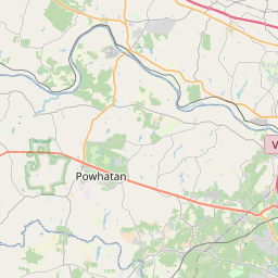
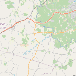
Woodlake Map, Satellite view of Woodlake, Virginia
Woodlake is a census-designated place (CDP) located in Chesterfield County, Virginia, USA.
Location informations of Woodlake
Latitude of city of Woodlake is 37.42106 and longitude of city of Woodlake is -77.67931- What Country is Woodlake In? Woodlake is located in the United States of America.
- What State is Woodlake located in? Woodlake is located in Virginia.
- What County is Woodlake In? The County of Woodlake is Chesterfield County
Woodlake, Virginia (VA), USA Geographic Information
| Country | United States |
| Country Code | US |
| State Name | Virginia |
| Latitude | 37.42106 |
| Longitude | -77.67931 |
| DMS Lat | 37°25'15.816" N |
| DMS Long | 77°40'45.516" W |
| DMS coordinates : | 37°25'15.816" N 77°40'45.516" W |
Current Date and Time in Woodlake, Virginia, USA
| Woodlake Time Zone : America/New_York |
What day is it in Woodlake right now?Saturday (May 24, 2025) |
What time is it?Current local time and date at Woodlake is 09:43:41 (05/24/2025) : (America/New_York) |
Postcode / zip code of Woodlake
Woodlake is the actual or alternate city name associated with 1 ZIP Codes by the US Postal Service.
List of all postal codes in Woodlake, Virginia, United States.
23112 Zip Code
Online Map of Woodlake - road map, satellite view and street view


Check out our interactive map of Woodlake, Virginia and you'll easily find your way around the Woodlake major roads and highways.
Satellite Map of Woodlake, VA, USA
This is online map of the address Woodlake, VA, United States. You may use button to move and zoom in / out. The map information is for reference only.
Woodle Airport (6.72 Km / 4.18 Miles)
Johnston Willis Heliport (12.41 Km / 7.71 Miles)
Richmond Executive-Chesterfield County Airport (13.72 Km / 8.53 Miles)
Flatrock Air Strip (16.79 Km / 10.43 Miles)
Chippenham Hospital Heliport (17.07 Km / 10.61 Miles)
Jayarz Airport (18.00 Km / 11.18 Miles)
Merlin Aerodrome (20.29 Km / 12.61 Miles)
Defense Supply Center Richmond Heliport (20.39 Km / 12.67 Miles)
Mc Guire Va Medical Center Pad Heliport (20.90 Km / 12.98 Miles)
Federal Reserve Heliport (21.40 Km / 13.30 Miles)
Spring Valley Airport (22.29 Km / 13.85 Miles)
Plainview Airport (22.64 Km / 14.07 Miles)
Mannboro Medical Center Heliport (22.70 Km / 14.11 Miles)
St. Mary's Hospital Heliport (22.76 Km / 14.14 Miles)
Fighting Creek Farm Airport (23.28 Km / 14.47 Miles)
H D H Heliport (23.79 Km / 14.78 Miles)
Sabot Airport (23.92 Km / 14.87 Miles)
Hill Top Airport (24.26 Km / 15.07 Miles)
Brown's Island Heliport (24.31 Km / 15.11 Miles)
Fire Station No. 14 Heliport (24.44 Km / 15.19 Miles)
CLOVER HILL ELEM (498 m / 0.31 Miles)
WOOLRIDGE ELEM (1.12 Km / 0.70 Miles)
ACADEMY 360 (2.05 Km / 1.27 Miles)
CHESTERFIELD CAREER & TECHNICAL CENTER AT HULL (2.05 Km / 1.27 Miles)
CCPSONLINE (2.28 Km / 1.42 Miles)
COSBY HIGH (2.65 Km / 1.65 Miles)
SWIFT CREEK MIDDLE (3.67 Km / 2.28 Miles)
SWIFT CREEK ELEM (3.83 Km / 2.38 Miles)
ALBERTA SMITH ELEM (4.31 Km / 2.68 Miles)
CLOVER HILL HIGH (4.58 Km / 2.84 Miles)
SPRING RUN ELEM (4.91 Km / 3.05 Miles)
List of places near to Woodlake
| Name | Distance |
|---|---|
| Brandermill | 2.89 Km / 1.80 Miles |
| Rockwood | 10.37 Km / 6.44 Miles |
| Manchester | 14.67 Km / 9.12 Miles |
| Bon Air | 15.76 Km / 9.79 Miles |
| Meadowbrook | 18.43 Km / 11.45 Miles |
| Bensley | 21.03 Km / 13.07 Miles |
| Bellwood | 21.36 Km / 13.27 Miles |
| Tuckahoe | 21.70 Km / 13.48 Miles |
| Chester | 22.18 Km / 13.78 Miles |
| Richmond | 24.32 Km / 15.11 Miles |